Pertheville-Ners (Pertheville-Ners)

- commune in Calvados, France
- Country:

- Postal Code: 14700
- Coordinates: 48° 52' 41" N, 0° 6' 32" E


- GPS tracks (wikiloc): [Link]
- Area: 8.25 sq km
- Population: 246
- Wikipedia en: wiki(en)
- Wikipedia: wiki(fr)
- Wikidata storage: Wikidata: Q741469
- Wikipedia Commons Category: [Link]
- Freebase ID: [/m/031qf1]
- Freebase ID: [/m/031qf1]
- GeoNames ID: Alt: [6427374]
- GeoNames ID: Alt: [6427374]
- SIREN number: [211404983]
- SIREN number: [211404983]
- BnF ID: [15247908z]
- BnF ID: [15247908z]
- INSEE municipality code: 14498
- INSEE municipality code: 14498
Shares border with regions:

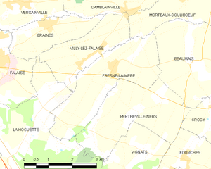
Fresné-la-Mère
- commune in Calvados, France
- Country:
- Postal Code: 14700
- Coordinates: 48° 53' 39" N, 0° 7' 19" E
- GPS tracks (wikiloc): [Link]
- Area: 8.14 sq km
- Population: 639


Vignats
- commune in Calvados, France
- Country:
- Postal Code: 14700
- Coordinates: 48° 51' 16" N, 0° 6' 13" E
- GPS tracks (wikiloc): [Link]
- Area: 8.8 sq km
- Population: 282


Fourches
- commune in Calvados, France
- Country:
- Postal Code: 14620
- Coordinates: 48° 51' 40" N, 0° 4' 47" E
- GPS tracks (wikiloc): [Link]
- Area: 4.78 sq km
- Population: 225

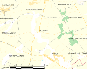
Beaumais
- commune in Calvados, France
- Country:
- Postal Code: 14620
- Coordinates: 48° 53' 42" N, 0° 4' 30" E
- GPS tracks (wikiloc): [Link]
- Area: 10.73 sq km
- Population: 178


Crocy
- commune in Calvados, France
- Country:
- Postal Code: 14620
- Coordinates: 48° 52' 48" N, 0° 3' 55" E
- GPS tracks (wikiloc): [Link]
- Area: 10.07 sq km
- Population: 314


La Hoguette
- commune in Calvados, France
- Country:
- Postal Code: 14700
- Coordinates: 48° 52' 41" N, 0° 9' 38" E
- GPS tracks (wikiloc): [Link]
- Area: 24.44 sq km
- Population: 719