Piré-sur-Seiche (Piré-sur-Seiche)

- former commune in Ille-et-Vilaine, France
- Country:

- Postal Code: 35150
- Coordinates: 48° 0' 34" N, 1° 25' 50" E


- GPS tracks (wikiloc): [Link]
- Area: 36.34 sq km
- Population: 2523
- Web site: http://www.pire-sur-seiche.fr
- Wikipedia en: wiki(en)
- Wikipedia: wiki(fr)
- Wikidata storage: Wikidata: Q196579
- Wikipedia Commons Category: [Link]
- Freebase ID: [/m/03m999n]
- Freebase ID: [/m/03m999n]
- Freebase ID: [/m/03m999n]
- GeoNames ID: Alt: [6432784]
- GeoNames ID: Alt: [6432784]
- GeoNames ID: Alt: [6432784]
- SIREN number: [213502206]
- SIREN number: [213502206]
- SIREN number: [213502206]
- BnF ID: [15257162r]
- BnF ID: [15257162r]
- BnF ID: [15257162r]
- VIAF ID: Alt: [263524316]
- VIAF ID: Alt: [263524316]
- VIAF ID: Alt: [263524316]
- OSM relation ID: [140822]
- OSM relation ID: [140822]
- OSM relation ID: [140822]
- SUDOC authorities ID: [067083552]
- SUDOC authorities ID: [067083552]
- SUDOC authorities ID: [067083552]
- INSEE municipality code: 35220
- INSEE municipality code: 35220
- INSEE municipality code: 35220
- GNS Unique Feature ID: -1458396
- GNS Unique Feature ID: -1458396
- GNS Unique Feature ID: -1458396
Shares border with regions:

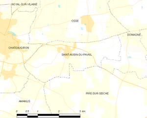
Saint-Aubin-du-Pavail
- former commune in Ille-et-Vilaine, France
- Country:
- Postal Code: 35410
- Coordinates: 48° 2' 37" N, 1° 27' 41" E
- GPS tracks (wikiloc): [Link]
- Area: 5.83 sq km
- Population: 854
- Web site: [Link]


Chancé
- commune in Ille-et-Vilaine, France
- Country:
- Postal Code: 35680
- Coordinates: 48° 2' 9" N, 1° 22' 48" E
- GPS tracks (wikiloc): [Link]
- Area: 5.22 sq km
- Population: 302
- Web site: [Link]

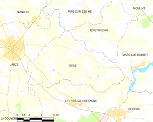
Essé
- commune in Ille-et-Vilaine, France
- Country:
- Postal Code: 35150
- Coordinates: 47° 57' 27" N, 1° 25' 28" E
- GPS tracks (wikiloc): [Link]
- Area: 23.19 sq km
- Population: 1111
- Web site: [Link]


Boistrudan
- commune in Ille-et-Vilaine, France
- Country:
- Postal Code: 35150
- Coordinates: 47° 58' 10" N, 1° 24' 4" E
- GPS tracks (wikiloc): [Link]
- Area: 12.8 sq km
- Population: 687


Domagné
- commune in Ille-et-Vilaine, France
- Country:
- Postal Code: 35113
- Coordinates: 48° 4' 13" N, 1° 23' 29" E
- GPS tracks (wikiloc): [Link]
- Area: 29 sq km
- Population: 2290
- Web site: [Link]


Moulins
- commune in Ille-et-Vilaine, France
- Country:
- Postal Code: 35680
- Coordinates: 48° 0' 9" N, 1° 22' 20" E
- GPS tracks (wikiloc): [Link]
- Area: 15.21 sq km
- Population: 709

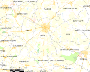
Janzé
- commune in Ille-et-Vilaine, France
- Country:
- Postal Code: 35150
- Coordinates: 47° 57' 38" N, 1° 29' 57" E
- GPS tracks (wikiloc): [Link]
- Area: 41.26 sq km
- Population: 8268


Amanlis
- commune in Ille-et-Vilaine, France
- Country:
- Postal Code: 35150
- Coordinates: 48° 0' 23" N, 1° 28' 34" E
- GPS tracks (wikiloc): [Link]
- Area: 25.25 sq km
- Population: 1688