Plumaugat (Plumaugat)

- commune in Côtes-d'Armor, France
- Country:

- Postal Code: 22250
- Coordinates: 48° 15' 18" N, 2° 14' 20" E


- GPS tracks (wikiloc): [Link]
- Area: 40.43 sq km
- Population: 1112
- Web site: http://perso.orange.fr/plumaugat/
- Wikipedia en: wiki(en)
- Wikipedia: wiki(fr)
- Wikidata storage: Wikidata: Q594119
- Wikipedia Commons Category: [Link]
- Freebase ID: [/m/03hlrv0]
- GeoNames ID: Alt: [2986613]
- SIREN number: [212202402]
- BnF ID: [15251238q]
- INSEE municipality code: 22240
Shares border with regions:


Sévignac
- commune in Côtes-d'Armor, France
- Country:
- Postal Code: 22250
- Coordinates: 48° 19' 59" N, 2° 20' 20" E
- GPS tracks (wikiloc): [Link]
- Area: 43.25 sq km
- Population: 1099
- Web site: [Link]

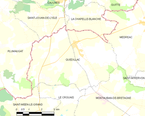
Quédillac
- commune in Ille-et-Vilaine, France
- Country:
- Postal Code: 35290
- Coordinates: 48° 14' 58" N, 2° 8' 33" E
- GPS tracks (wikiloc): [Link]
- Area: 26.54 sq km
- Population: 1185
- Web site: [Link]

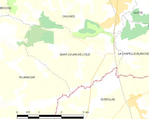
Saint-Jouan-de-l'Isle
- commune in Côtes-d'Armor, France
- Country:
- Postal Code: 22350
- Coordinates: 48° 16' 3" N, 2° 9' 33" E
- GPS tracks (wikiloc): [Link]
- Area: 8.09 sq km
- Population: 492
- Web site: [Link]


Broons
- commune in Côtes-d'Armor, France
- Country:
- Postal Code: 22250
- Coordinates: 48° 19' 3" N, 2° 15' 34" E
- GPS tracks (wikiloc): [Link]
- Area: 35.21 sq km
- Population: 2900
- Web site: [Link]


Trémorel
- commune in Côtes-d'Armor, France
- Country:
- Postal Code: 22230
- Coordinates: 48° 11' 57" N, 2° 17' 20" E
- GPS tracks (wikiloc): [Link]
- Area: 33.76 sq km
- Population: 1146
- Web site: [Link]


Caulnes
- commune in Côtes-d'Armor, France
- Country:
- Postal Code: 22350
- Coordinates: 48° 17' 20" N, 2° 9' 17" E
- GPS tracks (wikiloc): [Link]
- Area: 31.36 sq km
- Population: 2468


Saint-Méen-le-Grand
- commune in Ille-et-Vilaine, France
- Country:
- Postal Code: 35290
- Coordinates: 48° 11' 21" N, 2° 11' 27" E
- GPS tracks (wikiloc): [Link]
- Area: 18.28 sq km
- Population: 4610
- Web site: [Link]


Lanrelas
- commune in Côtes-d'Armor, France
- Country:
- Postal Code: 22250
- Coordinates: 48° 15' 7" N, 2° 17' 38" E
- GPS tracks (wikiloc): [Link]
- Area: 29.4 sq km
- Population: 820


Loscouët-sur-Meu
- commune in Côtes-d'Armor, France
- Country:
- Postal Code: 22230
- Coordinates: 48° 10' 40" N, 2° 14' 31" E
- GPS tracks (wikiloc): [Link]
- Area: 22.26 sq km
- Population: 646