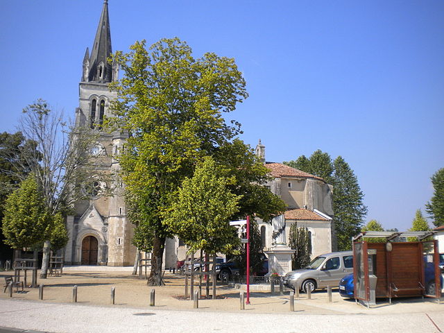
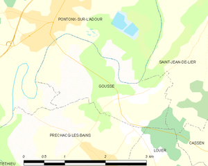
Pontonx-sur-l'Adour (Pontonx-sur-l'Adour)
- commune in Landes, France
- Country:

- Postal Code: 40465
- Coordinates: 43° 47' 16" N, 0° 55' 34" E


- GPS tracks (wikiloc): [Link]
- AboveSeaLevel: 26 м m
- Area: 49.42 sq km
- Population: 2739
- Web site: http://www.pontonx.fr
- Wikipedia en: wiki(en)
- Wikipedia: wiki(fr)
- Wikidata storage: Wikidata: Q1112272
- Wikipedia Commons Category: [Link]
- Freebase ID: [/m/03nvypc]
- Freebase ID: [/m/03nvypc]
- GeoNames ID: Alt: [6433932]
- GeoNames ID: Alt: [6433932]
- SIREN number: [214002305]
- SIREN number: [214002305]
- BnF ID: [15259172j]
- BnF ID: [15259172j]
- INSEE municipality code: 40230
- INSEE municipality code: 40230
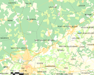
Shares border with regions:


Bégaar
- commune in Landes, France
- Country:

- Postal Code: 40400
- Coordinates: 43° 49' 36" N, 0° 51' 1" E


- GPS tracks (wikiloc): [Link]
- AboveSeaLevel: 19 м m
- Area: 27.8 sq km
- Population: 1134
- Web site: [Link]


Laluque
- commune in Landes, France
- Country:

- Postal Code: 40465
- Coordinates: 43° 51' 14" N, 0° 59' 34" E


- GPS tracks (wikiloc): [Link]
- AboveSeaLevel: 62 м m
- Area: 52.81 sq km
- Population: 1008
- Web site: [Link]


Saint-Jean-de-Lier
- commune in Landes, France
- Country:

- Postal Code: 40380
- Coordinates: 43° 47' 22" N, 0° 52' 43" E


- GPS tracks (wikiloc): [Link]
- Area: 8.15 sq km
- Population: 414


Gousse
- commune in Landes, France
- Country:

- Postal Code: 40465
- Coordinates: 43° 46' 22" N, 0° 53' 48" E


- GPS tracks (wikiloc): [Link]
- Area: 4.09 sq km
- Population: 321


Téthieu
- commune in Landes, France
- Country:

- Postal Code: 40990
- Coordinates: 43° 45' 4" N, 0° 58' 30" E


- GPS tracks (wikiloc): [Link]
- AboveSeaLevel: 10 м m
- Area: 11.03 sq km
- Population: 725


Préchacq-les-Bains
- commune in Landes, France
- Country:

- Postal Code: 40465
- Coordinates: 43° 45' 30" N, 0° 54' 30" E


- GPS tracks (wikiloc): [Link]
- AboveSeaLevel: 20 м m
- Area: 8.63 sq km
- Population: 682
- Web site: [Link]


Saint-Vincent-de-Paul
- commune in Landes, France
- Country:

- Postal Code: 40990
- Coordinates: 43° 44' 31" N, 1° 0' 1" E


- GPS tracks (wikiloc): [Link]
- Area: 32.37 sq km
- Population: 3082
- Web site: [Link]
