%20banner.jpg)
Occitania (Occitanie)

- region of France
- Country:

- Capital: Toulouse
- Coordinates: 43° 38' 56" N, 2° 20' 37" E


- GPS tracks (wikiloc): [Link]
- Area: 72724 sq km
- Population: 5774185
- Web site: http://www.laregion.fr/
- Wikipedia en: wiki(en)
- Wikipedia: wiki(fr)
- Wikidata storage: Wikidata: Q18678265
- Wikipedia Commons Category: [Link]
- Wikipedia Commons Maps Category: [Link]
- Freebase ID: [/m/012ng90t]
- GeoNames ID: Alt: [11071623]
- SIREN number: [200053791]
- OSM relation ID: [3792883]
- archINFORM location ID: [3289]
- MusicBrainz area ID: [ea63a285-1851-4e13-9fb8-0186f1a9fbae]
- TGN ID: [8711854]
- Encyclopædia Universalis ID: [languedoc-roussillon-midi-pyrenees-region-administrative]
- Twitter username: Alt: [Occitanie]
- YouTube channel ID: [UCpv8Xt9IzKZjzfxBngP2bVQ]
- INSEE region code: [76]
- ISO 3166-2 code: FR-OCC
Includes regions:


Gard
- department located in southern France in the Occitanie region
- Country:
- Capital: Nîmes
- Coordinates: 44° 7' 41" N, 4° 4' 54" E
- GPS tracks (wikiloc): [Link]
- Area: 5853 sq km
- Population: 738189
- Web site: [Link]


Gers
- French department
- Country:
- Capital: Auch
- Coordinates: 43° 39' 0" N, 0° 35' 0" E
- GPS tracks (wikiloc): [Link]
- Area: 6257 sq km
- Population: 190932
- Web site: [Link]


Haute-Garonne
- French department
- Country:
- Capital: Toulouse
- Coordinates: 43° 25' 0" N, 1° 30' 0" E
- GPS tracks (wikiloc): [Link]
- Area: 6309 sq km
- Population: 1335103
- Web site: [Link]


Hérault
- department of France
- Country:
- Capital: Montpellier
- Coordinates: 43° 36' 39" N, 3° 52' 38" E
- GPS tracks (wikiloc): [Link]
- Area: 6224 sq km
- Population: 1120190
- Web site: [Link]


Lot
- French department
- Country:
- Capital: Cahors
- Coordinates: 44° 33' 32" N, 1° 34' 35" E
- GPS tracks (wikiloc): [Link]
- Area: 5217 sq km
- Population: 173400
- Web site: [Link]


Lozère
- French department
- Country:
- Capital: Mende
- Coordinates: 44° 20' 0" N, 3° 36' 0" E
- GPS tracks (wikiloc): [Link]
- Area: 5166.9 sq km
- Population: 76309
- Web site: [Link]


Hautes-Pyrénées
- French department
- Country:
- Capital: Tarbes
- Coordinates: 43° 12' 0" N, 0° 8' 0" E
- GPS tracks (wikiloc): [Link]
- Area: 4464 sq km
- Population: 228582
- Web site: [Link]


Pyrénées-Orientales
- department of southern France
- Country:
- Capital: Perpignan
- Coordinates: 42° 30' 0" N, 2° 45' 0" E
- GPS tracks (wikiloc): [Link]
- Area: 4116 sq km
- Population: 471038
- Web site: [Link]


Tarn
- French department
- Country:
- Capital: Albi
- Coordinates: 43° 54' 35" N, 2° 6' 33" E
- GPS tracks (wikiloc): [Link]
- Area: 5758 sq km
- Population: 386543
- Web site: [Link]


Tarn-et-Garonne
- French department
- Country:
- Capital: Montauban
- Coordinates: 44° 0' 0" N, 1° 20' 0" E
- GPS tracks (wikiloc): [Link]
- Area: 3718 sq km
- Population: 255274
- Web site: [Link]
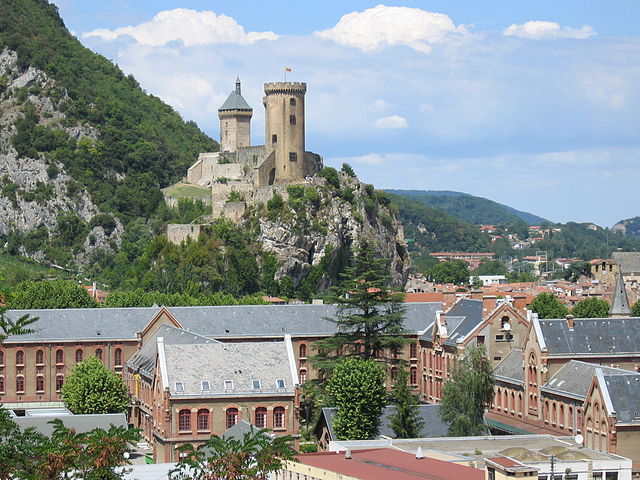

Ariège
- French department
- Country:
- Capital: Foix
- Coordinates: 43° 0' 0" N, 1° 30' 0" E
- GPS tracks (wikiloc): [Link]
- Area: 4890 sq km
- Population: 152499
- Web site: [Link]


Aude
- department in south-central France named after the river Aude
- Country:
- Capital: Carcassonne
- Coordinates: 43° 5' 0" N, 2° 25' 0" E
- GPS tracks (wikiloc): [Link]
- Area: 6139 sq km
- Population: 366957
- Web site: [Link]


Aveyron
- French department
- Country:
- Capital: Rodez
- Coordinates: 44° 15' 0" N, 2° 42' 0" E
- GPS tracks (wikiloc): [Link]
- Area: 8735 sq km
- Population: 279169
- Web site: [Link]
Shares border with regions:


Provence-Alpes-Côte d'Azur
- region of France
 Hiking in Provence-Alpes-Côte d'Azur
Provence-Alpes-Côte d'Azur (PACA) is a stunning region in southeastern France, known for its diverse landscapes, rich history, and vibrant culture. It offers a wide range of hiking opportunities, from coastal trails along the Mediterranean to rugged paths in the Alps. Here are some key points to consider when hiking in this beautiful region:...
- Country:
- Capital: Marseille
- Coordinates: 44° 0' 0" N, 6° 0' 0" E
- GPS tracks (wikiloc): [Link]
- Area: 31400 sq km
- Population: 5007977
- Web site: [Link]


Auvergne-Rhône-Alpes
- administrative region of France
Hiking in Auvergne-Rhône-Alpes
Auvergne-Rhône-Alpes is a stunning region in southeastern France known for its diverse landscapes, which include mountains, lakes, and volcanic formations. It offers a wealth of hiking opportunities for all levels of experience. Here are some highlights and notable areas for hiking in this beautiful region:...
- Country:
- Capital: Lyon
- Local Dialing Code: 04
- Coordinates: 45° 44' 25" N, 4° 49' 10" E
- GPS tracks (wikiloc): [Link]
- Area: 69711 sq km
- Population: 7877698
- Web site: [Link]

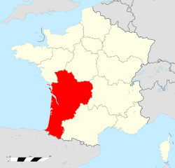
Nouvelle-Aquitaine
- region of France
- Country:
- Capital: Bordeaux
- Coordinates: 44° 50' 12" N, 0° 35' 20" E
- GPS tracks (wikiloc): [Link]
- Area: 84061 sq km
- Population: 5911482
- Web site: [Link]