Port-Mort (Port-Mort)

- commune in Eure, France
- Country:

- Postal Code: 27940
- Coordinates: 49° 10' 8" N, 1° 24' 24" E


- GPS tracks (wikiloc): [Link]
- Area: 12.17 sq km
- Population: 936
- Web site: http://www.port-mort.com
- Wikipedia en: wiki(en)
- Wikipedia: wiki(fr)
- Wikidata storage: Wikidata: Q613509
- Wikipedia Commons Category: [Link]
- Freebase ID: [/m/03nqkzx]
- Freebase ID: [/m/03nqkzx]
- GeoNames ID: Alt: [6430533]
- GeoNames ID: Alt: [6430533]
- SIREN number: [212704738]
- SIREN number: [212704738]
- BnF ID: [15253708n]
- BnF ID: [15253708n]
- PACTOLS thesaurus ID: [pcrtHy25nMbU9z]
- PACTOLS thesaurus ID: [pcrtHy25nMbU9z]
- INSEE municipality code: 27473
- INSEE municipality code: 27473
Shares border with regions:
Hennezis
- commune in Eure, France
- Country:
- Postal Code: 27700
- Coordinates: 49° 11' 35" N, 1° 27' 53" E
- GPS tracks (wikiloc): [Link]
- Area: 15.63 sq km
- Population: 783
- Web site: [Link]
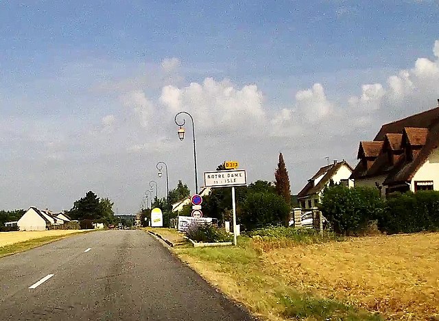

Notre-Dame-de-l'Isle
- commune in Eure, France
- Country:
- Postal Code: 27940
- Coordinates: 49° 8' 44" N, 1° 25' 54" E
- GPS tracks (wikiloc): [Link]
- Area: 11.81 sq km
- Population: 672
- Web site: [Link]
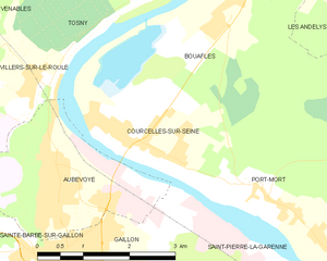
Courcelles-sur-Seine
- commune in Eure, France
- Country:
- Postal Code: 27940
- Coordinates: 49° 10' 58" N, 1° 21' 31" E
- GPS tracks (wikiloc): [Link]
- Area: 5.47 sq km
- Population: 2004
- Web site: [Link]

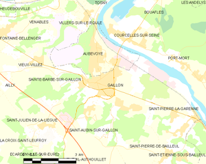
Gaillon
- commune in Eure, France
- Country:
- Postal Code: 27600
- Coordinates: 49° 9' 37" N, 1° 20' 9" E
- GPS tracks (wikiloc): [Link]
- AboveSeaLevel: 59 м m
- Area: 10.19 sq km
- Population: 7027


Bouafles
- commune in Eure, France
- Country:
- Postal Code: 27700
- Coordinates: 49° 12' 39" N, 1° 23' 3" E
- GPS tracks (wikiloc): [Link]
- Area: 12.61 sq km
- Population: 643
- Web site: [Link]