Puch-d'Agenais (Puch-d'Agenais)

- commune in Lot-et-Garonne, France
- Country:

- Postal Code: 47160
- Coordinates: 44° 19' 43" N, 0° 14' 36" E


- GPS tracks (wikiloc): [Link]
- Area: 23 sq km
- Population: 705
- Wikipedia en: wiki(en)
- Wikipedia: wiki(fr)
- Wikidata storage: Wikidata: Q1105111
- Wikipedia Commons Category: [Link]
- Freebase ID: [/m/03qm2gq]
- GeoNames ID: Alt: [6435038]
- SIREN number: [214702144]
- BnF ID: [15261295r]
- INSEE municipality code: 47214
Shares border with regions:

Villefranche-du-Queyran
- commune in Lot-et-Garonne, France
- Country:
- Postal Code: 47160
- Coordinates: 44° 18' 28" N, 0° 11' 49" E
- GPS tracks (wikiloc): [Link]
- Area: 16.55 sq km
- Population: 405


Villeton
- commune in Lot-et-Garonne, France
- Country:
- Postal Code: 47400
- Coordinates: 44° 21' 44" N, 0° 16' 18" E
- GPS tracks (wikiloc): [Link]
- Area: 10.24 sq km
- Population: 460

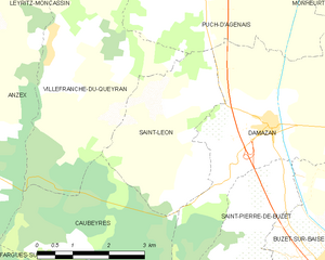
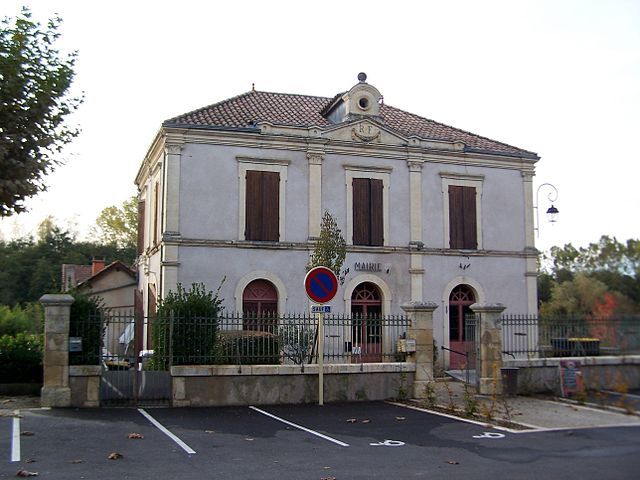
Saint-Léon
- commune in Lot-et-Garonne, France
- Country:
- Postal Code: 47160
- Coordinates: 44° 17' 33" N, 0° 14' 32" E
- GPS tracks (wikiloc): [Link]
- Area: 9.6 sq km
- Population: 315


Saint-Léger
- commune in Lot-et-Garonne, France
- Country:
- Postal Code: 47160
- Coordinates: 44° 17' 21" N, 0° 19' 6" E
- GPS tracks (wikiloc): [Link]
- Area: 5.79 sq km
- Population: 149


Monheurt
- commune in Lot-et-Garonne, France
- Country:
- Postal Code: 47160
- Coordinates: 44° 20' 25" N, 0° 18' 27" E
- GPS tracks (wikiloc): [Link]
- Area: 11.44 sq km
- Population: 198
- Web site: [Link]


Damazan
- commune in Lot-et-Garonne, France
- Country:
- Postal Code: 47160
- Coordinates: 44° 17' 25" N, 0° 16' 32" E
- GPS tracks (wikiloc): [Link]
- Area: 16.37 sq km
- Population: 1329
- Web site: [Link]


Razimet
- commune in Lot-et-Garonne, France
- Country:
- Postal Code: 47160
- Coordinates: 44° 21' 8" N, 0° 14' 5" E
- GPS tracks (wikiloc): [Link]
- Area: 7.18 sq km
- Population: 323