Puy-du-Lac (Puy-du-Lac)

- commune in Charente-Maritime, France
- Country:

- Postal Code: 17380
- Coordinates: 45° 57' 4" N, 0° 45' 13" E


- GPS tracks (wikiloc): [Link]
- Area: 14.6 sq km
- Population: 475
- Wikipedia en: wiki(en)
- Wikipedia: wiki(fr)
- Wikidata storage: Wikidata: Q24442
- Wikipedia Commons Category: [Link]
- Freebase ID: [/m/03mcjlc]
- GeoNames ID: Alt: [6428038]
- SIREN number: [211702923]
- BnF ID: [152491532]
- INSEE municipality code: 17292
Shares border with regions:

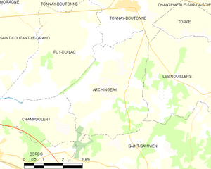
Archingeay
- commune in Charente-Maritime, France
- Country:
- Postal Code: 17380
- Coordinates: 45° 55' 51" N, 0° 42' 21" E
- GPS tracks (wikiloc): [Link]
- Area: 16.61 sq km
- Population: 680


Champdolent
- commune in Charente-Maritime, France
- Country:
- Postal Code: 17430
- Coordinates: 45° 55' 9" N, 0° 48' 5" E
- GPS tracks (wikiloc): [Link]
- Area: 12.02 sq km
- Population: 399


Saint-Coutant-le-Grand
- commune in Charente-Maritime, France
- Country:
- Postal Code: 17430
- Coordinates: 45° 57' 14" N, 0° 46' 8" E
- GPS tracks (wikiloc): [Link]
- Area: 12.8 sq km
- Population: 410


Tonnay-Boutonne
- commune in Charente-Maritime, France
- Country:
- Postal Code: 17380
- Coordinates: 45° 58' 4" N, 0° 42' 24" E
- GPS tracks (wikiloc): [Link]
- Area: 22.73 sq km
- Population: 1161