Riviera-Pays-d'Enhaut District (Bezirk Riviera-Pays-d’Enhaut)
- district of the canton of Vaud, Switzerland
 Hiking in Riviera-Pays-d'Enhaut District
The Riviera-Pays-d'Enhaut District, located in the Vaud Canton of Switzerland, offers stunning landscapes, charming villages, and a variety of hiking opportunities that cater to all levels of experience. Here are some aspects to consider when hiking in this beautiful region:
Key Features:
-
Scenic Trails: The district boasts a diverse range of trails, from easy lakeside walks around Lake Geneva to more challenging mountain hikes. Popular routes often include views of the surrounding Alps and lush valleys.
-
Lake Geneva: Hiking along the shores of Lake Geneva provides picturesque views and serene settings. The route from Montreux to Villeneuve is particularly popular, featuring beautiful vistas and charming lakeside towns.
-
Alpine Hiking: For those seeking more of a challenge, the higher altitudes in the Pays-d'Enhaut region offer a variety of alpine trails, such as the paths leading to the imposing peaks of the Pre-Alps. The hike from Château-d'Oex to the Col des Mosses is a notable example.
-
Flora and Fauna: The region is rich in biodiversity, making it a great location to observe various plant species and wildlife along the trails. In spring and summer, you may encounter wildflowers in full bloom.
-
Cultural Experience: The villages in the district, such as Château-d'Oex and Rougemont, are known for their cultural heritage, including traditional chalets and local cuisine. Incorporating visits to these villages can enhance your hiking experience.
-
Accessibility: Many hiking trails are accessible via public transportation, allowing hikers to easily reach starting points without the need for a car.
Tips for Hiking in Riviera-Pays-d'Enhaut:
- Weather Considerations: Check the weather forecast before heading out, as conditions can change rapidly in the mountains.
- Gear Up: Wear appropriate hiking shoes and carry layers of clothing to adjust to changing temperatures.
- Hydration and Snacks: Bring sufficient water and snacks to keep your energy up during longer hikes.
- Maps and Guides: Utilize local maps or GPS apps to navigate the trails effectively.
- Respect Nature: Follow the Leave No Trace principles to preserve the natural environment.
Overall, hiking in the Riviera-Pays-d'Enhaut District provides an excellent opportunity to experience the stunning natural beauty and cultural richness of this Swiss region. Whether you are a seasoned hiker or a beginner, there is something for everyone to enjoy!
- Country:

- Capital: Vevey
- Licence Plate Code: VD
- Coordinates: 46° 27' 56" N, 6° 50' 56" E


- GPS tracks (wikiloc): [Link]
- AboveSeaLevel: 558 м m
- Area: 282.88 sq km
- Wikipedia en: wiki(en)
- Wikipedia: wiki(de)
- Wikidata storage: Wikidata: Q665689
- Wikipedia Commons Category: [Link]
- Freebase ID: [/m/04f5mv1]
- GeoNames ID: Alt: [7285009]
- archINFORM location ID: [42795]
Includes regions:


Blonay
- municipality in Switzerland
Blonay, a charming commune located in the Vaud region of Switzerland, offers a delightful mix of natural beauty and well-maintained hiking trails, perfect for hikers of all skill levels. It’s situated near Lake Geneva and is surrounded by the stunning landscapes of the Swiss Alps, making it a fantastic destination for outdoor enthusiasts....
- Country:

- Postal Code: 1807
- Local Dialing Code: 021
- Licence Plate Code: VD
- Coordinates: 46° 28' 0" N, 6° 54' 0" E


- GPS tracks (wikiloc): [Link]
- AboveSeaLevel: 629 м m
- Area: 16.03 sq km
- Population: 6190
- Web site: [Link]
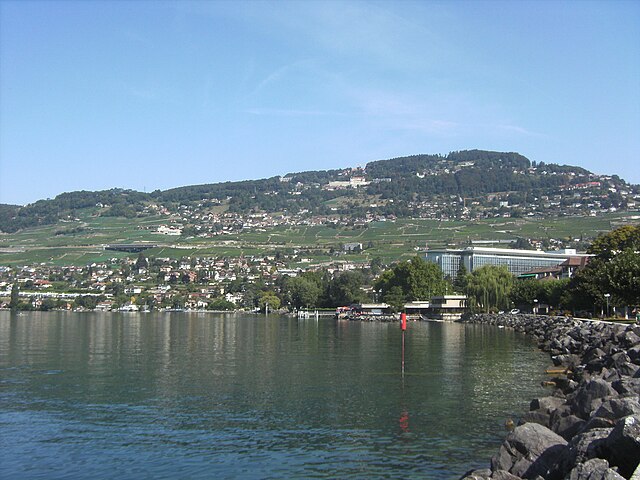

Chardonne
- municipality in Switzerland
Chardonne, located in the Lavaux region of Switzerland, is a picturesque village that offers a fantastic hiking experience with breathtaking views of Lake Geneva and the surrounding mountains. Here are some highlights and tips for hiking in Chardonne:...
- Country:

- Local Dialing Code: 021
- Licence Plate Code: VD
- Coordinates: 46° 29' 19" N, 6° 49' 18" E


- GPS tracks (wikiloc): [Link]
- AboveSeaLevel: 918 м m
- Area: 10.30 sq km
- Population: 2914
- Web site: [Link]

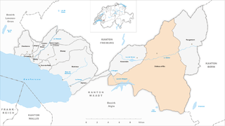
Château-d'Œx
- municipality in Switzerland
Château-d'Œx, located in the heart of the Swiss Alps in the Vaud region, is a beautiful destination for hiking enthusiasts. Known for its stunning alpine landscapes, this picturesque village offers a variety of trails for all skill levels, from leisurely walks to more challenging hikes....
- Country:

- Local Dialing Code: 026
- Licence Plate Code: VD
- Coordinates: 46° 28' 0" N, 7° 7' 0" E


- GPS tracks (wikiloc): [Link]
- AboveSeaLevel: 958 м m
- Area: 113.76 sq km
- Population: 3433
- Web site: [Link]

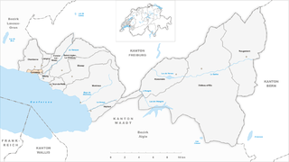
Corseaux
- municipality in Switzerland
Corseaux, located in the Vaud region of Switzerland along the shores of Lake Geneva, offers a picturesque setting for hiking enthusiasts. The area is characterized by its stunning views of the lake, rolling vineyards, and the surrounding mountains. Here are some highlights of hiking in and around Corseaux:...
- Country:

- Postal Code: 1802
- Local Dialing Code: 021
- Licence Plate Code: VD
- Coordinates: 46° 28' 0" N, 6° 50' 0" E


- GPS tracks (wikiloc): [Link]
- AboveSeaLevel: 445 м m
- Area: 1.06 sq km
- Population: 2278
- Web site: [Link]


Corsier-sur-Vevey
- municipality in Switzerland
Corsier-sur-Vevey is a charming village located on the shores of Lake Geneva in the Vaud region of Switzerland, near Vevey and Montreux. It offers a variety of hiking opportunities that showcase stunning views of the lake and surrounding mountains....
- Country:

- Postal Code: 1804
- Local Dialing Code: 021
- Licence Plate Code: VD
- Coordinates: 46° 28' 0" N, 6° 51' 0" E


- GPS tracks (wikiloc): [Link]
- AboveSeaLevel: 420 м m
- Area: 1.06 sq km
- Population: 3401
- Web site: [Link]

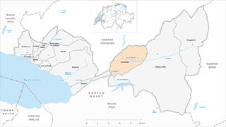
Rossinière
- municipality in Switzerland
Rossinière is a picturesque village located in the Swiss canton of Vaud, nestled in the striking landscapes of the Swiss Alps. It is particularly known for its beautiful scenery, charming architecture, and proximity to several hiking trails that cater to different skill levels. Here are some key details about hiking in Rossinière:...
- Country:

- Postal Code: 1658
- Local Dialing Code: 026
- Licence Plate Code: VD
- Coordinates: 46° 28' 0" N, 7° 5' 0" E


- GPS tracks (wikiloc): [Link]
- AboveSeaLevel: 920 м m
- Area: 23.34 sq km
- Population: 543
- Web site: [Link]


Veytaux
- municipality in Switzerland
Veytaux, located in the Vaud canton of Switzerland, is a charming area situated along the shores of Lake Geneva and is known for its stunning landscapes and beautiful hiking trails. Here's what you should know about hiking in this picturesque region:...
- Country:

- Postal Code: 1820
- Local Dialing Code: 021
- Licence Plate Code: VD
- Coordinates: 46° 25' 38" N, 6° 57' 50" E


- GPS tracks (wikiloc): [Link]
- AboveSeaLevel: 1508 м m
- Area: 6.73 sq km
- Population: 868
- Web site: [Link]


Vevey
- city on Lake Geneva, in the canton of Vaud, Switzerland
Vevey, a picturesque town located on the shores of Lake Geneva in Switzerland, offers a variety of hiking opportunities that cater to different skill levels and preferences. The region is known for its stunning landscapes, including vineyards, mountains, and beautiful lake views....
- Country:

- Postal Code: 1800
- Local Dialing Code: 021
- Licence Plate Code: VD
- Coordinates: 46° 28' 0" N, 6° 51' 0" E


- GPS tracks (wikiloc): [Link]
- AboveSeaLevel: 383 м m
- Area: 2.38 sq km
- Population: 19827
- Web site: [Link]
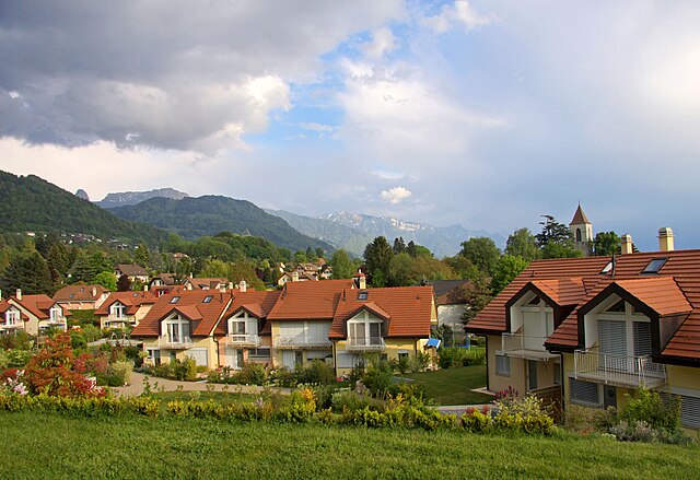

Saint-Légier-La Chiésaz
- municipality in Switzerland
 Hiking in Saint-Légier-La Chiésaz
Saint-Légier-La Chiésaz is a charming municipality located in the canton of Vaud, Switzerland, nestled in the foothills of the Swiss Alps and offering stunning views of Lake Geneva and the surrounding mountains. Hiking in this area is a delightful experience, with trails suitable for a range of skill levels....
- Country:

- Postal Code: 1806
- Local Dialing Code: 021
- Licence Plate Code: VD
- Coordinates: 46° 28' 0" N, 6° 53' 0" E


- GPS tracks (wikiloc): [Link]
- AboveSeaLevel: 580 м m
- Area: 15.12 sq km
- Population: 5163
- Web site: [Link]

Montreux
- municipality in Switzerland
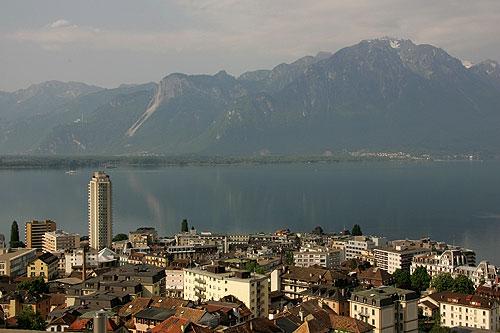
Montreux, located on the shores of Lake Geneva in Switzerland, is not only famous for its beautiful lakeside promenade and the annual jazz festival but also offers a variety of stunning hiking opportunities in the surrounding areas. Here are some highlights and options for hiking in and around Montreux:...
- Country:

- Postal Code: 1833; 1832; 1824; 1823; 1822; 1820; 1818; 1817; 1816; 1815
- Local Dialing Code: 021
- Licence Plate Code: VD
- Coordinates: 46° 26' 0" N, 6° 55' 0" E


- GPS tracks (wikiloc): [Link]
- AboveSeaLevel: 390 м m
- Area: 33.41 sq km
- Population: 26433
- Web site: [Link]


Jongny
- municipality in Switzerland
Jongny, a charming commune in the Canton of Vaud, Switzerland, offers beautiful hiking opportunities with stunning views of Lake Geneva and the surrounding Alps. Here are some key points about hiking in Jongny:...
- Country:

- Postal Code: 1805
- Local Dialing Code: 021
- Licence Plate Code: VD
- Coordinates: 46° 29' 15" N, 6° 50' 48" E


- GPS tracks (wikiloc): [Link]
- AboveSeaLevel: 784 м m
- Area: 2.16 sq km
- Population: 1550
- Web site: [Link]


La Tour-de-Peilz
- municipality in Switzerland
La Tour-de-Peilz is a charming town situated on the shores of Lake Geneva in Switzerland, surrounded by stunning landscapes that are ideal for hiking enthusiasts. The region offers a variety of trails suitable for all levels, providing hikers with options that range from leisurely lakeside walks to more challenging mountain hikes....
- Country:

- Postal Code: 1814
- Local Dialing Code: 021
- Licence Plate Code: VD
- Coordinates: 46° 27' 18" N, 6° 52' 10" E


- GPS tracks (wikiloc): [Link]
- AboveSeaLevel: 430 м m
- Area: 3.29 sq km
- Population: 11752
- Web site: [Link]


Rougemont
- city in the canton of Vaud, Switzerland
Rougemont is a picturesque village located in the Bernese Oberland region of Switzerland, surrounded by stunning alpine scenery, making it an excellent destination for hiking enthusiasts. Here are some key aspects to consider when hiking in Rougemont:...
- Country:

- Postal Code: 1659
- Local Dialing Code: 026
- Licence Plate Code: VD
- Coordinates: 46° 29' 0" N, 7° 13' 0" E


- GPS tracks (wikiloc): [Link]
- AboveSeaLevel: 1007 м m
- Area: 48.56 sq km
- Population: 889
- Web site: [Link]
Shares border with regions:


Aigle District
- district of the canton of Vaud, Switzerland
Aigle District, located in the Vaud canton of Switzerland, offers a picturesque setting for hikers. Nestled at the foot of the Alps, it features diverse landscapes, including vineyards, rolling hills, and stunning mountain views. Here are some highlights for hiking in the area:...
- Country:

- Capital: Aigle
- Licence Plate Code: VD
- Coordinates: 46° 19' 58" N, 7° 4' 36" E


- GPS tracks (wikiloc): [Link]
- AboveSeaLevel: 1363 м m
- Area: 434.85 sq km


Lavaux-Oron District
- district of the canton of Vaud, Switzerland
 Hiking in Lavaux-Oron District
The Lavaux-Oron District, located in Switzerland, is renowned for its stunning landscapes, picturesque vineyards, and breathtaking views of Lake Geneva and the surrounding Alps. Here’s what you need to know about hiking in this beautiful area:...
- Country:

- Licence Plate Code: VD
- Coordinates: 46° 29' 0" N, 6° 44' 0" E


- GPS tracks (wikiloc): [Link]
- AboveSeaLevel: 683 м m
- Area: 134.57 sq km
