
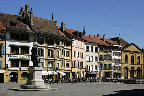
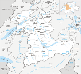
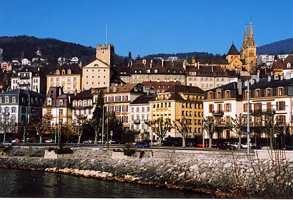
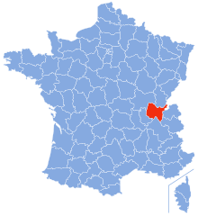
Canton of Vaud (Kanton Waadt)


- canton of Switzerland
 Hiking in Canton of Vaud
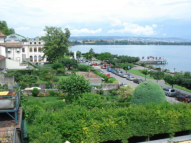
The Canton of Vaud, located in the French-speaking part of Switzerland, is a fantastic destination for hiking enthusiasts. It offers a diverse range of landscapes, from picturesque lakeside trails along Lake Geneva to challenging mountain hikes in the Alps. Here are some highlights of hiking in this beautiful region:
1.
- Lake Geneva Region: The trails along the lakeshore provide stunning views of the lake and the Alps. The area offers both leisurely walks and more challenging hikes.
- Jura Mountains: The Jura range features rolling hills, dense forests, and panoramic ridgelines. Trails such as the Creux du Van and the hiking paths near Vallée de Joux are popular.
- Lavaux Vineyards: This UNESCO World Heritage site offers terraces of vineyards, where you can enjoy scenic views while hiking through charming villages and along the slopes.
2.
- Sentier des Toblerones: A unique trail along the Lake Geneva shoreline that takes you through historical fortifications and offers breathtaking views of the water and surrounding mountains.
- Le Mont Tendre: The highest point in the Jura Mountains, it provides a moderate hike with rewarding views from the summit.
- Les Hautes-Alpes: For more adventurous hikers, there are trails leading into the higher altitudes of the Alps, offering challenging terrain and stunning alpine scenery.
3.
- Spring/Summer: This is the best time for hiking, with wildflowers blooming and trails accessible.
- Autumn: Fall colors create a beautiful backdrop for hikes, especially in forested areas.
- Winter: Some trails may be accessible for snowshoeing or winter hiking, but check conditions and prepare for colder weather.
4.
- Many hiking areas are well-marked with signs and maps. There are also numerous mountain huts and restaurants where hikers can rest and enjoy local cuisine.
- It’s advisable to bring water, snacks, and a first-aid kit, as some trails may be isolated.
5.
- Always check weather conditions before heading out.
- Respect local wildlife and stay on marked trails to protect the environment.
- Ensure you're equipped for the hike with appropriate footwear and gear.
6.
- The Canton of Vaud is easily accessible by public transportation, including trains and buses, which frequently connect towns and hiking areas.
- Consider using the Swiss Travel Pass for convenience if you're traveling from other regions.
Whether you're a beginner or an experienced hiker, the Canton of Vaud has something for everyone. Enjoy the spectacular views and the serenity of nature as you explore this beautiful part of Switzerland!
- Country:

- Capital: Lausanne
- Licence Plate Code: VD
- Coordinates: 46° 37' 0" N, 6° 33' 0" E


- GPS tracks (wikiloc): [Link]
- AboveSeaLevel: 495 м m
- Area: 3212 sq km
- Web site: http://www.vd.ch/
- Wikipedia en: wiki(en)
- Wikipedia: wiki(de)
- Wikidata storage: Wikidata: Q12771
- Wikipedia Commons Gallery: [Link]
- Wikipedia Commons Category: [Link]
- Freebase ID: [/m/01qcz7]
- GeoNames ID: Alt: [2658182]
- BnF ID: [119386827]
- VIAF ID: Alt: [148338130]
- OSM relation ID: [1702421]
- GND ID: Alt: [4078982-2]
- archINFORM location ID: [2942]
- Library of Congress authority ID: Alt: [n79123645]
- PACTOLS thesaurus ID: [pcrtvqxe0kgqRM]
- MusicBrainz area ID: [2c333d07-cd97-440c-8c91-8833c921a04a]
- Quora topic ID: [Canton-of-Vaud]
- Encyclopædia Universalis ID: [canton-de-vaud]
- HDS ID: [7395]
- ISNI: Alt: [0000 0001 0721 4122]
- NUTS code: [CH011]
- Klexikon article ID: [Waadt]
- STW Thesaurus for Economics ID: [16979-1]
- ISO 3166-2 code: CH-VD
- FIPS 10-4 (countries and regions): SZ23
Includes regions:


Broye-Vully District
- district of the canton of Vaud, Switzerland
Hiking in Broye-Vully District
The Broye-Vully District, located in the canton of Vaud in Switzerland, is a fantastic destination for hiking enthusiasts. This region offers a variety of trails suitable for different skill levels, catering to both casual walkers and more experienced hikers....
- Country:
- Capital: Payerne
- Licence Plate Code: VD
- Coordinates: 46° 49' 0" N, 6° 56' 0" E
- GPS tracks (wikiloc): [Link]
- AboveSeaLevel: 471 м m
- Area: 264.98 sq km


Aigle District
- district of the canton of Vaud, Switzerland
Hiking in Aigle District
Aigle District, located in the Vaud canton of Switzerland, offers a picturesque setting for hikers. Nestled at the foot of the Alps, it features diverse landscapes, including vineyards, rolling hills, and stunning mountain views. Here are some highlights for hiking in the area:...
- Country:
- Capital: Aigle
- Licence Plate Code: VD
- Coordinates: 46° 19' 58" N, 7° 4' 36" E
- GPS tracks (wikiloc): [Link]
- AboveSeaLevel: 1363 м m
- Area: 434.85 sq km

Morges District
- district of the canton of Vaud, Switzerland
Hiking in Morges District
Morges District, located on the shores of Lake Geneva in Switzerland, offers a variety of scenic hiking opportunities that cater to different skill levels. The region boasts beautiful landscapes, vineyards, and charming villages, making it an excellent destination for hikers....
- Country:
- Capital: Morges
- Licence Plate Code: VD
- Coordinates: 46° 30' 0" N, 6° 30' 0" E
- GPS tracks (wikiloc): [Link]
- AboveSeaLevel: 492 м m
- Area: 372.99 sq km


Lausanne District
- district of the canton of Vaud, Switzerland
Hiking in Lausanne District
Hiking in the Lausanne District, located in the picturesque region of Switzerland, offers a blend of stunning views, varied terrain, and a chance to explore the beautiful natural landscape of the Swiss Alps and Lake Geneva. Here are some highlights and tips for hiking in this area:...
- Country:
- Capital: Lausanne
- Licence Plate Code: VD
- Coordinates: 46° 31' 16" N, 6° 38' 28" E
- GPS tracks (wikiloc): [Link]
- AboveSeaLevel: 501 м m
- Area: 65.15 sq km

Jura-Nord vaudois District
- district of the canton of Vaud, Switzerland
Hiking in Jura-Nord vaudois District
Hiking in the Jura-Nord Vaudois District, located in the Jura Mountains of Switzerland, offers stunning landscapes, diverse flora and fauna, and a range of trails that cater to all skill levels. Here are some highlights:...
- Country:
- Capital: Yverdon-les-Bains
- Licence Plate Code: VD
- Coordinates: 46° 46' 0" N, 6° 38' 0" E
- GPS tracks (wikiloc): [Link]
- AboveSeaLevel: 654 м m
- Area: 702.61 sq km


Lavaux-Oron District
- district of the canton of Vaud, Switzerland
Hiking in Lavaux-Oron District
The Lavaux-Oron District, located in Switzerland, is renowned for its stunning landscapes, picturesque vineyards, and breathtaking views of Lake Geneva and the surrounding Alps. Here’s what you need to know about hiking in this beautiful area:...
- Country:
- Licence Plate Code: VD
- Coordinates: 46° 29' 0" N, 6° 44' 0" E
- GPS tracks (wikiloc): [Link]
- AboveSeaLevel: 683 м m
- Area: 134.57 sq km


Riviera-Pays-d'Enhaut District
- district of the canton of Vaud, Switzerland
Hiking in Riviera-Pays-d'Enhaut District
The Riviera-Pays-d'Enhaut District, located in the Vaud Canton of Switzerland, offers stunning landscapes, charming villages, and a variety of hiking opportunities that cater to all levels of experience. Here are some aspects to consider when hiking in this beautiful region:...
- Country:
- Capital: Vevey
- Licence Plate Code: VD
- Coordinates: 46° 27' 56" N, 6° 50' 56" E
- GPS tracks (wikiloc): [Link]
- AboveSeaLevel: 558 м m
- Area: 282.88 sq km


Ouest Lausannois District
- district of the canton of Vaud, Switzerland
Hiking in Ouest Lausannois District
The Ouest Lausannois District, located in the canton of Vaud in Switzerland, is a scenic area that offers various hiking opportunities amidst beautiful landscapes, featuring vineyards, rolling hills, and views of Lake Geneva. Here are some highlights and tips for hiking in this region:...
- Country:
- Licence Plate Code: VD
- Coordinates: 46° 32' 19" N, 6° 35' 3" E
- GPS tracks (wikiloc): [Link]
- AboveSeaLevel: 413 м m
- Area: 26.32 sq km

Nyon District
- district of the canton of Vaud, Switzerland
Hiking in Nyon District
Hiking in the Nyon District, located in the Vaud canton of Switzerland, offers a stunning blend of natural beauty, cultural sites, and diverse landscapes. Here are some key highlights to consider when hiking in this area:...
- Country:
- Capital: Nyon
- Licence Plate Code: VD
- Coordinates: 46° 25' 12" N, 6° 13' 18" E
- GPS tracks (wikiloc): [Link]
- AboveSeaLevel: 469 м m
- Area: 307.34 sq km


Gros-de-Vaud District
- district of the canton of Vaud, Switzerland
Hiking in Gros-de-Vaud District
Gros-de-Vaud District, located in the canton of Vaud in Switzerland, offers a wonderful hiking experience with its picturesque landscapes, charming villages, and diverse terrain. Here are some highlights of hiking in this beautiful region:...
- Country:
- Capital: Echallens
- Licence Plate Code: VD
- Coordinates: 46° 37' 59" N, 6° 37' 59" E
- GPS tracks (wikiloc): [Link]
- AboveSeaLevel: 636 м m
- Area: 232.22 sq km
Shares border with regions:

canton of Bern
- canton of Switzerland
Hiking in canton of Bern
The Canton of Bern, located in Switzerland, offers some of the most stunning landscapes and diverse trails for hiking enthusiasts. This region boasts a mix of alpine scenery, picturesque villages, and lush valleys, making it an excellent destination for all levels of hikers. Here are some highlights you can expect when hiking in the Canton of Bern:...
- Country:
- Capital: Bern
- Licence Plate Code: BE
- Coordinates: 46° 50' 0" N, 7° 37' 0" E
- GPS tracks (wikiloc): [Link]
- AboveSeaLevel: 542 м m
- Area: 5959 sq km
- Population: 1031126
- Web site: [Link]


Canton of Geneva
- canton of Switzerland
Hiking in Canton of Geneva
Hiking in the Canton of Geneva offers a unique blend of urban accessibility and stunning natural landscapes. While Geneva itself is well-known for its cosmopolitan atmosphere, the surrounding areas provide numerous opportunities for outdoor enthusiasts....
- Country:
- Capital: Geneva
- Licence Plate Code: GE
- Coordinates: 46° 13' 5" N, 6° 9' 58" E
- GPS tracks (wikiloc): [Link]
- AboveSeaLevel: 375 м m
- Area: 282.49 sq km
- Web site: [Link]


Canton of Fribourg
- canton of Switzerland
Hiking in Canton of Fribourg
The Canton of Fribourg, located in western Switzerland, is a fantastic destination for hiking enthusiasts. Known for its diverse landscapes, Fribourg offers a combination of rolling hills, dense forests, and stunning alpine vistas. Here are some highlights and tips for hiking in this beautiful region:...
- Country:
- Capital: Fribourg
- Licence Plate Code: FR
- Coordinates: 46° 43' 0" N, 7° 5' 0" E
- GPS tracks (wikiloc): [Link]
- AboveSeaLevel: 643 м m
- Area: 1671.36 sq km
- Web site: [Link]

Canton of Neuchâtel
- canton of Switzerland
Hiking in Canton of Neuchâtel
The Canton of Neuchâtel, located in western Switzerland, is a stunning area for hiking, featuring a diverse landscape that ranges from rolling hills and deep forests to beautiful lakes and mountainous areas. Here are some highlights and tips for hiking in this picturesque region:...
- Country:
- Capital: Neuchâtel
- Licence Plate Code: NE
- Coordinates: 46° 59' 0" N, 6° 47' 0" E
- GPS tracks (wikiloc): [Link]
- AboveSeaLevel: 430 м m
- Area: 802.24 sq km
- Web site: [Link]


Haute-Savoie
- French department
Hiking in Haute-Savoie
Haute-Savoie, located in the southeastern part of France, is a stunning region of the French Alps known for its breathtaking landscapes, picturesque villages, and a plethora of outdoor activities. Hiking is one of the most popular pursuits in this area, offering trails that cater to all experience levels and showcasing everything from serene lakes to rugged mountain peaks....
- Country:

- Capital: Annecy
- Coordinates: 46° 0' 0" N, 6° 20' 0" E
- GPS tracks (wikiloc): [Link]
- AboveSeaLevel: 1160 м m
- Area: 4388 sq km
- Population: 793938
- Web site: [Link]


Auvergne-Rhône-Alpes
- administrative region of France
Hiking in Auvergne-Rhône-Alpes
Auvergne-Rhône-Alpes is a stunning region in southeastern France known for its diverse landscapes, which include mountains, lakes, and volcanic formations. It offers a wealth of hiking opportunities for all levels of experience. Here are some highlights and notable areas for hiking in this beautiful region:...
- Country:
- Capital: Lyon
- Local Dialing Code: 04
- Coordinates: 45° 44' 25" N, 4° 49' 10" E
- GPS tracks (wikiloc): [Link]
- Area: 69711 sq km
- Population: 7877698
- Web site: [Link]

Ain
- French département
Hiking in Ain
Certainly! Ain, a department located in the Auvergne-Rhône-Alpes region of France, offers a diverse range of hiking opportunities, from gentle trails suited for families to more challenging hikes for experienced trekkers. Here are some highlights about hiking in Ain:...
- Country:
- Capital: Bourg-en-Bresse
- Coordinates: 46° 5' 0" N, 5° 20' 0" E
- GPS tracks (wikiloc): [Link]
- Area: 5762 sq km
- Population: 631877
- Web site: [Link]

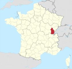
Jura
- French department
Hiking in Jura
Hiking in the Jura department, located in the Bourgogne-Franche-Comté region of eastern France, presents a remarkable opportunity to explore stunning natural landscapes, rich biodiversity, and charming villages. The Jura mountain range, characterized by its rolling hills, dense forests, and picturesque lakes, offers diverse hiking trails suitable for all levels of hikers....
- Country:
- Capital: Lons-le-Saunier
- Coordinates: 46° 40' 31" N, 5° 33' 16" E
- GPS tracks (wikiloc): [Link]
- Area: 4999 sq km
- Population: 260587
- Web site: [Link]

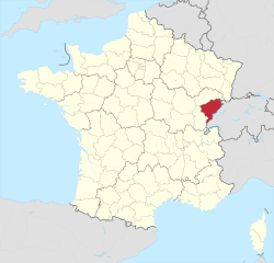
Doubs
- French department with 3 arrondissements
Hiking in Doubs
Hiking in the Doubs region, located in eastern France, offers stunning landscapes and a rich natural heritage. The Doubs department is known for its rugged terrain, deep valleys, and diverse ecosystems, making it a wonderful destination for outdoor enthusiasts. Here are some highlights and recommendations for hiking in the area:...
- Country:
- Capital: Besançon
- Coordinates: 47° 10' 0" N, 6° 25' 0" E
- GPS tracks (wikiloc): [Link]
- Area: 5234 sq km
- Population: 536959
- Web site: [Link]


Canton of Valais
- canton of Switzerland
Hiking in Canton of Valais
The Canton of Valais, located in southwestern Switzerland, is a fantastic destination for hiking enthusiasts. Famous for its stunning landscapes dominated by the Alps, the region offers a wide variety of trails suitable for all levels of hikers. Here are some key points to know about hiking in Valais:...
- Country:
- Capital: Sion
- Licence Plate Code: VS
- Coordinates: 46° 4' 0" N, 7° 36' 0" E
- GPS tracks (wikiloc): [Link]
- AboveSeaLevel: 512 м m
- Area: 5224.50 sq km
- Web site: [Link]