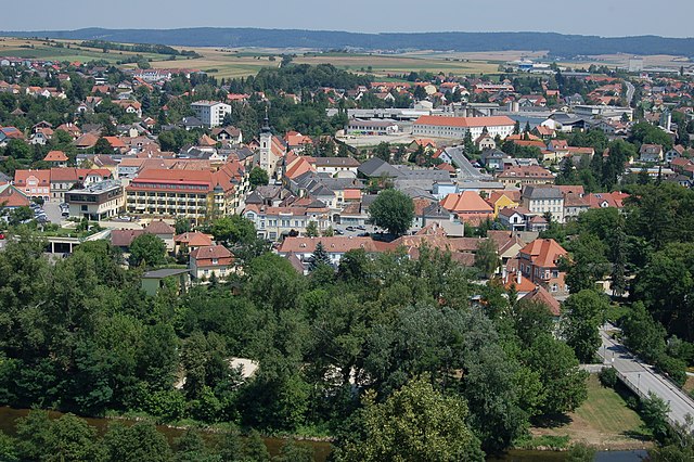
Rosenburg-Mold (Rosenburg-Mold)
- municipality in Austria
Rosenburg-Mold, located in Austria's Lower Austria region, is an excellent destination for hiking enthusiasts. The area is known for its beautiful landscapes, rich biodiversity, and winding trails that cater to a range of hiking abilities.
Key Highlights:
-
Scenic Trails: The region features a variety of trails set against the backdrop of rolling hills, vineyards, and forests. You can find well-marked hiking paths that lead through picturesque countryside, offering stunning views of the surrounding landscapes.
-
Nature Reserves: Many trails pass through protected areas that are home to diverse wildlife and plant species. This makes it an ideal spot for nature lovers and those interested in photography.
-
Local Culture: Hiking in Rosenburg-Mold allows you to immerse yourself in the local culture. You might pass by traditional villages and farms, where you can stop to taste local wines or regional dishes.
-
Seasonal Hiking: The best times to hike in Rosenburg-Mold are in spring and autumn when the weather is mild, and the scenery is particularly beautiful. Spring offers blooming flora, while autumn showcases vibrant foliage.
-
Trail Difficulty: The area has a mix of easy to moderate trails, making it suitable for families and beginner hikers, as well as more experienced trekkers looking for a challenge.
Recommended Trails:
- Rosenburg Circuit: A rewarding loop that takes you around the nearby Rosenburg Castle, providing a blend of historical interest and natural beauty.
- Mold Nature Trail: This trail focuses on the local flora and fauna, with informative signs along the way.
Tips for Hikers:
- Prepare for Weather: Conditions can change rapidly, so it's wise to check the weather forecast and dress in layers.
- Hydration and Snacks: Make sure to carry plenty of water and snacks, especially on longer hikes.
- Respect Nature: Stay on marked trails and be mindful of local wildlife. Leave no trace to preserve the beauty of the area.
In summary, hiking in Rosenburg-Mold is an enriching experience that combines outdoor adventure with cultural exploration. Whether you’re trekking solo or with family and friends, the trails here offer something for everyone. Enjoy your hike!
- Country:

- Postal Code: 3573
- Local Dialing Code: 02982
- Licence Plate Code: HO
- Coordinates: 48° 38' 24" N, 15° 42' 0" E


- GPS tracks (wikiloc): [Link]
- AboveSeaLevel: 268 м m
- Area: 30.66 sq km
- Population: 856
- Web site: http://www.rosenburg-mold.at
- Wikipedia en: wiki(en)
- Wikipedia: wiki(de)
- Wikidata storage: Wikidata: Q669827
- Wikipedia Commons Category: [Link]
- Freebase ID: [/m/02qx9ds]
- GeoNames ID: Alt: [7871780]
- VIAF ID: Alt: [240900976]
- Austrian municipality key: [31121]
Shares border with regions:

Gars am Kamp
- municipality in Austria
Gars am Kamp is a picturesque village located in Lower Austria, known for its scenic landscapes and well-marked hiking trails. Nestled in the Kamp Valley, it offers a mix of cultural heritage and natural beauty, making it a great destination for hikers of all levels....
- Country:

- Postal Code: 3571
- Local Dialing Code: 02985
- Licence Plate Code: HO
- Coordinates: 48° 35' 57" N, 15° 39' 48" E


- GPS tracks (wikiloc): [Link]
- AboveSeaLevel: 256 м m
- Area: 50.46 sq km
- Population: 3534
- Web site: [Link]

Altenburg, Lower Austria
- municipality in Austria
 Hiking in Altenburg, Lower Austria
Altenburg, located in Lower Austria, is a beautiful area for hiking enthusiasts. The region is characterized by rolling hills, picturesque landscapes, and rich forests, making it ideal for outdoor adventures....
- Country:

- Postal Code: 3591
- Local Dialing Code: 02982
- Licence Plate Code: HO
- Coordinates: 48° 39' 0" N, 15° 35' 0" E


- GPS tracks (wikiloc): [Link]
- AboveSeaLevel: 388 м m
- Area: 28.1 sq km
- Population: 828
- Web site: [Link]

Horn
- municipality in Austria
Horn, located in the northeastern part of Austria, is a beautiful area rich in natural landscapes and outdoor activities, making it a great destination for hiking enthusiasts. The region is characterized by rolling hills, lush forests, and scenic views of the surrounding countryside....
- Country:

- Postal Code: 3580
- Local Dialing Code: 0 29 82
- Licence Plate Code: HO
- Coordinates: 48° 39' 55" N, 15° 39' 21" E


- GPS tracks (wikiloc): [Link]
- AboveSeaLevel: 311 м m
- Area: 39.23 sq km
- Population: 6520
- Web site: [Link]


Meiseldorf
- municipality in Austria
Meiseldorf is a beautiful village located in the Lower Austria region of Austria. While it may not be as widely recognized as some of the larger hiking areas in the Alps, it offers serene trails and scenic views that are perfect for outdoor enthusiasts....
- Country:

- Postal Code: 3744
- Local Dialing Code: 02983
- Licence Plate Code: HO
- Coordinates: 48° 39' 53" N, 15° 45' 6" E


- GPS tracks (wikiloc): [Link]
- AboveSeaLevel: 398 м m
- Area: 35.45 sq km
- Population: 876
- Web site: [Link]

Burgschleinitz-Kühnring
- municipality in Austria
 Hiking in Burgschleinitz-Kühnring
Burgschleinitz-Kühnring, located in Lower Austria, is a picturesque area with varied terrain that offers a range of hiking opportunities. Here are some highlights to consider when planning a hike in this region:...
- Country:

- Local Dialing Code: 02984
- Licence Plate Code: HO
- Coordinates: 48° 36' 27" N, 15° 49' 0" E


- GPS tracks (wikiloc): [Link]
- AboveSeaLevel: 376 м m
- Area: 41.84 sq km
- Population: 1360
- Web site: [Link]