Saint-Aubin-sur-Gaillon (Saint-Aubin-sur-Gaillon)

- commune in Eure, France
- Country:

- Postal Code: 27600
- Coordinates: 49° 8' 50" N, 1° 19' 46" E


- GPS tracks (wikiloc): [Link]
- Area: 19.46 sq km
- Population: 1871
- Web site: http://www.saintaubinsurgaillon.fr/
- Wikipedia en: wiki(en)
- Wikipedia: wiki(fr)
- Wikidata storage: Wikidata: Q544613
- Wikipedia Commons Category: [Link]
- Freebase ID: [/m/02x6cr0]
- Freebase ID: [/m/02x6cr0]
- GeoNames ID: Alt: [6430563]
- GeoNames ID: Alt: [6430563]
- SIREN number: [212705172]
- SIREN number: [212705172]
- BnF ID: [15253751s]
- BnF ID: [15253751s]
- VIAF ID: Alt: [126760551]
- VIAF ID: Alt: [126760551]
- PACTOLS thesaurus ID: [pcrtMcjpSlS29V]
- PACTOLS thesaurus ID: [pcrtMcjpSlS29V]
- MusicBrainz area ID: [e4a015f8-866e-4f4f-b9c6-4dc2deda55e8]
- MusicBrainz area ID: [e4a015f8-866e-4f4f-b9c6-4dc2deda55e8]
- SUDOC authorities ID: [067091423]
- SUDOC authorities ID: [067091423]
- Trismegistos Geo ID: [24160]
- Trismegistos Geo ID: [24160]
- INSEE municipality code: 27517
- INSEE municipality code: 27517
Shares border with regions:


Champenard
- commune in Eure, France
- Country:
- Postal Code: 27600
- Coordinates: 49° 6' 23" N, 1° 20' 1" E
- GPS tracks (wikiloc): [Link]
- Area: 2.32 sq km
- Population: 253

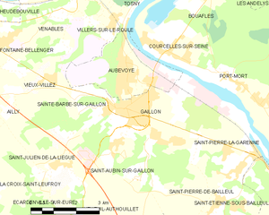
Gaillon
- commune in Eure, France
- Country:
- Postal Code: 27600
- Coordinates: 49° 9' 37" N, 1° 20' 9" E
- GPS tracks (wikiloc): [Link]
- AboveSeaLevel: 59 м m
- Area: 10.19 sq km
- Population: 7027