Saint-Avit (Saint-Avit)

- commune in Landes, France
- Country:

- Postal Code: 40090
- Coordinates: 43° 56' 28" N, 0° 26' 43" E


- GPS tracks (wikiloc): [Link]
- AboveSeaLevel: 96 м m
- Area: 40.74 sq km
- Population: 609
- Web site: http://stavit.lemarsan.fr
- Wikipedia en: wiki(en)
- Wikipedia: wiki(fr)
- Wikidata storage: Wikidata: Q40618
- Wikipedia Commons Category: [Link]
- Freebase ID: [/m/03y01m0]
- GeoNames ID: Alt: [6616739]
- SIREN number: [214002503]
- BnF ID: [152591925]
- MusicBrainz area ID: [77af32c8-a7f8-4ff4-86e9-74420caf96df]
- INSEE municipality code: 40250
Shares border with regions:

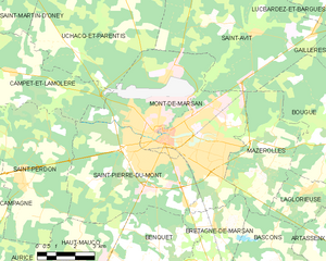
Mont-de-Marsan
- commune in Landes, France
- Country:
- Postal Code: 40000
- Coordinates: 43° 53' 25" N, 0° 30' 2" E
- GPS tracks (wikiloc): [Link]
- AboveSeaLevel: 63 м m
- Area: 36.88 sq km
- Population: 30629
- Web site: [Link]


Uchacq-et-Parentis
- commune in Landes, France
- Country:
- Postal Code: 40090
- Coordinates: 43° 55' 41" N, 0° 33' 37" E
- GPS tracks (wikiloc): [Link]
- Area: 38.58 sq km
- Population: 580

Lucbardez-et-Bargues
- commune in Landes, France
- Country:
- Postal Code: 40090
- Coordinates: 43° 58' 17" N, 0° 24' 18" E
- GPS tracks (wikiloc): [Link]
- Area: 21.48 sq km
- Population: 570

Mazerolles
- commune in Landes, France
- Country:
- Postal Code: 40090
- Coordinates: 43° 52' 31" N, 0° 26' 11" E
- GPS tracks (wikiloc): [Link]
- AboveSeaLevel: 84 м m
- Area: 15.97 sq km
- Population: 659


Gaillères
- commune in Landes, France
- Country:
- Postal Code: 40090
- Coordinates: 43° 56' 26" N, 0° 22' 21" E
- GPS tracks (wikiloc): [Link]
- Area: 14.04 sq km
- Population: 603

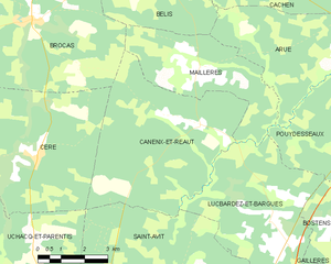
Canenx-et-Réaut
- commune in Landes, France
- Country:
- Postal Code: 40090
- Coordinates: 44° 0' 24" N, 0° 26' 33" E
- GPS tracks (wikiloc): [Link]
- Area: 28.07 sq km
- Population: 161


Bougue
- commune in Landes, France
- Country:
- Postal Code: 40090
- Coordinates: 43° 53' 24" N, 0° 23' 33" E
- GPS tracks (wikiloc): [Link]
- Area: 21.96 sq km
- Population: 738