Saint-Barnabé (Saint-Barnabé)

- commune in Côtes-d'Armor, France
- Country:

- Postal Code: 22600
- Coordinates: 48° 8' 15" N, 2° 42' 10" E


- GPS tracks (wikiloc): [Link]
- Area: 22.75 sq km
- Population: 1253
- Wikipedia en: wiki(en)
- Wikipedia: wiki(fr)
- Wikidata storage: Wikidata: Q1082363
- Wikipedia Commons Category: [Link]
- Freebase ID: [/m/03m4bp2]
- SIREN number: [212202758]
- BnF ID: [152512737]
- VIAF ID: Alt: [249388005]
- INSEE municipality code: 22275
Shares border with regions:


Rohan
- commune in Morbihan, France
- Country:
- Postal Code: 56580
- Coordinates: 48° 4' 7" N, 2° 45' 10" E
- GPS tracks (wikiloc): [Link]
- Area: 23.43 sq km
- Population: 1650
- Web site: [Link]


La Prénessaye
- commune in Côtes-d'Armor, France
- Country:
- Postal Code: 22210
- Coordinates: 48° 10' 59" N, 2° 38' 2" E
- GPS tracks (wikiloc): [Link]
- Area: 16.97 sq km
- Population: 885
- Web site: [Link]


Saint-Maudan
- commune in Côtes-d'Armor, France
- Country:
- Postal Code: 22600
- Coordinates: 48° 6' 49" N, 2° 46' 27" E
- GPS tracks (wikiloc): [Link]
- Area: 6.67 sq km
- Population: 401
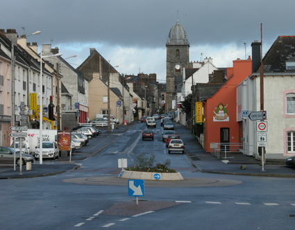

Loudéac
- commune in Côtes-d'Armor, France
- Country:
- Postal Code: 22600
- Coordinates: 48° 10' 40" N, 2° 45' 12" E
- GPS tracks (wikiloc): [Link]
- Area: 80.24 sq km
- Population: 9615
- Web site: [Link]


La Chèze
- commune in Côtes-d'Armor, France
- Country:
- Postal Code: 22210
- Coordinates: 48° 7' 53" N, 2° 39' 22" E
- GPS tracks (wikiloc): [Link]
- AboveSeaLevel: 67 м m
- Area: 2.53 sq km
- Population: 570


Bréhan
- commune in Morbihan, France
- Country:
- Postal Code: 56580
- Coordinates: 48° 3' 39" N, 2° 41' 14" E
- GPS tracks (wikiloc): [Link]
- Area: 51.65 sq km
- Population: 2322
- Web site: [Link]


La Ferrière
- former commune in Côtes-d'Armor, France
- Country:
- Postal Code: 22210
- Coordinates: 48° 8' 31" N, 2° 36' 24" E
- GPS tracks (wikiloc): [Link]
- Area: 15.64 sq km
- Population: 455