Saint-Benoist-sur-Mer (Saint-Benoist-sur-Mer)

- commune in Vendée, France
- Country:

- Postal Code: 85540
- Coordinates: 46° 25' 30" N, 1° 21' 16" E


- GPS tracks (wikiloc): [Link]
- Area: 15.53 sq km
- Population: 449
- Web site: http://www.saintbenoistsurmer.fr/
- Wikipedia en: wiki(en)
- Wikipedia: wiki(fr)
- Wikidata storage: Wikidata: Q629022
- Wikipedia Commons Category: [Link]
- Freebase ID: [/m/03qhkkq]
- GeoNames ID: Alt: [2981413]
- SIREN number: [218502011]
- BnF ID: [15278324d]
- PACTOLS thesaurus ID: [pcrtHtqLri4cpU]
- INSEE municipality code: 85201
Shares border with regions:

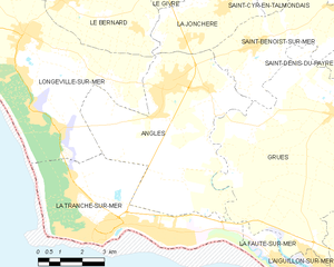
Angles
- commune in Vendée, France
- Country:
- Postal Code: 85750
- Coordinates: 46° 24' 31" N, 1° 24' 12" E
- GPS tracks (wikiloc): [Link]
- Area: 34.27 sq km
- Population: 2759
- Web site: [Link]


La Jonchère
- commune in Vendée, France
- Country:
- Postal Code: 85540
- Coordinates: 46° 26' 24" N, 1° 22' 29" E
- GPS tracks (wikiloc): [Link]
- Area: 11.5 sq km
- Population: 430
- Web site: [Link]

Lairoux
- commune in Vendée, France
- Country:
- Postal Code: 85400
- Coordinates: 46° 26' 52" N, 1° 16' 1" E
- GPS tracks (wikiloc): [Link]
- Area: 13.19 sq km
- Population: 611

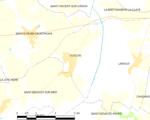
Curzon
- commune in Vendée, France
- Country:
- Postal Code: 85540
- Coordinates: 46° 26' 51" N, 1° 18' 34" E
- GPS tracks (wikiloc): [Link]
- AboveSeaLevel: 8 м m
- Area: 5.93 sq km
- Population: 493
- Web site: [Link]

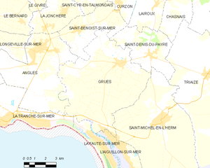
Grues
- commune in Vendée, France
- Country:
- Postal Code: 85580
- Coordinates: 46° 23' 56" N, 1° 18' 16" E
- GPS tracks (wikiloc): [Link]
- Area: 47.18 sq km
- Population: 838


Saint-Cyr-en-Talmondais
- commune in Vendée, France
- Country:
- Postal Code: 85540
- Coordinates: 46° 27' 38" N, 1° 20' 13" E
- GPS tracks (wikiloc): [Link]
- Area: 13.91 sq km
- Population: 372
- Web site: [Link]


Saint-Denis-du-Payré
- commune in Vendée, France
- Country:
- Postal Code: 85580
- Coordinates: 46° 24' 26" N, 1° 16' 7" E
- GPS tracks (wikiloc): [Link]
- Area: 16.24 sq km
- Population: 384