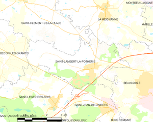
Saint-Clément-de-la-Place (Saint-Clément-de-la-Place)

- commune in Maine-et-Loire, France
- Country:

- Postal Code: 49370
- Coordinates: 47° 31' 30" N, 0° 44' 47" E


- GPS tracks (wikiloc): [Link]
- Area: 33.23 sq km
- Population: 2190
- Web site: http://www.saint-clement-de-la-place.fr
- Wikipedia en: wiki(en)
- Wikipedia: wiki(fr)
- Wikidata storage: Wikidata: Q935444
- Wikipedia Commons Category: [Link]
- Freebase ID: [/m/03x_tvr]
- Freebase ID: [/m/03x_tvr]
- Freebase ID: [/m/03x_tvr]
- GeoNames ID: Alt: [6435280]
- GeoNames ID: Alt: [6435280]
- GeoNames ID: Alt: [6435280]
- SIREN number: [214902710]
- SIREN number: [214902710]
- SIREN number: [214902710]
- BnF ID: [152618702]
- BnF ID: [152618702]
- BnF ID: [152618702]
- INSEE municipality code: 49271
- INSEE municipality code: 49271
- INSEE municipality code: 49271
Shares border with regions:


Brain-sur-Longuenée
- former commune in Maine-et-Loire, France
- Country:
- Postal Code: 49220
- Coordinates: 47° 35' 5" N, 0° 45' 44" E
- GPS tracks (wikiloc): [Link]
- Area: 22.43 sq km
- Population: 947
- Web site: [Link]

Bécon-les-Granits
- commune in Maine-et-Loire, France
- Country:
- Postal Code: 49370
- Coordinates: 47° 30' 9" N, 0° 48' 4" E
- GPS tracks (wikiloc): [Link]
- Area: 46.17 sq km
- Population: 2809
- Web site: [Link]


La Membrolle-sur-Longuenée
- former commune in Maine-et-Loire, France
- Country:
- Postal Code: 49770
- Coordinates: 47° 33' 40" N, 0° 40' 26" E
- GPS tracks (wikiloc): [Link]
- AboveSeaLevel: 63 м m
- Area: 9.44 sq km
- Population: 2027
- Web site: [Link]


La Pouëze
- former commune in Maine-et-Loire, France
- Country:
- Postal Code: 49370
- Coordinates: 47° 33' 10" N, 0° 48' 35" E
- GPS tracks (wikiloc): [Link]
- Area: 22.15 sq km
- Population: 1951

La Meignanne
- former commune in Maine-et-Loire, France
- Country:
- Postal Code: 49770
- Coordinates: 47° 31' 10" N, 0° 40' 9" E
- GPS tracks (wikiloc): [Link]
- AboveSeaLevel: 35 м m
- Area: 23.39 sq km
- Population: 2317
- Web site: [Link]
Saint-Lambert-la-Potherie
- commune in Maine-et-Loire, France
- Country:
- Postal Code: 49070
- Coordinates: 47° 29' 1" N, 0° 40' 39" E
- GPS tracks (wikiloc): [Link]
- Area: 13.81 sq km
- Population: 2619
- Web site: [Link]