Saint-Eutrope (Saint-Eutrope)

- former commune in Charente, France
- Country:

- Postal Code: 16190
- Coordinates: 45° 25' 5" N, 0° 6' 41" E


- GPS tracks (wikiloc): [Link]
- Area: 2.67 sq km
- Population: 169
- Wikipedia en: wiki(en)
- Wikipedia: wiki(fr)
- Wikidata storage: Wikidata: Q950513
- Wikipedia Commons Category: [Link]
- Freebase ID: [/m/03mcd9k]
- GeoNames ID: Alt: [6427829]
- BnF ID: [15248751s]
- INSEE municipality code: 16314
Shares border with regions:

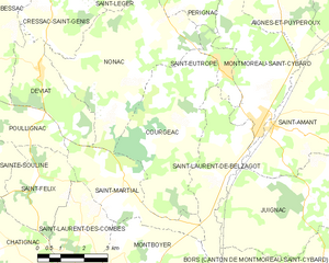
Courgeac
- commune in Charente, France
- Country:
- Postal Code: 16190
- Coordinates: 45° 23' 38" N, 0° 5' 5" E
- GPS tracks (wikiloc): [Link]
- Area: 18.42 sq km
- Population: 208


Nonac
- commune in Charente, France
- Country:
- Postal Code: 16190
- Coordinates: 45° 25' 14" N, 0° 3' 23" E
- GPS tracks (wikiloc): [Link]
- Area: 20.84 sq km
- Population: 301
- Web site: [Link]


Pérignac
- commune in Charente, France
- Country:
- Postal Code: 16250
- Coordinates: 45° 27' 52" N, 0° 4' 38" E
- GPS tracks (wikiloc): [Link]
- Area: 25.52 sq km
- Population: 470


Saint-Laurent-de-Belzagot
- former commune in Charente, France
- Country:
- Postal Code: 16190
- Coordinates: 45° 23' 25" N, 0° 7' 5" E
- GPS tracks (wikiloc): [Link]
- Area: 9.99 sq km
- Population: 407


Montmoreau-Saint-Cybard
- former commune in Charente, France
- Country:
- Postal Code: 16190
- Coordinates: 45° 23' 56" N, 0° 7' 51" E
- GPS tracks (wikiloc): [Link]
- AboveSeaLevel: 82 м m
- Area: 12 sq km
- Population: 1061
- Web site: [Link]