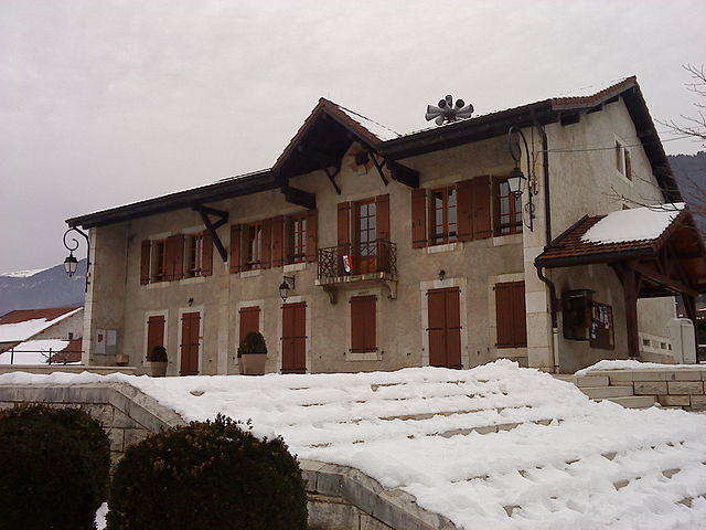
Saint-Genis-Pouilly (Saint-Genis-Pouilly)
- commune in Ain, France
 Hiking in Saint-Genis-Pouilly
Saint-Genis-Pouilly is a charming commune located in the Ain department of France, close to the border with Switzerland, and it offers some lovely opportunities for hiking. Nestled near the Jura Mountains and the natural reserves around Geneva, the area is rich in diverse landscapes, making it a great destination for outdoor enthusiasts.
Hiking Trails
-
La Forêt de la Côtière: This nearby forest offers numerous trails for walkers and is perfect for a peaceful hike surrounded by nature. The paths are well-marked and suitable for hikers of all levels.
-
Jura Mountains: Not far from Saint-Genis-Pouilly, the Jura Mountains offer more challenging hiking routes with stunning views of the Alps and Lake Geneva. Popular hikes include trails leading to the craggy peaks and forested areas.
-
Plateau de Cessy: This area features a more relaxed hiking experience, with easy trails suitable for families. The flat terrain offers beautiful panoramic views and is great for picnics.
-
Regional Nature Reserve of the Haute Chaîne du Jura: This protected area has designated hiking paths that allow you to explore the rich biodiversity of the region, including unique flora and fauna.
Tips for Hiking in Saint-Genis-Pouilly
- Stay Hydrated: Always carry sufficient water, especially during warmer months.
- Check Weather Conditions: The weather in the Jura Mountains can change rapidly; make sure to check the forecast before heading out.
- Local Rules: Be aware of any local regulations, especially in natural reserves, to protect the environment.
- Trail Maps: While many trails are well-marked, it’s a good idea to carry a map or download a hiking app for navigation.
Additional Activities
In addition to hiking, Saint-Genis-Pouilly is close to Geneva, where you can enjoy cultural activities, restaurants, and lakeside walks. This makes it easy to combine outdoor exploration with urban excursions.
Conclusion
Whether you're an experienced hiker or a family looking for a leisurely stroll, Saint-Genis-Pouilly provides a delightful mix of natural beauty and outdoor adventure. Just remember to respect nature and enjoy the stunning landscapes that this region has to offer!
- Country:

- Postal Code: 01630
- Coordinates: 46° 14' 36" N, 6° 1' 17" E


- GPS tracks (wikiloc): [Link]
- Area: 9.77 sq km
- Population: 10824
- Web site: http://www.saint-genis-pouilly.fr
- Wikipedia en: wiki(en)
- Wikipedia: wiki(fr)
- Wikidata storage: Wikidata: Q332416
- Wikipedia Commons Category: [Link]
- Wikipedia Commons Maps Category: [Link]
- Freebase ID: [/m/02wyxkv]
- Freebase ID: [/m/02wyxkv]
- GeoNames ID: Alt: [2979983]
- GeoNames ID: Alt: [2979983]
- SIREN number: [210103545]
- SIREN number: [210103545]
- BnF ID: [144169712]
- BnF ID: [144169712]
- VIAF ID: Alt: [266367341]
- VIAF ID: Alt: [266367341]
- Quora topic ID: [Saint-Genis-Pouilly]
- Quora topic ID: [Saint-Genis-Pouilly]
- SUDOC authorities ID: [086025821]
- SUDOC authorities ID: [086025821]
- INSEE municipality code: 01354
- INSEE municipality code: 01354
Shares border with regions:
Crozet
- commune in Ain, France
Hiking in Crozet
Crozet, located in the Ain department of the Auvergne-Rhône-Alpes region in France, offers beautiful hiking opportunities with stunning views of the Jura Mountains and the surrounding countryside. Here are some highlights for hiking in and around Crozet:...
- Country:
- Postal Code: 01170
- Coordinates: 46° 16' 50" N, 6° 0' 45" E
- GPS tracks (wikiloc): [Link]
- Area: 27.47 sq km
- Population: 2115
- Web site: [Link]

Sergy
- commune in Ain, France
Hiking in Sergy
Sergy is a picturesque village located in the Ain department in the Auvergne-Rhône-Alpes region of France, near the border with Switzerland. This area offers a blend of beautiful landscapes, lush forests, and various trails that cater to different levels of hiking experience....
- Country:
- Postal Code: 01630
- Coordinates: 46° 15' 11" N, 6° 0' 0" E
- GPS tracks (wikiloc): [Link]
- Area: 9.46 sq km
- Population: 2015
- Web site: [Link]

Prévessin-Moëns
- commune in Ain, France
Hiking in Prévessin-Moëns
Prévessin-Moëns is a charming commune in the Ain department of France, located near the border with Switzerland and just a short distance from Geneva. While it may not be as well known as some other hiking destinations, it offers some lovely trails and opportunities for outdoor enthusiasts....
- Country:
- Postal Code: 01280
- Coordinates: 46° 15' 20" N, 6° 4' 55" E
- GPS tracks (wikiloc): [Link]
- Area: 12.07 sq km
- Population: 7860
- Web site: [Link]

Chevry
- commune in Ain, France
Hiking in Chevry
Chevry is a charming commune located in the Ain department of the Auvergne-Rhône-Alpes region in southeastern France. Nestled near the Jura Mountains and close to the Swiss border, this area provides some beautiful hiking opportunities and stunning natural scenery....
- Country:
- Postal Code: 01170
- Coordinates: 46° 16' 51" N, 6° 2' 13" E
- GPS tracks (wikiloc): [Link]
- Area: 5.84 sq km
- Population: 1525
- Web site: [Link]

Thoiry
- commune in Ain, France
Hiking in Thoiry
Thoiry, located in the Ain department of France, is a beautiful area that offers various hiking opportunities, particularly due to its picturesque landscapes that blend mountains, forests, and countryside. Here are some highlights and tips for hiking in this region:...
- Country:
- Postal Code: 01710
- Coordinates: 46° 14' 11" N, 5° 58' 47" E
- GPS tracks (wikiloc): [Link]
- Area: 28.93 sq km
- Population: 6161
- Web site: [Link]