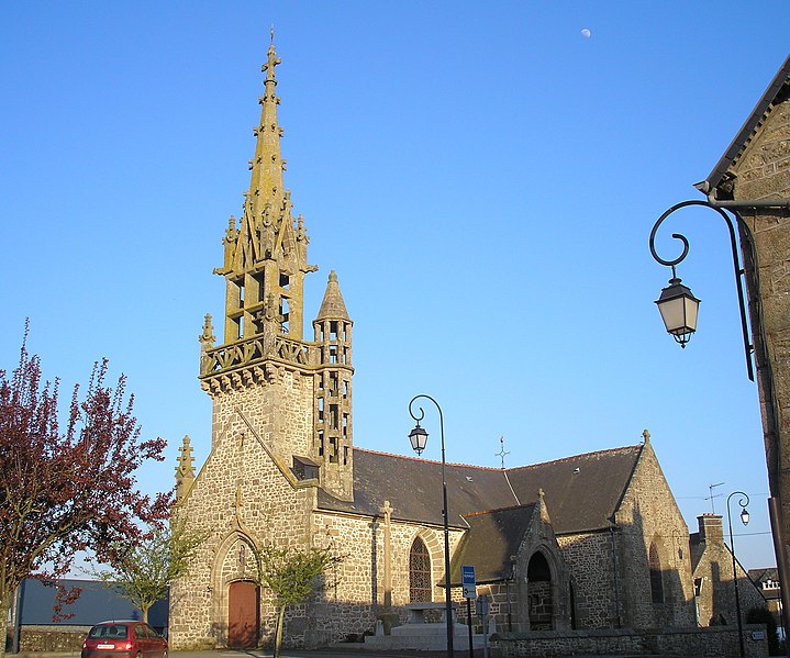
Saint-Georges-de-Reintembault (Saint-Georges-de-Reintembault)

- commune in Ille-et-Vilaine, France
- Country:

- Postal Code: 35420
- Coordinates: 48° 30' 27" N, 1° 14' 36" E


- GPS tracks (wikiloc): [Link]
- AboveSeaLevel: 130 м m
- Area: 31.02 sq km
- Population: 1556
- Web site: http://saint-georges-de-reintembault.fr
- Wikipedia en: wiki(en)
- Wikipedia: wiki(fr)
- Wikidata storage: Wikidata: Q686913
- Wikipedia Commons Category: [Link]
- Freebase ID: [/m/03mf4l2]
- Freebase ID: [/m/03mf4l2]
- GeoNames ID: Alt: [2979926]
- GeoNames ID: Alt: [2979926]
- SIREN number: [213502719]
- SIREN number: [213502719]
- BnF ID: [15257213t]
- BnF ID: [15257213t]
- OSM relation ID: [146018]
- OSM relation ID: [146018]
- INSEE municipality code: 35271
- INSEE municipality code: 35271
Shares border with regions:

Hamelin
- commune in Manche, France
- Country:
- Postal Code: 50730
- Coordinates: 48° 32' 38" N, 1° 12' 34" E
- GPS tracks (wikiloc): [Link]
- Area: 2.46 sq km
- Population: 98


Montjoie-Saint-Martin
- commune in Manche, France
- Country:
- Postal Code: 50240
- Coordinates: 48° 31' 56" N, 1° 17' 28" E
- GPS tracks (wikiloc): [Link]
- Area: 7.49 sq km
- Population: 252

Monthault
- commune in Ille-et-Vilaine, France
- Country:
- Postal Code: 35420
- Coordinates: 48° 30' 41" N, 1° 10' 53" E
- GPS tracks (wikiloc): [Link]
- Area: 8.2 sq km
- Population: 271
- Web site: [Link]

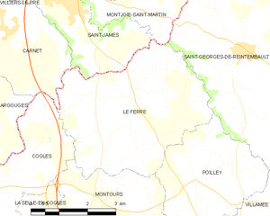
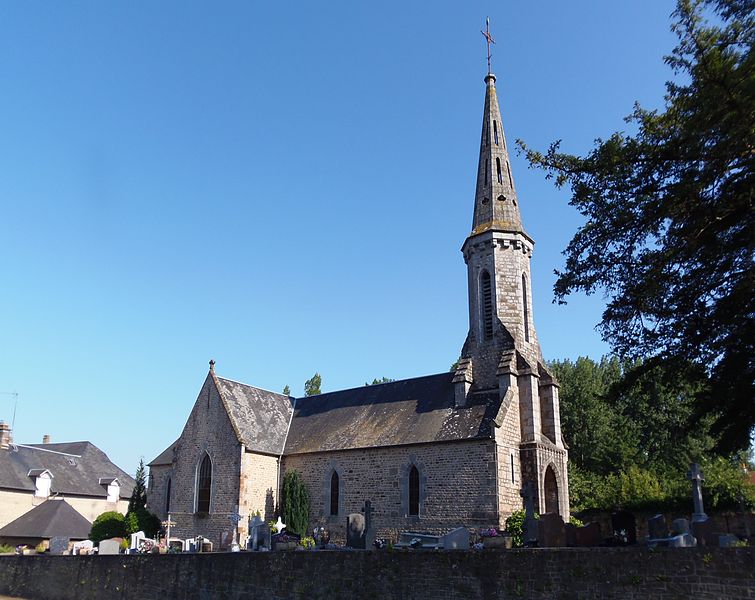
Le Ferré
- commune in Ille-et-Vilaine, France
- Country:
- Postal Code: 35420
- Coordinates: 48° 29' 33" N, 1° 17' 38" E
- GPS tracks (wikiloc): [Link]
- Area: 16.92 sq km
- Population: 689
- Web site: [Link]


Villamée
- commune in Ille-et-Vilaine, France
- Country:
- Postal Code: 35420
- Coordinates: 48° 27' 39" N, 1° 13' 18" E
- GPS tracks (wikiloc): [Link]
- Area: 10.66 sq km
- Population: 315


Poilley
- commune in Ille-et-Vilaine, France
- Country:
- Postal Code: 35420
- Coordinates: 48° 27' 56" N, 1° 15' 45" E
- GPS tracks (wikiloc): [Link]
- Area: 10.78 sq km
- Population: 387


Mellé
- commune in Ille-et-Vilaine, France
- Country:
- Postal Code: 35420
- Coordinates: 48° 29' 17" N, 1° 11' 20" E
- GPS tracks (wikiloc): [Link]
- Area: 15.5 sq km
- Population: 656
- Web site: [Link]


Saint-Laurent-de-Terregatte
- commune in Manche, France
- Country:
- Postal Code: 50111
- Coordinates: 48° 34' 20" N, 1° 15' 33" E
- GPS tracks (wikiloc): [Link]
- Area: 16.35 sq km
- Population: 644


Saint-Aubin-de-Terregatte
- commune in Manche, France
- Country:
- Postal Code: 50111
- Coordinates: 48° 34' 33" N, 1° 17' 58" E
- GPS tracks (wikiloc): [Link]
- Area: 20.96 sq km
- Population: 685
- Web site: [Link]


Saint-Martin-de-Landelles
- former commune in Manche, France
- Country:
- Postal Code: 50730
- Coordinates: 48° 32' 45" N, 1° 10' 19" E
- GPS tracks (wikiloc): [Link]
- Area: 19.91 sq km
- Population: 1124
- Web site: [Link]