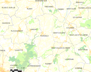
Saint-Gilles-du-Mené (Saint-Gilles-du-Mené)
- former commune in Côtes-d'Armor, France
- Country:

- Postal Code: 22330
- Coordinates: 48° 14' 53" N, 2° 32' 53" E


- GPS tracks (wikiloc): [Link]
- Area: 12.92 sq km
- Population: 469
- Web site: http://pagesperso-orange.fr/st-gilles-du-mene/
- Wikipedia en: wiki(en)
- Wikipedia: wiki(fr)
- Wikidata storage: Wikidata: Q1013984
- Wikipedia Commons Category: [Link]
- Freebase ID: [/m/03m4c0s]
- BnF ID: [15251290t]
- INSEE municipality code: 22292
Shares border with regions:


Saint-Jacut-du-Mené
- former commune in Côtes-d'Armor, France
- Country:

- Postal Code: 22330
- Coordinates: 48° 17' 1" N, 2° 28' 54" E


- GPS tracks (wikiloc): [Link]
- Area: 19.81 sq km
- Population: 741
- Web site: [Link]


Plessala
- former commune in Côtes-d'Armor, France
- Country:

- Postal Code: 22330
- Coordinates: 48° 16' 33" N, 2° 37' 10" E


- GPS tracks (wikiloc): [Link]
- Area: 51.45 sq km
- Population: 1812
- Web site: [Link]


Saint-Gouéno
- former commune in Côtes-d'Armor, France
- Country:

- Postal Code: 22330
- Coordinates: 48° 16' 3" N, 2° 34' 7" E


- GPS tracks (wikiloc): [Link]
- Area: 20.08 sq km
- Population: 694


Laurenan
- commune in Côtes-d'Armor, France
- Country:

- Postal Code: 22230
- Coordinates: 48° 11' 57" N, 2° 32' 8" E


- GPS tracks (wikiloc): [Link]
- Area: 30.9 sq km
- Population: 734
