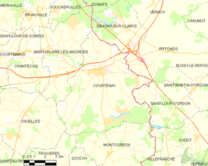
Saint-Hilaire-les-Andrésis (Saint-Hilaire-les-Andrésis)

- commune in Loiret, France
- Country:

- Postal Code: 45320
- Coordinates: 48° 3' 12" N, 3° 0' 46" E


- GPS tracks (wikiloc): [Link]
- Area: 25.71 sq km
- Population: 908
- Web site: http://www.saint-hilaire-les-andresis.fr/default/
- Wikipedia en: wiki(en)
- Wikipedia: wiki(fr)
- Wikidata storage: Wikidata: Q1429322
- Wikipedia Commons Category: [Link]
- Freebase ID: [/m/03nwg8w]
- SIREN number: [214502817]
- BnF ID: [152606739]
- PACTOLS thesaurus ID: [pcrtmErJkuNAJt]
- INSEE municipality code: 45281
Shares border with regions:


Chuelles
- commune in Loiret, France
- Country:
- Postal Code: 45220
- Coordinates: 48° 0' 10" N, 2° 57' 56" E
- GPS tracks (wikiloc): [Link]
- Area: 30.82 sq km
- Population: 1185
- Web site: [Link]


Domats
- commune in Yonne, France
- Country:
- Postal Code: 89150
- Coordinates: 48° 6' 51" N, 3° 4' 0" E
- GPS tracks (wikiloc): [Link]
- Area: 24.15 sq km
- Population: 856


Savigny-sur-Clairis
- commune in Yonne, France
- Country:
- Postal Code: 89150
- Coordinates: 48° 4' 29" N, 3° 5' 36" E
- GPS tracks (wikiloc): [Link]
- Area: 16.44 sq km
- Population: 453


Ervauville
- commune in Loiret, France
- Country:
- Postal Code: 45320
- Coordinates: 48° 5' 23" N, 2° 58' 54" E
- GPS tracks (wikiloc): [Link]
- Area: 12.54 sq km
- Population: 557


Foucherolles
- commune in Loiret, France
- Country:
- Postal Code: 45320
- Coordinates: 48° 5' 36" N, 3° 0' 44" E
- GPS tracks (wikiloc): [Link]
- Area: 9.8 sq km
- Population: 298


Chantecoq
- commune in Loiret, France
- Country:
- Postal Code: 45320
- Coordinates: 48° 3' 8" N, 2° 57' 24" E
- GPS tracks (wikiloc): [Link]
- Area: 15.93 sq km
- Population: 507
- Web site: [Link]

Courtenay
- commune in Loiret, France
- Country:
- Postal Code: 45320
- Coordinates: 48° 2' 21" N, 3° 3' 19" E
- GPS tracks (wikiloc): [Link]
- Area: 50.13 sq km
- Population: 4029
- Web site: [Link]