
Saint-Jean-Pied-de-Port (Saint-Jean-Pied-de-Port)

- commune in Pyrénées-Atlantiques, France
- Country:

- Postal Code: 64220
- Coordinates: 43° 9' 51" N, 1° 14' 12" E


- GPS tracks (wikiloc): [Link]
- AboveSeaLevel: 180 м m
- Area: 2.73 sq km
- Population: 1580
- Web site: http://www.st-jean-pied-de-port.fr
- Wikipedia en: wiki(en)
- Wikipedia: wiki(fr)
- Wikidata storage: Wikidata: Q270294
- Wikipedia Commons Category: [Link]
- Freebase ID: [/m/053bfm]
- Freebase ID: [/m/053bfm]
- GeoNames ID: Alt: [2979207]
- GeoNames ID: Alt: [2979207]
- SIREN number: [216404855]
- SIREN number: [216404855]
- BnF ID: [15270307w]
- BnF ID: [15270307w]
- VIAF ID: Alt: [136198393]
- VIAF ID: Alt: [136198393]
- OSM relation ID: [168589]
- OSM relation ID: [168589]
- GND ID: Alt: [4354139-2]
- GND ID: Alt: [4354139-2]
- Library of Congress authority ID: Alt: [n94079982]
- Library of Congress authority ID: Alt: [n94079982]
- PACTOLS thesaurus ID: [pcrtw5s7WovjWx]
- PACTOLS thesaurus ID: [pcrtw5s7WovjWx]
- MusicBrainz area ID: [127dfefc-151c-4132-9762-d961e2b67809]
- MusicBrainz area ID: [127dfefc-151c-4132-9762-d961e2b67809]
- SUDOC authorities ID: [156954265]
- SUDOC authorities ID: [156954265]
- Gran Enciclopèdia Catalana ID: [0060033]
- Gran Enciclopèdia Catalana ID: [0060033]
- INSEE municipality code: 64485
- INSEE municipality code: 64485
Shares border with regions:


Saint-Jean-le-Vieux
- commune in Pyrénées-Atlantiques, France
- Country:
- Postal Code: 64220
- Coordinates: 43° 9' 55" N, 1° 11' 36" E
- GPS tracks (wikiloc): [Link]
- Area: 11.64 sq km
- Population: 855


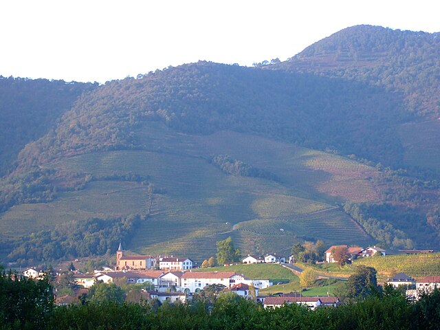
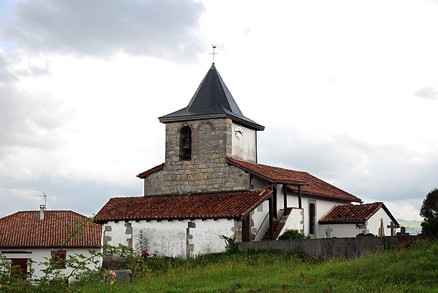
Saint-Michel
- commune in Pyrénées-Atlantiques, France
- Country:
- Postal Code: 64220
- Coordinates: 43° 8' 10" N, 1° 13' 16" E
- GPS tracks (wikiloc): [Link]
- Area: 30.3 sq km
- Population: 288

Ispoure
- commune in Pyrénées-Atlantiques, France
- Country:
- Postal Code: 64220
- Coordinates: 43° 10' 15" N, 1° 14' 3" E
- GPS tracks (wikiloc): [Link]
- Area: 7.85 sq km
- Population: 673

Çaro
- commune in Pyrénées-Atlantiques, France
- Country:
- Postal Code: 64220
- Coordinates: 43° 8' 51" N, 1° 13' 3" E
- GPS tracks (wikiloc): [Link]
- Area: 4.01 sq km
- Population: 193

Uhart-Cize
- commune in Pyrénées-Atlantiques, France
- Country:
- Postal Code: 64220
- Coordinates: 43° 9' 53" N, 1° 14' 40" E
- GPS tracks (wikiloc): [Link]
- Area: 11.66 sq km
- Population: 798