Saint-Léger-des-Prés (Saint-Léger-des-Prés)

- commune in Ille-et-Vilaine, France
- Country:

- Postal Code: 35270
- Coordinates: 48° 23' 43" N, 1° 39' 6" E


- GPS tracks (wikiloc): [Link]
- Area: 5.54 sq km
- Population: 249
- Wikipedia en: wiki(en)
- Wikipedia: wiki(fr)
- Wikidata storage: Wikidata: Q640373
- Wikipedia Commons Category: [Link]
- Freebase ID: [/m/03mf17g]
- Freebase ID: [/m/03mf17g]
- GeoNames ID: Alt: [6432844]
- GeoNames ID: Alt: [6432844]
- SIREN number: [213502867]
- SIREN number: [213502867]
- BnF ID: [15257228v]
- BnF ID: [15257228v]
- OSM relation ID: [145549]
- OSM relation ID: [145549]
- INSEE municipality code: 35286
- INSEE municipality code: 35286
Shares border with regions:


Cuguen
- commune in Ille-et-Vilaine, France
- Country:
- Postal Code: 35270
- Coordinates: 48° 26' 58" N, 1° 39' 48" E
- GPS tracks (wikiloc): [Link]
- Area: 23.54 sq km
- Population: 834


Lanrigan
- commune in Ille-et-Vilaine, France
- Country:
- Postal Code: 35270
- Coordinates: 48° 23' 47" N, 1° 41' 56" E
- GPS tracks (wikiloc): [Link]
- Area: 3.98 sq km
- Population: 151


Marcillé-Raoul
- commune in Ille-et-Vilaine, France
- Country:
- Postal Code: 35560
- Coordinates: 48° 23' 13" N, 1° 36' 21" E
- GPS tracks (wikiloc): [Link]
- Area: 22.41 sq km
- Population: 796
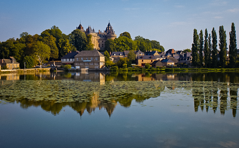

Combourg
- commune in Ille-et-Vilaine, France
- Country:
- Postal Code: 35270
- Coordinates: 48° 24' 31" N, 1° 45' 6" E
- GPS tracks (wikiloc): [Link]
- AboveSeaLevel: 66 м m
- Area: 63.55 sq km
- Population: 5862
- Web site: [Link]


Dingé
- commune in Ille-et-Vilaine, France
- Country:
- Postal Code: 35440
- Coordinates: 48° 21' 27" N, 1° 42' 58" E
- GPS tracks (wikiloc): [Link]
- Area: 52.89 sq km
- Population: 1666


Noyal-sous-Bazouges
- commune in Ille-et-Vilaine, France
- Country:
- Postal Code: 35560
- Coordinates: 48° 24' 48" N, 1° 37' 27" E
- GPS tracks (wikiloc): [Link]
- Area: 14.83 sq km
- Population: 391