Saint-Léger-lès-Domart (Saint-Léger-lès-Domart)
- commune in Somme, France
- Country:

- Postal Code: 80780
- Coordinates: 50° 2' 57" N, 2° 8' 15" E


- GPS tracks (wikiloc): [Link]
- Area: 7.05 sq km
- Population: 1857
- Wikipedia en: wiki(en)
- Wikipedia: wiki(fr)
- Wikidata storage: Wikidata: Q1217365
- Wikipedia Commons Category: [Link]
- Freebase ID: [/m/03qmppn]
- GeoNames ID: Alt: [6444734]
- SIREN number: [218006658]
- BnF ID: [152771803]
- VIAF ID: Alt: [140433459]
- SUDOC authorities ID: [030042038]
- INSEE municipality code: 80706
Shares border with regions:


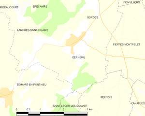
Berneuil
- commune in Somme, France
- Country:

- Postal Code: 80620
- Coordinates: 50° 5' 41" N, 2° 10' 16" E


- GPS tracks (wikiloc): [Link]
- Area: 5.51 sq km
- Population: 260


Pernois
- commune in Somme, France
- Country:

- Postal Code: 80670
- Coordinates: 50° 3' 8" N, 2° 11' 4" E


- GPS tracks (wikiloc): [Link]
- Area: 8.83 sq km
- Population: 726


Berteaucourt-les-Dames
- commune in Somme, France
- Country:

- Postal Code: 80850
- Coordinates: 50° 2' 48" N, 2° 9' 10" E


- GPS tracks (wikiloc): [Link]
- Area: 4.64 sq km
- Population: 1161
- Web site: [Link]


Domart-en-Ponthieu
- commune in Somme, France
- Country:

- Postal Code: 80620
- Coordinates: 50° 4' 28" N, 2° 7' 31" E


- GPS tracks (wikiloc): [Link]
- Area: 17.93 sq km
- Population: 1134


Saint-Ouen
- commune in Somme, France
- Country:

- Postal Code: 80610
- Coordinates: 50° 2' 13" N, 2° 7' 19" E


- GPS tracks (wikiloc): [Link]
- Area: 4.35 sq km
- Population: 1915
- Web site: [Link]


Surcamps
- commune in Somme, France
- Country:

- Postal Code: 80620
- Coordinates: 50° 4' 10" N, 2° 4' 29" E


- GPS tracks (wikiloc): [Link]
- Area: 2.97 sq km
- Population: 68


Ville-le-Marclet
- commune in Somme, France
- Country:

- Postal Code: 80420
- Coordinates: 50° 1' 22" N, 2° 5' 19" E


- GPS tracks (wikiloc): [Link]
- Area: 8.93 sq km
- Population: 481
