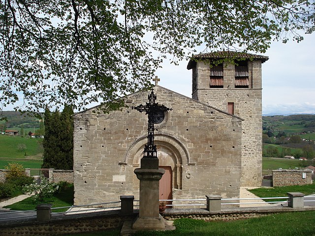
Saint-Laurent-d'Onay (Saint-Laurent-d'Onay)

- commune in Drôme, France
 Hiking in Saint-Laurent-d'Onay
Saint-Laurent-d'Onay is a beautiful commune located in the French region of Auvergne-Rhône-Alpes. While it is lesser-known compared to some of the more famous hiking destinations in France, it offers a peaceful setting with opportunities for hiking enthusiasts to explore its natural landscapes.
Hiking Opportunities
-
Scenic Trails: The area around Saint-Laurent-d'Onay features scenic trails that bring you through lush forests, rolling hills, and perhaps views of the Monts du Forez. These trails can vary in difficulty, making it suitable for both novice and experienced hikers.
-
Nature Observation: The region is rich in biodiversity, so you may encounter various flora and fauna. Birdwatching can also be enjoyable along certain paths, especially in the early morning.
-
Cultural Insights: Hiking in this area can also provide a glimpse into local history and culture. There may be opportunities to pass by traditional farms, ancient ruins, or local chapels, offering a more immersive experience.
-
Nearby Attractions: Consider combining your hiking experience with a visit to nearby landmarks or towns. The Monts du Forez regional park is not too far and can offer additional hiking opportunities.
Tips for Hiking in Saint-Laurent-d'Onay
- Trail Maps: Make sure to obtain a map of the trails in the area or download a hiking app to help you navigate.
- Weather Considerations: Always check the weather forecast before heading out, as conditions can change quickly in mountainous regions.
- Safety Gear: Wear appropriate footwear and carry enough water, snacks, and a basic first-aid kit.
- Leave No Trace: Respect nature by following the Leave No Trace principles, ensuring the area's beauty remains intact for other hikers.
Conclusion
Hiking in Saint-Laurent-d'Onay can be a wonderful way to enjoy the natural beauty of the Auvergne-Rhône-Alpes region. If you're looking for a quieter, more off-the-beaten-path experience, this area is certainly worth exploring!
- Country:

- Postal Code: 26350
- Coordinates: 45° 10' 56" N, 5° 6' 5" E


- GPS tracks (wikiloc): [Link]
- Area: 6.28 sq km
- Population: 152
- Wikipedia en: wiki(en)
- Wikipedia: wiki(fr)
- Wikidata storage: Wikidata: Q1075856
- Wikipedia Commons Category: [Link]
- Freebase ID: [/m/03mhkkm]
- SIREN number: [212603104]
- BnF ID: [15253170d]
- INSEE municipality code: 26310
Shares border with regions:


Montmiral
- commune in Drôme, France
Hiking in Montmiral
Montmiral, located in the picturesque region of the Occitanie near the Tarn department in France, offers a charming hiking experience surrounded by stunning landscapes and historical architecture. The area is known for its rolling hills, vineyards, and medieval villages, making it an excellent destination for outdoor enthusiasts and history buffs alike....
- Country:
- Postal Code: 26750
- Coordinates: 45° 9' 19" N, 5° 8' 59" E
- GPS tracks (wikiloc): [Link]
- Area: 26.69 sq km
- Population: 652
- Web site: [Link]


Saint-Bonnet-de-Valclérieux
- commune in Drôme, France
Hiking in Saint-Bonnet-de-Valclérieux
Saint-Bonnet-de-Valclérieux is a charming village located in the Auvergne-Rhône-Alpes region of France, nestled in the picturesque countryside. The area is known for its natural beauty and offers a range of hiking opportunities, making it a great destination for outdoor enthusiasts....
- Country:
- Postal Code: 26350
- Coordinates: 45° 11' 43" N, 5° 8' 35" E
- GPS tracks (wikiloc): [Link]
- Area: 8.29 sq km
- Population: 217
Saint-Michel-sur-Savasse
- commune in Drôme, France
Hiking in Saint-Michel-sur-Savasse
Saint-Michel-sur-Savasse is a charming commune in the Drôme department of France, located near the Rhône River. While it may not be as widely recognized as some other hiking destinations, it offers beautiful landscapes and opportunities for outdoor enthusiasts....
- Country:
- Postal Code: 26750
- Coordinates: 45° 8' 44" N, 5° 7' 22" E
- GPS tracks (wikiloc): [Link]
- Area: 11.11 sq km
- Population: 568

Miribel
- commune in Drôme, France
Hiking in Miribel
Miribel is a picturesque commune in the Drôme department of southeastern France, surrounded by stunning landscapes that are perfect for hiking enthusiasts. The region is characterized by its rolling hills, scenic vineyards, and lush forests, making it an ideal destination for outdoor activities....
- Country:
- Postal Code: 26350
- Coordinates: 45° 11' 57" N, 5° 6' 39" E
- GPS tracks (wikiloc): [Link]
- AboveSeaLevel: 393 м m
- Area: 6.55 sq km
- Population: 298


Le Chalon
- commune in Drôme, France
Hiking in Le Chalon
Le Chalon, located in the picturesque region of France, offers various hiking opportunities amidst stunning landscapes, rich cultural heritage, and diverse ecosystems. While specific trails may vary depending on the exact location referred to as Le Chalon, here's a general overview of what you might expect when hiking in this area:...
- Country:
- Postal Code: 26350
- Coordinates: 45° 9' 20" N, 5° 5' 18" E
- GPS tracks (wikiloc): [Link]
- Area: 8.38 sq km
- Population: 213
- Web site: [Link]


Crépol
- commune in Drôme, France
Hiking in Crépol
Crépol is a charming commune located in the Drôme department in the Auvergne-Rhône-Alpes region of France. While it may not be as famous as some of the larger hiking destinations, it offers beautiful landscapes and a peaceful environment perfect for hiking enthusiasts....
- Country:
- Postal Code: 26350
- Coordinates: 45° 10' 28" N, 5° 4' 14" E
- GPS tracks (wikiloc): [Link]
- Area: 11.42 sq km
- Population: 551