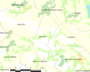
Saint-Loubouer (Saint-Loubouer)
- commune in Landes, France
- Country:

- Postal Code: 40320
- Coordinates: 43° 40' 37" N, 0° 25' 12" E


- GPS tracks (wikiloc): [Link]
- Area: 16.95 sq km
- Population: 443
- Wikipedia en: wiki(en)
- Wikipedia: wiki(fr)
- Wikidata storage: Wikidata: Q1004297
- Wikipedia Commons Category: [Link]
- Freebase ID: [/m/03nnv98]
- GeoNames ID: Alt: [6433963]
- SIREN number: [214002701]
- BnF ID: [15259212z]
- INSEE municipality code: 40270
Shares border with regions:
Vielle-Tursan
- commune in Landes, France
- Country:

- Postal Code: 40320
- Coordinates: 43° 40' 32" N, 0° 27' 2" E


- GPS tracks (wikiloc): [Link]
- Area: 12.81 sq km
- Population: 263
Bats
- commune in Landes, France
- Country:

- Postal Code: 40320
- Coordinates: 43° 39' 32" N, 0° 27' 31" E


- GPS tracks (wikiloc): [Link]
- Area: 7.35 sq km
- Population: 304


Eugénie-les-Bains
- commune in Landes, France
- Country:

- Postal Code: 40320
- Coordinates: 43° 41' 45" N, 0° 22' 42" E


- GPS tracks (wikiloc): [Link]
- Area: 11.03 sq km
- Population: 447
- Web site: [Link]
Fargues
- commune in Landes, France
- Country:

- Postal Code: 40500
- Coordinates: 43° 43' 45" N, 0° 27' 0" E


- GPS tracks (wikiloc): [Link]
- Area: 11.84 sq km
- Population: 334
Urgons
- commune in Landes, France
- Country:

- Postal Code: 40320
- Coordinates: 43° 38' 56" N, 0° 26' 35" E


- GPS tracks (wikiloc): [Link]
- Area: 11.53 sq km
- Population: 261
Castelnau-Tursan
- commune in Landes, France
- Country:

- Postal Code: 40320
- Coordinates: 43° 39' 28" N, 0° 24' 25" E


- GPS tracks (wikiloc): [Link]
- Area: 9.27 sq km
- Population: 194
Classun
- commune in Landes, France
- Country:

- Postal Code: 40320
- Coordinates: 43° 42' 38" N, 0° 24' 51" E


- GPS tracks (wikiloc): [Link]
- Area: 8.82 sq km
- Population: 271


Bahus-Soubiran
- commune in Landes, France
- Country:

- Postal Code: 40320
- Coordinates: 43° 40' 25" N, 0° 21' 22" E


- GPS tracks (wikiloc): [Link]
- Area: 14.53 sq km
- Population: 416


Buanes
- commune in Landes, France
- Country:

- Postal Code: 40320
- Coordinates: 43° 42' 39" N, 0° 25' 18" E


- GPS tracks (wikiloc): [Link]
- Area: 6.62 sq km
- Population: 262
