Saint-Méard-de-Drône (Saint-Méard-de-Drône)
- commune in Dordogne, France
- Country:

- Postal Code: 24600
- Coordinates: 45° 14' 57" N, 0° 25' 19" E


- GPS tracks (wikiloc): [Link]
- AboveSeaLevel: 69 м m
- Area: 8.95 sq km
- Population: 488
- Web site: http://www.saintmearddedronne.fr/
- Wikipedia en: wiki(en)
- Wikipedia: wiki(fr)
- Wikidata storage: Wikidata: Q199109
- Wikipedia Commons Category: [Link]
- Freebase ID: [/m/02rjzmy]
- Freebase ID: [/m/02rjzmy]
- GeoNames ID: Alt: [2978094]
- GeoNames ID: Alt: [2978094]
- SIREN number: [212404602]
- SIREN number: [212404602]
- BnF ID: [152521031]
- BnF ID: [152521031]
- VIAF ID: Alt: [311731916]
- VIAF ID: Alt: [311731916]
- PACTOLS thesaurus ID: [pcrtMcySTxxlYx]
- PACTOLS thesaurus ID: [pcrtMcySTxxlYx]
- INSEE municipality code: 24460
- INSEE municipality code: 24460
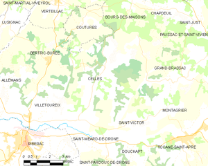
Shares border with regions:


Celles
- commune in Dordogne, France
- Country:

- Postal Code: 24600
- Coordinates: 45° 17' 49" N, 0° 24' 44" E


- GPS tracks (wikiloc): [Link]
- Area: 27.83 sq km
- Population: 572
- Web site: [Link]


Douchapt
- commune in Dordogne, France
- Country:

- Postal Code: 24350
- Coordinates: 45° 14' 34" N, 0° 26' 36" E


- GPS tracks (wikiloc): [Link]
- Area: 8.68 sq km
- Population: 361
