Saint-Méard-de-Gurçon (Saint-Méard-de-Gurçon)
- commune in Dordogne, France
- Country:

- Postal Code: 24610
- Coordinates: 44° 54' 33" N, 0° 11' 1" E


- GPS tracks (wikiloc): [Link]
- Area: 28.38 sq km
- Population: 794
- Web site: http://www.st-meard.fr
- Wikipedia en: wiki(en)
- Wikipedia: wiki(fr)
- Wikidata storage: Wikidata: Q180765
- Wikipedia Commons Category: [Link]
- Freebase ID: [/m/03mg9f2]
- Freebase ID: [/m/03mg9f2]
- GeoNames ID: Alt: [2978093]
- GeoNames ID: Alt: [2978093]
- SIREN number: [212404610]
- SIREN number: [212404610]
- BnF ID: [15252104c]
- BnF ID: [15252104c]
- PACTOLS thesaurus ID: [pcrtUgEyOwInIv]
- PACTOLS thesaurus ID: [pcrtUgEyOwInIv]
- INSEE municipality code: 24461
- INSEE municipality code: 24461
Shares border with regions:


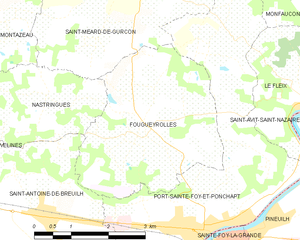
Fougueyrolles
- commune in Dordogne, France
- Country:

- Postal Code: 33220
- Coordinates: 44° 51' 56" N, 0° 11' 15" E


- GPS tracks (wikiloc): [Link]
- Area: 11.45 sq km
- Population: 495


Carsac-de-Gurson
- commune in Dordogne, France
- Country:

- Postal Code: 24610
- Coordinates: 44° 56' 49" N, 0° 5' 25" E


- GPS tracks (wikiloc): [Link]
- Area: 6.91 sq km
- Population: 199


Saint-Rémy
- commune in Dordogne, France
- Country:

- Postal Code: 24700
- Coordinates: 44° 56' 43" N, 0° 11' 5" E


- GPS tracks (wikiloc): [Link]
- Area: 22.26 sq km
- Population: 499
