Saint-Méloir-des-Bois (Saint-Méloir-des-Bois)

- commune in Côtes-d'Armor, France
- Country:

- Postal Code: 22980
- Coordinates: 48° 27' 27" N, 2° 15' 3" E


- GPS tracks (wikiloc): [Link]
- AboveSeaLevel: 70 м m
- Area: 6.13 sq km
- Population: 258
- Web site: http://stmeloirdesbois.org
- Wikipedia en: wiki(en)
- Wikipedia: wiki(fr)
- Wikidata storage: Wikidata: Q223086
- Wikipedia Commons Category: [Link]
- Freebase ID: [/m/03m4hx_]
- GeoNames ID: Alt: [6616123]
- SIREN number: [212203178]
- VIAF ID: Alt: [243164271]
- PACTOLS thesaurus ID: [pcrt8k2L6mn3FL]
- INSEE municipality code: 22317
Shares border with regions:

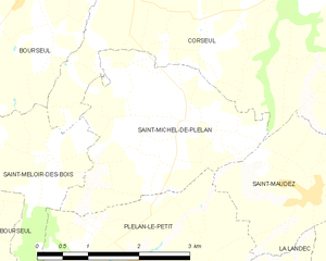
Saint-Michel-de-Plélan
- commune in Côtes-d'Armor, France
- Country:
- Postal Code: 22980
- Coordinates: 48° 27' 58" N, 2° 12' 55" E
- GPS tracks (wikiloc): [Link]
- Area: 7.24 sq km
- Population: 340


Corseul
- commune in Côtes-d'Armor, France
- Country:
- Postal Code: 22130
- Coordinates: 48° 28' 55" N, 2° 10' 12" E
- GPS tracks (wikiloc): [Link]
- Area: 41.74 sq km
- Population: 2151


Mégrit
- commune in Côtes-d'Armor, France
- Country:
- Postal Code: 22270
- Coordinates: 48° 22' 29" N, 2° 14' 55" E
- GPS tracks (wikiloc): [Link]
- Area: 20.63 sq km
- Population: 803
- Web site: [Link]

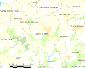
Plélan-le-Petit
- commune in Côtes-d'Armor, France
- Country:
- Postal Code: 22980
- Coordinates: 48° 26' 3" N, 2° 13' 12" E
- GPS tracks (wikiloc): [Link]
- Area: 21.23 sq km
- Population: 1894


Bourseul
- commune in Côtes-d'Armor, France
- Country:
- Postal Code: 22130
- Coordinates: 48° 29' 14" N, 2° 15' 32" E
- GPS tracks (wikiloc): [Link]
- Area: 22.23 sq km
- Population: 1127