Saint-Maurice-sur-Fessard (Saint-Maurice-sur-Fessard)

- commune in Loiret, France
- Country:

- Postal Code: 45700
- Coordinates: 47° 59' 32" N, 2° 37' 13" E


- GPS tracks (wikiloc): [Link]
- Area: 15.38 sq km
- Population: 1200
- Web site: http://www.mairie-saintmauricesurfessard.fr
- Wikipedia en: wiki(en)
- Wikipedia: wiki(fr)
- Wikidata storage: Wikidata: Q1418709
- Wikipedia Commons Category: [Link]
- Freebase ID: [/m/03nwf_j]
- GeoNames ID: Alt: [6434723]
- SIREN number: [214502932]
- BnF ID: [152606859]
- INSEE municipality code: 45293
Shares border with regions:


Pannes
- commune in Loiret, France
- Country:
- Postal Code: 45700
- Coordinates: 48° 1' 8" N, 2° 40' 2" E
- GPS tracks (wikiloc): [Link]
- Area: 20.84 sq km
- Population: 3691
- Web site: [Link]


Villemoutiers
- commune in Loiret, France
- Country:
- Postal Code: 45270
- Coordinates: 47° 59' 43" N, 2° 33' 30" E
- GPS tracks (wikiloc): [Link]
- Area: 16.18 sq km
- Population: 481

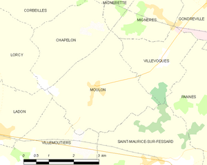
Moulon
- commune in Loiret, France
- Country:
- Postal Code: 45270
- Coordinates: 48° 1' 10" N, 2° 35' 28" E
- GPS tracks (wikiloc): [Link]
- Area: 9.4 sq km
- Population: 201
Villevoques
- commune in Loiret, France
- Country:
- Postal Code: 45700
- Coordinates: 48° 1' 46" N, 2° 37' 37" E
- GPS tracks (wikiloc): [Link]
- Area: 5.06 sq km
- Population: 213


Chevillon-sur-Huillard
- commune in Loiret, France
- Country:
- Postal Code: 45700
- Coordinates: 47° 57' 44" N, 2° 37' 31" E
- GPS tracks (wikiloc): [Link]
- Area: 19.34 sq km
- Population: 1388