Saint-Rémy (Saint-Rémy)

- commune in Côte-d'Or, France
- Country:

- Postal Code: 21500
- Coordinates: 47° 38' 12" N, 4° 17' 53" E


- GPS tracks (wikiloc): [Link]
- AboveSeaLevel: 220 м m
- Area: 13.82 sq km
- Population: 713
- Web site: http://www.saint-remy-21.com/
- Wikipedia en: wiki(en)
- Wikipedia: wiki(fr)
- Wikidata storage: Wikidata: Q725778
- Wikipedia Commons Category: [Link]
- Freebase ID: [/m/02wxpls]
- SIREN number: [212105688]
- BnF ID: [15250855q]
- INSEE municipality code: 21568
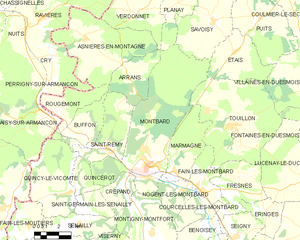
Shares border with regions:
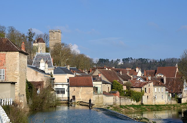
Montbard
- commune in Côte-d'Or, France
- Country:
- Postal Code: 21500
- Coordinates: 47° 37' 23" N, 4° 20' 13" E
- GPS tracks (wikiloc): [Link]
- AboveSeaLevel: 366 м m
- Area: 46.37 sq km
- Population: 5331
- Web site: [Link]

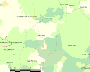
Arrans
- commune in Côte-d'Or, France
- Country:
- Postal Code: 21500
- Coordinates: 47° 41' 45" N, 4° 19' 7" E
- GPS tracks (wikiloc): [Link]
- Area: 10.52 sq km
- Population: 74


Buffon
- commune in Côte-d'Or, France
- Country:
- Postal Code: 21500
- Coordinates: 47° 39' 1" N, 4° 16' 29" E
- GPS tracks (wikiloc): [Link]
- AboveSeaLevel: 225 м m
- Area: 8.88 sq km
- Population: 179


Quincerot
- commune in Côte-d'Or, France
- Country:
- Postal Code: 21500
- Coordinates: 47° 36' 41" N, 4° 16' 0" E
- GPS tracks (wikiloc): [Link]
- AboveSeaLevel: 235 м m
- Area: 4.42 sq km
- Population: 79
Quincy-le-Vicomte
- commune in Côte-d'Or, France
- Country:
- Postal Code: 21500
- Coordinates: 47° 36' 28" N, 4° 15' 19" E
- GPS tracks (wikiloc): [Link]
- Area: 19.03 sq km
- Population: 206