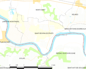
Saint-Seurin-de-Prats (Saint-Seurin-de-Prats)
- commune in Dordogne, France
- Country:

- Postal Code: 24230
- Coordinates: 44° 49' 42" N, 0° 4' 29" E


- GPS tracks (wikiloc): [Link]
- Area: 5.56 sq km
- Population: 484
- Wikipedia en: wiki(en)
- Wikipedia: wiki(fr)
- Wikidata storage: Wikidata: Q595949
- Wikipedia Commons Category: [Link]
- Freebase ID: [/m/03mg96k]
- Freebase ID: [/m/03mg96k]
- GeoNames ID: Alt: [2976946]
- GeoNames ID: Alt: [2976946]
- SIREN number: [212405013]
- SIREN number: [212405013]
- BnF ID: [15252144m]
- BnF ID: [15252144m]
- INSEE municipality code: 24501
- INSEE municipality code: 24501
Shares border with regions:


Montcaret
- commune in Dordogne, France
- Country:

- Postal Code: 24230
- Coordinates: 44° 51' 31" N, 0° 3' 49" E


- GPS tracks (wikiloc): [Link]
- Area: 17.07 sq km
- Population: 1431


Pessac-sur-Dordogne
- commune in Gironde, France
- Country:

- Postal Code: 33890
- Coordinates: 44° 49' 15" N, 0° 4' 44" E


- GPS tracks (wikiloc): [Link]
- Area: 7.78 sq km
- Population: 479
- Web site: [Link]


Juillac
- commune in Gironde, France
- Country:

- Postal Code: 33890
- Coordinates: 44° 48' 40" N, 0° 2' 24" E


- GPS tracks (wikiloc): [Link]
- AboveSeaLevel: 103 м m
- Area: 5.86 sq km
- Population: 259
