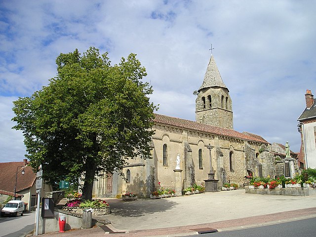
Saint-Sornin (Saint-Sornin)
- commune in Allier, France
- Country:

- Postal Code: 03240
- Coordinates: 46° 24' 40" N, 3° 0' 57" E


- GPS tracks (wikiloc): [Link]
- Area: 19.44 sq km
- Population: 230
- Wikipedia en: wiki(en)
- Wikipedia: wiki(fr)
- Wikidata storage: Wikidata: Q272842
- Wikipedia Commons Category: [Link]
- Freebase ID: [/m/02rtsx1]
- Freebase ID: [/m/02rtsx1]
- GeoNames ID: Alt: [6618114]
- GeoNames ID: Alt: [6618114]
- SIREN number: [210302600]
- SIREN number: [210302600]
- VIAF ID: Alt: [312792841]
- VIAF ID: Alt: [312792841]
- Library of Congress authority ID: Alt: [n78098002]
- Library of Congress authority ID: Alt: [n78098002]
- INSEE municipality code: 03260
- INSEE municipality code: 03260
Shares border with regions:

Chappes
- commune in Allier, France
- Country:

- Postal Code: 03390
- Coordinates: 46° 23' 16" N, 2° 55' 36" E


- GPS tracks (wikiloc): [Link]
- AboveSeaLevel: 410 м m
- Area: 18.6 sq km
- Population: 212

Buxières-les-Mines
- commune in Allier, France
- Country:

- Postal Code: 03440
- Coordinates: 46° 28' 5" N, 2° 57' 36" E


- GPS tracks (wikiloc): [Link]
- Area: 46.95 sq km
- Population: 1065

Chavenon
- commune in Allier, France
- Country:

- Postal Code: 03440
- Coordinates: 46° 24' 50" N, 2° 56' 47" E


- GPS tracks (wikiloc): [Link]
- Area: 17.47 sq km
- Population: 132

Deux-Chaises
- commune in Allier, France
- Country:

- Postal Code: 03240
- Coordinates: 46° 22' 48" N, 3° 2' 15" E


- GPS tracks (wikiloc): [Link]
- Area: 41.01 sq km
- Population: 406

Le Montet
- commune in Allier, France
- Country:

- Postal Code: 03240
- Coordinates: 46° 24' 32" N, 3° 3' 19" E


- GPS tracks (wikiloc): [Link]
- Area: 1.77 sq km
- Population: 469
Rocles
- commune in Allier, France
- Country:

- Postal Code: 03240
- Coordinates: 46° 25' 26" N, 3° 1' 52" E


- GPS tracks (wikiloc): [Link]
- Area: 21.66 sq km
- Population: 386