Sainte-Foy (Sainte-Foy)

- commune in Vendée, France
- Country:

- Postal Code: 85150
- Coordinates: 46° 32' 43" N, 1° 40' 14" E


- GPS tracks (wikiloc): [Link]
- Area: 15.62 sq km
- Population: 2017
- Web site: http://www.saintefoy85.fr
- Wikipedia en: wiki(en)
- Wikipedia: wiki(fr)
- Wikidata storage: Wikidata: Q728186
- Wikipedia Commons Category: [Link]
- Freebase ID: [/m/03qltdb]
- GeoNames ID: Alt: [6445191]
- SIREN number: [218502144]
- BnF ID: [15278337r]
- INSEE municipality code: 85214
Shares border with regions:


Château-d'Olonne
- former commune in Vendée, France
- Country:
- Postal Code: 85180
- Coordinates: 46° 30' 15" N, 1° 44' 14" E
- GPS tracks (wikiloc): [Link]
- AboveSeaLevel: 25 м m
- Area: 31.22 sq km
- Population: 13834
- Web site: [Link]

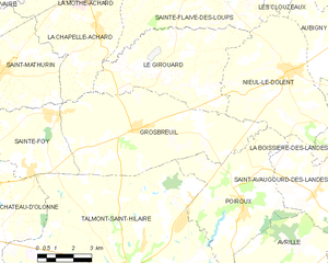
Grosbreuil
- commune in Vendée, France
- Country:
- Postal Code: 85440
- Coordinates: 46° 32' 22" N, 1° 37' 0" E
- GPS tracks (wikiloc): [Link]
- Area: 36.33 sq km
- Population: 2149
- Web site: [Link]


Saint-Mathurin
- commune in Vendée, France
- Country:
- Postal Code: 85150
- Coordinates: 46° 33' 54" N, 1° 42' 50" E
- GPS tracks (wikiloc): [Link]
- AboveSeaLevel: 32 м m
- Area: 23.51 sq km
- Population: 2225
- Web site: [Link]

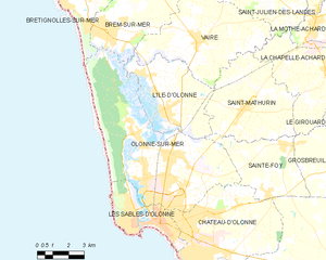
Olonne-sur-Mer
- former commune in Vendée, France
- Country:
- Postal Code: 85340
- Coordinates: 46° 32' 10" N, 1° 46' 22" E
- GPS tracks (wikiloc): [Link]
- Area: 45.61 sq km
- Population: 14875
- Web site: [Link]

Talmont-Saint-Hilaire
- commune in Vendée, France
- Country:
- Postal Code: 85440
- Coordinates: 46° 28' 2" N, 1° 37' 6" E
- GPS tracks (wikiloc): [Link]
- AboveSeaLevel: 25 м m
- Area: 89.53 sq km
- Population: 7363
- Web site: [Link]