.jpg)
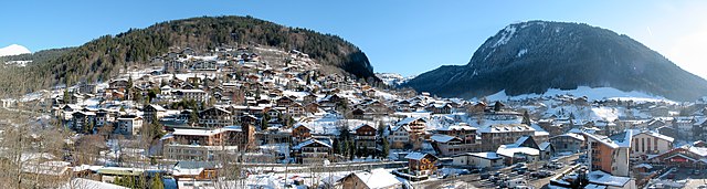
Samoëns (Samoëns)

- commune in Haute-Savoie, France
 Hiking in Samoëns
Samoëns is a beautiful village located in the Haute-Savoie region of the French Alps. It is known for its stunning scenery, traditional architecture, and excellent outdoor recreational opportunities, making it a fantastic destination for hiking enthusiasts. Here are some key points to consider when hiking in Samoëns:
Trails and Routes
-
Variety of Trails: Samoëns offers a wide range of hiking trails suitable for different skill levels, from easy walks to more challenging hikes. Many trails are well-marked and maintained.
-
Scenic Views: The hikes in and around Samoëns provide breathtaking views of the surrounding mountains, valleys, and alpine meadows. Popular routes often lead to vantage points like the Criou summit or the Tête de la Char.
-
Gorges de Tines: This relatively easy family-friendly hike takes you through stunning gorges, with opportunities to see waterfalls and diverse flora and fauna.
-
Cirque du Fer-à-Cheval: A slightly more challenging hike that rewards you with stunning natural landscapes, towering cliffs, and the chance to see wildlife.
Seasonal Considerations
- Summer Hiking: The summer months (June to September) are peak times for hiking, with many trails fully accessible and safe. This is the best time to enjoy wildflowers and the lush greenery of the mountains.
- Winter Hiking and Snowshoeing: During winter, some trails transform into snowshoeing paths, providing a different experience of the snowy landscape.
Preparation and Gear
- Footwear: Good hiking boots are essential, as trails can be rocky and uneven. Consider waterproof options if conditions are wet.
- Clothing: Wear layers to accommodate changes in temperature and weather. Don’t forget a windproof jacket and sun protection.
- Navigation: While many trails are well-marked, it's wise to carry a map or have a GPS device to ensure you stay on track.
Local Tips
- Guided Tours: If you're unfamiliar with the area or prefer company, consider joining a guided hike. Local guides can provide insights into the region's nature and history.
- Refreshments: Plan for breaks and bring enough water and snacks. Some trails have picnic spots or nearby mountain huts (refuges) where you can taste local cuisine.
Safety
- Always check the weather conditions before heading out, and be aware of your physical limits. It's recommended to let someone know your hiking plans.
Hiking in Samoëns provides not only a great physical challenge but also a chance to immerse yourself in breathtaking natural beauty. Enjoy your adventure!
- Country:

- Postal Code: 74340
- Coordinates: 46° 5' 2" N, 6° 43' 38" E


- GPS tracks (wikiloc): [Link]
- AboveSeaLevel: 710 м m
- Area: 97.29 sq km
- Population: 2396
- Web site: http://www.mairiedesamoens.fr
- Wikipedia en: wiki(en)
- Wikipedia: wiki(fr)
- Wikidata storage: Wikidata: Q741646
- Wikipedia Commons Category: [Link]
- Freebase ID: [/m/0bgw__]
- GeoNames ID: Alt: [2976284]
- SIREN number: [217402585]
- BnF ID: [152745120]
- VIAF ID: Alt: [167754733]
- GND ID: Alt: [4312806-3]
- Library of Congress authority ID: Alt: [n92045946]
- INSEE municipality code: 74258
Shares border with regions:

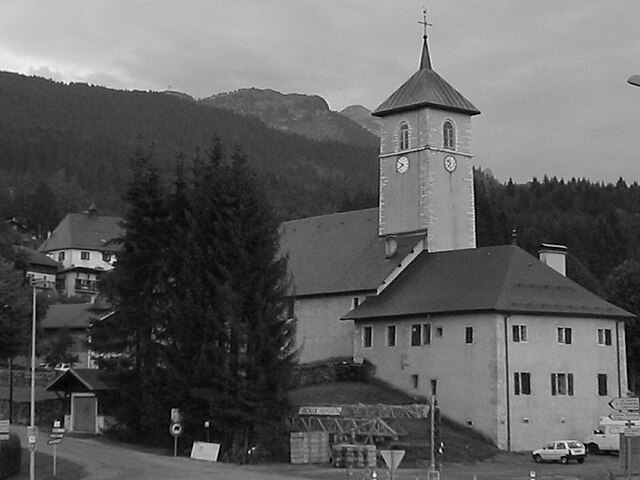
Morzine
- commune in Haute-Savoie, France
Hiking in Morzine
Morzine is a beautiful alpine town located in the French Alps, part of the Portes du Soleil ski area, which is well-known for both winter sports and summer hiking opportunities. The region offers a diverse range of trails and breathtaking landscapes, making it ideal for hikers of all levels. Here’s what you need to know about hiking in Morzine:...
- Country:
- Postal Code: 74110
- Coordinates: 46° 10' 48" N, 6° 42' 33" E
- GPS tracks (wikiloc): [Link]
- AboveSeaLevel: 1000 м m
- Area: 44.1 sq km
- Population: 2870
- Web site: [Link]

Arâches-la-Frasse
- commune in Haute-Savoie, France
Hiking in Arâches-la-Frasse
Arâches-la-Frasse is a charming commune located in the Haute-Savoie region of the French Alps. It is known for its stunning landscapes and proximity to the Grand Massif ski area, which also offers numerous hiking opportunities during the warmer months....
- Country:
- Postal Code: 74300
- Coordinates: 46° 2' 36" N, 6° 37' 53" E
- GPS tracks (wikiloc): [Link]
- Area: 37.69 sq km
- Population: 1928


Verchaix
- commune in Haute-Savoie, France
Hiking in Verchaix
Verchaix is a beautiful destination located in the French Alps, in the Haute-Savoie region. This picturesque village offers a range of hiking opportunities, making it an excellent choice for both casual hikers and experienced trekkers....
- Country:
- Postal Code: 74440
- Coordinates: 46° 5' 47" N, 6° 40' 35" E
- GPS tracks (wikiloc): [Link]
- Area: 15.89 sq km
- Population: 715


Sixt-Fer-à-Cheval
- commune in Haute-Savoie, France
Hiking in Sixt-Fer-à-Cheval
Sixt-Fer-à-Cheval is a stunning location in the French Alps, renowned for its breathtaking scenery and well-maintained hiking trails. It's located in the Haute-Savoie region and is part of the larger Sixt-Fer-à-Cheval Nature Reserve, which boasts impressive geological formations, waterfalls, and lush green valleys....
- Country:
- Postal Code: 74740
- Coordinates: 46° 3' 19" N, 6° 46' 32" E
- GPS tracks (wikiloc): [Link]
- AboveSeaLevel: 760 м m
- Area: 119.07 sq km
- Population: 775
- Web site: [Link]


Morillon
- commune in Haute-Savoie, France
Hiking in Morillon
Morillon, a charming village in the French Alps, is part of the larger Grand Massif ski area, which is known not only for skiing but also for a variety of outdoor activities in the warmer months, including hiking. Here are some key points about hiking in Morillon:...
- Country:
- Postal Code: 74440
- Coordinates: 46° 5' 2" N, 6° 40' 32" E
- GPS tracks (wikiloc): [Link]
- Area: 14.51 sq km
- Population: 632
- Web site: [Link]