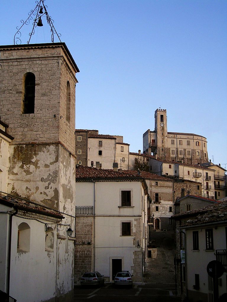
Sant'Angelo del Pesco (Sant'Angelo del Pesco)
.svg)
- Italian comune
 Hiking in Sant'Angelo del Pesco
Sant'Angelo del Pesco is a beautiful comune located in the Abruzzo region of Italy, surrounded by stunning natural landscapes perfect for hiking enthusiasts. The area is rich with diverse flora and fauna, picturesque views, and various trails of varying difficulty levels.
Hiking Trails
-
Monte Caprile: A popular route that offers panoramic views of the surrounding mountains and valleys. The trail can be a moderate challenge, making it suitable for hikers with some experience.
-
Valley of the Orta River: This trail takes you along the river, allowing for a more leisurely hike. It's relatively flat and suitable for families or those looking for an easier trek.
-
Sentiero del Parco Nazionale d'Abruzzo: The nearby national park provides several trails that lead to breathtaking natural sights, including waterfalls, wildlife, and ancient forests.
-
Civita di Oricola to Sant'Angelo del Pesco: This is a scenic route that combines both cultural and natural experiences. It allows hikers to explore small villages and historical sites along the path.
Best Time to Hike
- Spring (April to June): Ideal for wildflowers, milder temperatures, and great visibility.
- Fall (September to November): Offers stunning foliage and cooler temperatures.
Tips for Hikers
-
Gear Up Appropriately: Ensure you have sturdy hiking boots, appropriate clothing for the weather, and a good backpack with essentials like water, snacks, and a first aid kit.
-
Stay on Marked Trails: To preserve the natural environment and ensure safety, always stick to marked paths.
-
Wildlife Awareness: Be mindful of the local wildlife and maintain a respectful distance.
-
Local Regulations: Familiarize yourself with the local guidelines and regulations regarding hiking in the area.
-
Map and GPS: Carry a map of the trails and a GPS device or smartphone app to help navigate.
Hiking in Sant'Angelo del Pesco provides a unique blend of natural beauty and cultural exploration, making it a rewarding experience for those who enjoy outdoor activities. Enjoy your hike!
- Country:

- Postal Code: 86080
- Local Dialing Code: 0865
- Licence Plate Code: IS
- Coordinates: 41° 53' 0" N, 14° 15' 0" E


- GPS tracks (wikiloc): [Link]
- AboveSeaLevel: 650 м m
- Area: 15.59 sq km
- Population: 356
- Web site: http://www.comune.santangelodelpesco.is.it
- Wikipedia en: wiki(en)
- Wikipedia: wiki(it)
- Wikidata storage: Wikidata: Q279612
- Wikipedia Commons Category: [Link]
- Freebase ID: [/m/0gq_xq]
- GeoNames ID: Alt: [6537956]
- VIAF ID: Alt: [141107959]
- OSM relation ID: [41605]
- Library of Congress authority ID: Alt: [no2008091438]
- ISTAT ID: 094046
- Italian cadastre code: I282
Shares border with regions:


Capracotta
- Italian comune
Hiking in Capracotta
Capracotta, located in the Apennine Mountains of Italy, is a delightful destination for hiking enthusiasts. This charming mountain town is situated in the Molise region and offers breathtaking landscapes, rich biodiversity, and a network of well-marked trails suitable for various skill levels....
- Country:
- Postal Code: 86082
- Local Dialing Code: 0865
- Licence Plate Code: IS
- Coordinates: 41° 50' 0" N, 14° 16' 0" E
- GPS tracks (wikiloc): [Link]
- AboveSeaLevel: 1421 м m
- Area: 42.55 sq km
- Population: 874
- Web site: [Link]
Castel del Giudice
- Italian comune
Hiking in Castel del Giudice
Castel del Giudice, located in the province of Isernia in the Molise region of Italy, is a picturesque village nestled in the Apennine Mountains. The area is known for its stunning landscapes, rich history, and outdoor recreational opportunities, making it an excellent destination for hiking enthusiasts....
- Country:
- Postal Code: 86080
- Local Dialing Code: 0865
- Licence Plate Code: IS
- Coordinates: 41° 51' 0" N, 14° 14' 0" E
- GPS tracks (wikiloc): [Link]
- AboveSeaLevel: 800 м m
- Area: 14.81 sq km
- Population: 324
- Web site: [Link]


Pescopennataro
- Italian comune
Hiking in Pescopennataro
Pescopennataro is a charming village located in the Molise region of Italy, nestled in the Apennine mountains. This picturesque area is a great destination for hiking enthusiasts, offering scenic trails and breathtaking views. Here are some key points to consider when hiking in and around Pescopennataro:...
- Country:
- Postal Code: 86080
- Local Dialing Code: 0865
- Licence Plate Code: IS
- Coordinates: 41° 52' 41" N, 14° 17' 39" E
- GPS tracks (wikiloc): [Link]
- AboveSeaLevel: 1190 м m
- Area: 18.84 sq km
- Population: 273
- Web site: [Link]


Borrello
- Italian comune
Hiking in Borrello
Borrello is a small village located in the Abruzzo region of Italy, characterized by its beautiful landscapes, charming hillsides, and proximity to both the mountains and the Adriatic Sea. Hiking in this region can offer stunning views and a chance to explore the natural beauty of Italy....
- Country:
- Postal Code: 66040
- Local Dialing Code: 0872
- Licence Plate Code: CH
- Coordinates: 41° 55' 0" N, 14° 18' 0" E
- GPS tracks (wikiloc): [Link]
- AboveSeaLevel: 804 м m
- Area: 14.51 sq km
- Population: 335
- Web site: [Link]

Gamberale
- Italian comune
Hiking in Gamberale
Gamberale, a charming village located in the Abruzzo region of Italy, offers a fantastic hiking experience surrounded by stunning natural landscapes. The area is characterized by mountainous terrain, lush forests, and picturesque views, making it an excellent destination for outdoor enthusiasts....
- Country:
- Postal Code: 66040
- Local Dialing Code: 0872
- Licence Plate Code: CH
- Coordinates: 41° 54' 0" N, 14° 13' 0" E
- GPS tracks (wikiloc): [Link]
- AboveSeaLevel: 1343 м m
- Area: 15.56 sq km
- Population: 300
- Web site: [Link]


Pizzoferrato
- Italian comune
Hiking in Pizzoferrato
Pizzoferrato, a picturesque village located in the Abruzzo region of Italy, offers a variety of hiking opportunities for outdoor enthusiasts. Nestled in the Majella National Park, the area is characterized by stunning natural landscapes, rugged mountains, and diverse flora and fauna....
- Country:
- Postal Code: 66040
- Local Dialing Code: 0872
- Licence Plate Code: CH
- Coordinates: 41° 55' 0" N, 14° 14' 0" E
- GPS tracks (wikiloc): [Link]
- AboveSeaLevel: 1251 м m
- Area: 30.92 sq km
- Population: 1062
- Web site: [Link]


Quadri
- Italian comune
Hiking in Quadri
Quadri is a small village located in the eastern part of the Italian Alps, specifically within the province of Cosenza in the Calabria region. While not as widely recognized as some other hiking destinations in Italy, Quadri offers beautiful natural landscapes, including mountains, forests, and scenic views....
- Country:
- Postal Code: 66040
- Local Dialing Code: 0872
- Licence Plate Code: CH
- Coordinates: 41° 55' 26" N, 14° 17' 16" E
- GPS tracks (wikiloc): [Link]
- AboveSeaLevel: 590 м m
- Area: 7.45 sq km
- Population: 778
- Web site: [Link]