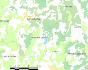
Sarran (Sarran)

- commune in Corrèze, France
- Country:

- Postal Code: 19800
- Coordinates: 45° 24' 37" N, 1° 56' 17" E


- GPS tracks (wikiloc): [Link]
- Area: 26.09 sq km
- Population: 271
- Wikipedia en: wiki(en)
- Wikipedia: wiki(fr)
- Wikidata storage: Wikidata: Q382182
- Wikipedia Commons Category: [Link]
- Freebase ID: [/m/03md4zn]
- GeoNames ID: Alt: [6428469]
- SIREN number: [211925102]
- BnF ID: [152498879]
- VIAF ID: Alt: [238145352]
- PACTOLS thesaurus ID: [pcrt4KgJY06ou9]
- INSEE municipality code: 19251
Shares border with regions:


Saint-Yrieix-le-Déjalat
- commune in Corrèze, France
- Country:
- Postal Code: 19300
- Coordinates: 45° 27' 25" N, 1° 58' 18" E
- GPS tracks (wikiloc): [Link]
- Area: 40.33 sq km
- Population: 353


Corrèze
- commune in Corrèze, France
- Country:
- Postal Code: 19800
- Coordinates: 45° 22' 21" N, 1° 52' 30" E
- GPS tracks (wikiloc): [Link]
- Area: 34.16 sq km
- Population: 1122
- Web site: [Link]

Meyrignac-l'Église
- commune in Corrèze, France
- Country:
- Postal Code: 19800
- Coordinates: 45° 24' 3" N, 1° 51' 7" E
- GPS tracks (wikiloc): [Link]
- Area: 10.22 sq km
- Population: 62


Chaumeil
- commune in Corrèze, France
- Country:
- Postal Code: 19390
- Coordinates: 45° 27' 23" N, 1° 52' 54" E
- GPS tracks (wikiloc): [Link]
- Area: 31.7 sq km
- Population: 158


Vitrac-sur-Montane
- commune in Corrèze, France
- Country:
- Postal Code: 19800
- Coordinates: 45° 22' 36" N, 1° 56' 10" E
- GPS tracks (wikiloc): [Link]
- Area: 27.24 sq km
- Population: 255


Rosiers-d'Égletons
- commune in Corrèze, France
- Country:
- Postal Code: 19300
- Coordinates: 45° 22' 39" N, 2° 0' 29" E
- GPS tracks (wikiloc): [Link]
- Area: 38.18 sq km
- Population: 1063
- Web site: [Link]