Schönbühel-Aggsbach (Schönbühel-Aggsbach)
- municipality in Austria
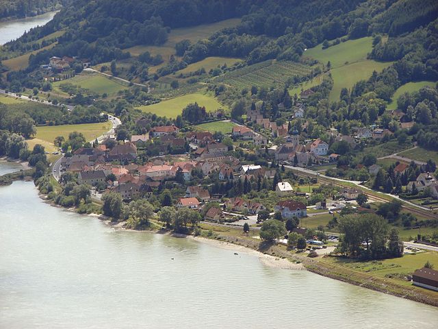
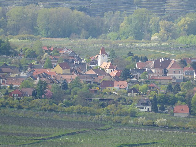
Schönbühel-Aggsbach, located in the beautiful Wachau Valley in Austria, is a great destination for hiking enthusiasts. The region is known for its stunning landscapes, vineyards, and the Danube River, providing a picturesque backdrop for outdoor activities.
Hiking Trails
-
Wachau Weltkulturerbe Trail: This trail runs along the Danube and offers a mix of easy and moderate hikes. You can experience the cultural heritage of the region while soaking in views of vineyards, historic towns, and castles.
-
Schönbühel Castle Trail: A shorter trail that takes you to the scenic Schönbühel Castle, providing panoramic views of the Danube and surrounding countryside.
-
Jauerling Mountain Trails: Just a bit further inland, the Jauerling Mountain offers several hiking paths with varied difficulty levels, stunning views, and opportunities to encounter local wildlife.
-
Vineyard Hikes: The paths through the vineyards are relatively easy and provide a unique opportunity to see the winemaking process and enjoy local wines. Many vineyards are open for tastings, making it a refreshing stop during your hike.
Tips for Hiking in Schönbühel-Aggsbach
-
Best Time to Visit: Spring and autumn are particularly beautiful times to hike in this region, with pleasant temperatures and vibrant foliage.
-
Check Trail Conditions: Before heading out, it’s a good idea to check the local resources for trail conditions, as some paths may be affected by weather or maintenance work.
-
Local Amenities: There are several small towns along the hiking routes where you can find accommodations, restaurants, and shops for supplies.
-
Safety: Always carry water, a map or GPS, and be aware of your hiking level. Make sure to inform someone about your plans, especially if you’re hiking alone.
-
Transport: Public transport options are available, making it easy to reach the starting points of various trails.
Conclusion
Schönbühel-Aggsbach offers a fantastic hiking experience that combines natural beauty, cultural heritage, and opportunities for wine tasting. Whether you’re an experienced hiker or just looking for a leisurely stroll, the area provides a wonderful escape into nature with plenty to see and enjoy.
- Country:

- Local Dialing Code: 02753
- Licence Plate Code: ME
- Coordinates: 48° 17' 31" N, 15° 24' 43" E


- GPS tracks (wikiloc): [Link]
- AboveSeaLevel: 210 м m
- Area: 28.37 sq km
- Population: 981
- Web site: http://www.schoenbuehel.at
- Wikipedia en: wiki(en)
- Wikipedia: wiki(de)
- Wikidata storage: Wikidata: Q666204
- Wikipedia Commons Category: [Link]
- Freebase ID: [/m/02qyfb0]
- GeoNames ID: Alt: [7871829]
- VIAF ID: Alt: [237028081]
- archINFORM location ID: [14484]
- MusicBrainz area ID: [19f7243a-276d-41c0-b50d-dd2e7e60c967]
- Austrian municipality key: [31542]
Shares border with regions:

Aggsbach
- municipality in Austria
Aggsbach is a picturesque area located in Austria, known for its stunning natural landscapes along the Danube River. While specific hiking trails may vary, there are generally several options available for different skill levels. Here are some highlights you might want to consider when planning your hiking trip in Aggsbach:...
- Country:

- Local Dialing Code: 02712
- Licence Plate Code: KR
- Coordinates: 48° 17' 0" N, 15° 24' 0" E


- GPS tracks (wikiloc): [Link]
- AboveSeaLevel: 214 м m
- Area: 13.72 sq km
- Population: 643

Melk
- municipality in Austria
Melk, located in Austria, is known for its stunning landscapes along the Danube River and its rich historical background, most notably the Melk Abbey. Hiking in and around Melk offers a variety of trails suited for different skill levels, with beautiful views of the countryside, vineyards, and the river itself....
- Country:

- Postal Code: 3390
- Local Dialing Code: 0 27 52
- Licence Plate Code: ME
- Coordinates: 48° 13' 37" N, 15° 20' 38" E


- GPS tracks (wikiloc): [Link]
- AboveSeaLevel: 213 м m
- Area: 25.71 sq km
- Population: 5308
- Web site: [Link]

Dunkelsteinerwald
- municipality in Austria
Dunkelsteinerwald is a picturesque region located in Austria, specifically in the municipality of Dunkelsteinerwald, which is part of the larger Lower Austria region. The area is characterized by its lush forests, rolling hills, and scenic landscapes, making it a fantastic destination for hiking enthusiasts....
- Country:

- Postal Code: 3392
- Local Dialing Code: 02753
- Licence Plate Code: ME
- Coordinates: 48° 18' 24" N, 15° 28' 20" E


- GPS tracks (wikiloc): [Link]
- AboveSeaLevel: 585 м m
- Area: 54.19 sq km
- Population: 2390
- Web site: [Link]


Maria Laach am Jauerling
- municipality in Austria
 Hiking in Maria Laach am Jauerling
Maria Laach am Jauerling, located in the picturesque region of Lower Austria, offers a variety of hiking opportunities that showcase the area's natural beauty and cultural heritage. Here are some aspects of hiking in this region:...
- Country:

- Postal Code: 3643
- Local Dialing Code: 02712
- Licence Plate Code: KR
- Coordinates: 48° 18' 11" N, 15° 20' 42" E


- GPS tracks (wikiloc): [Link]
- AboveSeaLevel: 591 м m
- Area: 36.44 sq km
- Population: 916
- Web site: [Link]

Emmersdorf an der Donau
- municipality in Austria
 Hiking in Emmersdorf an der Donau
Emmersdorf an der Donau is a picturesque village located in Austria, offering beautiful landscapes and a variety of hiking opportunities along the Danube River. The region is characterized by its stunning views, rich history, and well-maintained hiking trails suitable for hikers of all levels....
- Country:

- Postal Code: 3644
- Local Dialing Code: 02752
- Licence Plate Code: ME
- Coordinates: 48° 14' 26" N, 15° 20' 9" E


- GPS tracks (wikiloc): [Link]
- AboveSeaLevel: 211 м m
- Area: 29.81 sq km
- Population: 1778
- Web site: [Link]

Bergern im Dunkelsteinerwald
- municipality in Austria
 Hiking in Bergern im Dunkelsteinerwald
Bergern im Dunkelsteinerwald is a charming destination for hiking enthusiasts, located in Austria's Lower Austria region. The Dunkelsteinerwald itself is a picturesque forested area characterized by a mix of deciduous and coniferous trees, hills, and valleys, providing a beautiful backdrop for various outdoor activities. Here are some highlights to consider when planning your hiking adventure in this area:...
- Country:

- Postal Code: 3512
- Local Dialing Code: 02714
- Licence Plate Code: KR
- Coordinates: 48° 22' 0" N, 15° 33' 0" E


- GPS tracks (wikiloc): [Link]
- AboveSeaLevel: 305 м m
- Area: 36.53 sq km
- Population: 1253
- Web site: [Link]

Rossatz-Arnsdorf
- municipality in Austria
Rossatz-Arnsdorf, located in the Wachau Valley of Austria, is a picturesque area known for its stunning landscapes, vineyards, and rich cultural heritage. Hiking in this region offers a variety of trails suitable for different skill levels, making it a great destination for nature enthusiasts and outdoor adventurers....
- Country:

- Local Dialing Code: 02714
- Licence Plate Code: KR
- Coordinates: 48° 23' 45" N, 15° 30' 15" E


- GPS tracks (wikiloc): [Link]
- AboveSeaLevel: 225 м m
- Area: 3904 sq km
- Population: 1065
- Web site: [Link]