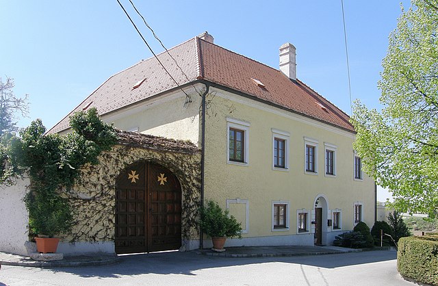
Seefeld-Kadolz (Seefeld-Kadolz)
- municipality in Austria
Seefeld-Kadolz, located in Austria, is known for its beautiful landscapes and excellent hiking opportunities. It's situated in the Weinviertel region of Lower Austria, surrounded by vineyards, rolling hills, and charming rural scenery. Here are some highlights of hiking in this area:
Hiking Trails
-
Regionally Diverse Trails: Seefeld-Kadolz offers a variety of trails that range from easy, family-friendly walks to more challenging routes. Many trails wind through the vineyards, providing stunning views and opportunities to explore local flora and fauna.
-
Scenic Routes: You can enjoy trails that take you through picturesque villages and open farmland, allowing hikers to experience the unique cultural heritage of the region.
-
Wine Hiking Trails: Given the area's reputation for wine production, consider exploring the wine hiking trails that combine beautiful landscapes with stops at local vineyards and wineries. This allows you to enjoy tastings while soaking in the views.
Tips for Hiking in Seefeld-Kadolz
-
Seasonal Considerations: Spring and autumn are ideal times for hiking here. The weather is usually mild, and the landscapes are vibrant, especially during the grape harvest in the fall.
-
Trail Maps and Guidance: It's advisable to have a reliable trail map or GPS, as well as local guidance if you're unfamiliar with the area. The local tourism office can provide updated maps and information.
-
Stay Hydrated and Prepared: Always bring enough water, snacks, and appropriate hiking gear. Weather can change quickly, so dress in layers.
-
Respect Local Regulations: Be mindful of the natural environment and any local regulations regarding wildlife and plant life, particularly in protected areas.
Additional Activities
In addition to hiking, Seefeld-Kadolz offers other outdoor activities such as cycling, wine tasting, and cultural exploration in nearby historical sites. After a long hike, visiting a local tavern or a winery can be a wonderful way to relax and enjoy the regional cuisine.
Overall, hiking in Seefeld-Kadolz is an enriching experience that combines outdoor activity with the chance to immerse yourself in the region's natural beauty and cultural heritage.
- Country:

- Postal Code: 2062
- Local Dialing Code: 02943
- Licence Plate Code: HL
- Coordinates: 48° 43' 0" N, 16° 10' 0" E


- GPS tracks (wikiloc): [Link]
- AboveSeaLevel: 192 м m
- Area: 21.87 sq km
- Population: 917
- Web site: http://www.seefeld-kadolz.at
- Wikipedia en: wiki(en)
- Wikipedia: wiki(de)
- Wikidata storage: Wikidata: Q666235
- Wikipedia Commons Category: [Link]
- Freebase ID: [/m/02qx78p]
- GeoNames ID: Alt: [7871769]
- VIAF ID: Alt: [244759835]
- Austrian municipality key: [31042]
Shares border with regions:

Großharras
- municipality in Austria
Großharras, located in Lower Austria, offers a range of hiking opportunities for outdoor enthusiasts. The region is characterized by its picturesque landscapes, rolling hills, and serene rural scenery, making it an ideal place for both casual walkers and experienced hikers....
- Country:

- Postal Code: 2034
- Local Dialing Code: 02526
- Licence Plate Code: MI
- Coordinates: 48° 39' 50" N, 16° 14' 51" E


- GPS tracks (wikiloc): [Link]
- AboveSeaLevel: 206 м m
- Area: 42.66 sq km
- Population: 1116
- Web site: [Link]

Mailberg
- municipality in Austria
Mailberg is a small town in Austria, located in the Burgenland region, known for its picturesque landscapes and wine production. While it may not be as famous as some of Austria's larger hiking destinations, it offers an array of hiking opportunities that allow you to enjoy the serene countryside, vineyards, and rolling hills....
- Country:

- Postal Code: 2024
- Local Dialing Code: 02943
- Licence Plate Code: HL
- Coordinates: 48° 40' 0" N, 16° 11' 0" E


- GPS tracks (wikiloc): [Link]
- AboveSeaLevel: 217 м m
- Area: 15.74 sq km
- Population: 558
- Web site: [Link]

Hadres
- municipality in Austria
Hadres is a picturesque area known for its beautiful landscapes and hiking opportunities, but it seems to be less well-known than other hiking destinations. Assuming Hadres refers to a specific region or area with hiking trails, here’s what you typically can expect when hiking in a less urbanized area:...
- Country:

- Postal Code: 2061
- Local Dialing Code: 02943
- Licence Plate Code: HL
- Coordinates: 48° 42' 0" N, 16° 8' 0" E


- GPS tracks (wikiloc): [Link]
- AboveSeaLevel: 194 м m
- Area: 34.46 sq km
- Population: 1685
- Web site: [Link]
