Semallé (Semallé)

- commune in Orne, France
- Country:

- Postal Code: 61250
- Coordinates: 48° 28' 30" N, 0° 9' 0" E


- GPS tracks (wikiloc): [Link]
- Area: 14.04 sq km
- Population: 372
- Wikipedia en: wiki(en)
- Wikipedia: wiki(fr)
- Wikidata storage: Wikidata: Q1441713
- Wikipedia Commons Category: [Link]
- Freebase ID: [/m/03qgptx]
- Freebase ID: [/m/03qgptx]
- GeoNames ID: Alt: [6439309]
- GeoNames ID: Alt: [6439309]
- SIREN number: [216104679]
- SIREN number: [216104679]
- BnF ID: [15268397d]
- BnF ID: [15268397d]
- INSEE municipality code: 61467
- INSEE municipality code: 61467
Shares border with regions:

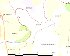
Chenay
- commune in Sarthe, France
- Country:
- Postal Code: 72610
- Coordinates: 48° 26' 58" N, 0° 9' 45" E
- GPS tracks (wikiloc): [Link]
- Area: 2.16 sq km
- Population: 224

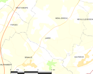
Larré
- commune in Orne, France
- Country:
- Postal Code: 61250
- Coordinates: 48° 29' 41" N, 0° 9' 52" E
- GPS tracks (wikiloc): [Link]
- Area: 5.67 sq km
- Population: 428
Forges
- former commune in Orne, France
- Country:
- Postal Code: 61250
- Coordinates: 48° 29' 55" N, 0° 7' 4" E
- GPS tracks (wikiloc): [Link]
- Area: 5.01 sq km
- Population: 218


Hauterive
- commune in Orne, France
- Country:
- Postal Code: 61250
- Coordinates: 48° 28' 39" N, 0° 11' 58" E
- GPS tracks (wikiloc): [Link]
- Area: 6.98 sq km
- Population: 488

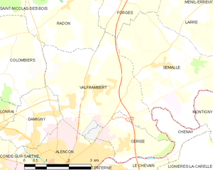
Valframbert
- commune in Orne, France
- Country:
- Postal Code: 61250
- Coordinates: 48° 27' 50" N, 0° 6' 29" E
- GPS tracks (wikiloc): [Link]
- Area: 13.95 sq km
- Population: 1697