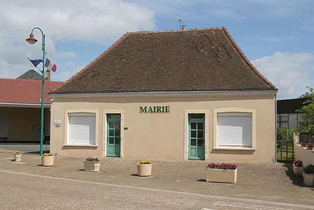
Souligné-sous-Ballon (Souligné-sous-Ballon)
- commune in Sarthe, France
- Country:

- Postal Code: 72290
- Coordinates: 48° 8' 20" N, 0° 14' 10" E


- GPS tracks (wikiloc): [Link]
- Area: 12.76 sq km
- Population: 1187
- Web site: http://souligne-sous-ballon.fr
- Wikipedia en: wiki(en)
- Wikipedia: wiki(fr)
- Wikidata storage: Wikidata: Q949796
- Wikipedia Commons Category: [Link]
- Freebase ID: [/m/03qj0_w]
- GeoNames ID: Alt: [2974012]
- SIREN number: [217203405]
- BnF ID: [152738922]
- INSEE municipality code: 72340
Shares border with regions:


La Guierche
- commune in Sarthe, France
- Country:

- Postal Code: 72380
- Coordinates: 48° 6' 51" N, 0° 11' 40" E


- GPS tracks (wikiloc): [Link]
- Area: 7.88 sq km
- Population: 1075


Saint-Mars-sous-Ballon
- former commune in Sarthe, France
- Country:

- Postal Code: 72290
- Coordinates: 48° 10' 21" N, 0° 14' 44" E


- GPS tracks (wikiloc): [Link]
- Area: 18.2 sq km
- Population: 817


Courcebœufs
- commune in Sarthe, France
- Country:

- Postal Code: 72290
- Coordinates: 48° 8' 15" N, 0° 17' 15" E


- GPS tracks (wikiloc): [Link]
- Area: 16.83 sq km
- Population: 634


Ballon, Sarthe
- former commune in Sarthe, France
- Country:

- Postal Code: 72290
- Coordinates: 48° 10' 33" N, 0° 14' 7" E


- GPS tracks (wikiloc): [Link]
- Area: 13.41 sq km
- Population: 1374


Montbizot
- commune in Sarthe, France
- Country:

- Postal Code: 72380
- Coordinates: 48° 8' 50" N, 0° 10' 57" E


- GPS tracks (wikiloc): [Link]
- Area: 11.38 sq km
- Population: 1823
- Web site: [Link]


Joué-l'Abbé
- commune in Sarthe, France
- Country:

- Postal Code: 72380
- Coordinates: 48° 6' 37" N, 0° 13' 2" E


- GPS tracks (wikiloc): [Link]
- Area: 10.39 sq km
- Population: 1296
- Web site: [Link]
