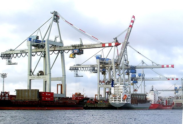
St. Pauli (St. Pauli)
- quarter of Hamburg, Germany
St. Pauli is primarily known as a vibrant and eclectic neighborhood in Hamburg, Germany, famous for its nightlife, cultural scene, and historic sites, rather than traditional hiking areas. However, if you're looking for outdoor activities, there are nearby parks and green spaces ideal for walking and exploring the urban environment. Here are a few options:
-
Planten un Blomen: This beautiful park features botanical gardens, lakes, and walking paths. It's a great place for leisurely strolls and enjoying nature amidst the urban setting.
-
Elbe Promenade: Walking along the Elbe River provides scenic views and a chance to enjoy the waterfront. The promenade is perfect for a long walk, bike ride, or simply relaxing by the river.
-
HafenCity and Speicherstadt: Exploring these historic and modern districts on foot can feel like a hike in terms of discovering hidden gems and architectural wonders.
-
Alter Elbtunnel (Old Elbe Tunnel): This historic tunnel allows pedestrians and cyclists to cross the Elbe River under the water. The descent and ascent can provide an interesting hiking-like experience in the city.
-
Wanderwege Hamburg: There are several longer trails around Hamburg and its outskirts. You may consider taking a train or other public transport to reach more traditional hiking trails in nearby areas such as the Lüneburg Heath or the Wadden Sea National Park.
When hiking or walking in urban environments like St. Pauli, be sure to wear comfortable shoes, stay hydrated, and be aware of your surroundings. Enjoy your urban hiking adventure!
- Country:

- Coordinates: 53° 33' 25" N, 9° 57' 50" E


- GPS tracks (wikiloc): [Link]
- AboveSeaLevel: 17 м m
- Area: 2.6 sq km
- Wikipedia en: wiki(en)
- Wikipedia: wiki(de)
- Wikidata storage: Wikidata: Q1556
- Wikipedia Commons Gallery: [Link]
- Wikipedia Commons Category: [Link]
- Wikipedia Commons Maps Category: [Link]
- Freebase ID: [/m/02mpnk]
- GeoNames ID: Alt: [6944296]
- OSM relation ID: [296012]
- GND ID: Alt: [4094649-6]
- archINFORM location ID: [4877]
Shares border with regions:


Hamburg-Neustadt
- quarter of Hamburg, Germany
Neustadt, located within the city limits of Hamburg, is primarily an urban area known for its historical architecture, cultural attractions, and vibrant atmosphere. While Neustadt itself is not typically known for traditional hiking as one might find in national parks or rural settings, there are plenty of opportunities for walking, exploring, and enjoying the outdoors in and around the district....
- Country:

- Postal Code: 20459; 20457; 20359; 20355; 20354
- Coordinates: 53° 33' 7" N, 9° 59' 8" E


- GPS tracks (wikiloc): [Link]
- AboveSeaLevel: 10 м m
- Area: 2.2 sq km
- Population: 12657
- Web site: [Link]


Steinwerder
- quarter in Hamburg, Germany
Steinwerder is a district in Hamburg, Germany, located on the south banks of the River Elbe. While it may not be a traditional hiking destination with extensive trails, it does offer some opportunities for outdoor activities, particularly along the waterfront and in nearby parks....
- Country:

- Coordinates: 53° 32' 4" N, 9° 57' 26" E


- GPS tracks (wikiloc): [Link]
- AboveSeaLevel: 2 м m
- Area: 10.4 sq km
- Population: 38


Altona-Altstadt
- one of 14 quarters in the district of Altona, Hamburg, Germany
Altona-Altstadt is a district in Hamburg, Germany, that offers a mix of urban and natural landscapes, making it an interesting place for hiking. While it may not have extensive hiking trails like more rural areas, there are still opportunities for walking and exploring scenic sites in and around the area....
- Country:

- Coordinates: 53° 32' 56" N, 9° 56' 52" E


- GPS tracks (wikiloc): [Link]
- Area: 2.8 sq km


Rotherbaum
- quarter of Eimsbüttel, a borough of Hamburg, Germany
Rotherbaum is a district in Hamburg, Germany, known more for its urban environment than hiking trails. However, if you're looking for outdoor activities and green spaces, there are some options nearby....
- Country:

- Coordinates: 53° 34' 5" N, 9° 59' 18" E


- GPS tracks (wikiloc): [Link]
- AboveSeaLevel: 19 м m
- Area: 2.9 sq km

