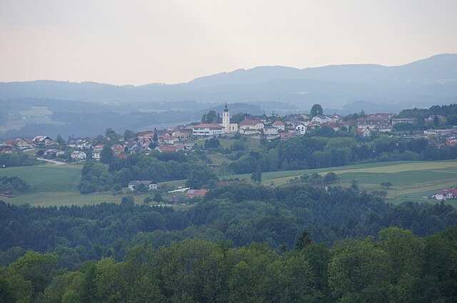
Stroheim (Stroheim)
- municipality in Austria
It seems there might be some confusion, as "Stroheim" doesn't refer to a widely recognized hiking destination. It could be a lesser-known area or perhaps a misspelling or miscommunication about a specific location.
If you're referring to a specific place, such as a local park, a mountain range, or a city in a particular country, please provide more details! If it’s a fictional or niche area, I would be happy to offer general advice on what to look for when hiking in new locations, including safety tips, what to pack, best practices, and how to enjoy your hike.
- Country:

- Postal Code: 4074
- Local Dialing Code: 07272
- Licence Plate Code: EF
- Coordinates: 48° 20' 20" N, 13° 57' 30" E


- GPS tracks (wikiloc): [Link]
- AboveSeaLevel: 489 м m
- Area: 28.75 sq km
- Population: 1555
- Web site: http://www.stroheim.at/
- Wikipedia en: wiki(en)
- Wikipedia: wiki(de)
- Wikidata storage: Wikidata: Q663774
- Wikipedia Commons Category: [Link]
- Freebase ID: [/m/03gv32h]
- GeoNames ID: Alt: [7871992]
- VIAF ID: Alt: [246972976]
- Austrian municipality key: [40512]
Shares border with regions:


Hartkirchen
- municipality in Austria
Hartkirchen is located in Austria's Upper Austria region, surrounded by picturesque landscapes ideal for hiking enthusiasts. The area features rolling hills, lush forests, and scenic farmland, making it an excellent destination for both casual walkers and more experienced hikers....
- Country:

- Postal Code: 4081
- Local Dialing Code: 07273
- Licence Plate Code: EF
- Coordinates: 48° 21' 50" N, 14° 0' 10" E


- GPS tracks (wikiloc): [Link]
- AboveSeaLevel: 273 м m
- Area: 39 sq km
- Population: 4099
- Web site: [Link]

Haibach ob der Donau
- municipality in Austria
 Hiking in Haibach ob der Donau
Haibach ob der Donau is a charming village located in Bavaria, Germany, known for its stunning landscapes and outdoor recreation opportunities, including hiking. Surrounded by the scenic Danube River and lush forests, it's a great destination for nature lovers and hiking enthusiasts....
- Country:

- Postal Code: 4083
- Local Dialing Code: 07279
- Licence Plate Code: EF
- Coordinates: 48° 24' 35" N, 13° 54' 59" E


- GPS tracks (wikiloc): [Link]
- AboveSeaLevel: 528 м m
- Area: 25.53 sq km
- Population: 1308
- Web site: [Link]

Prambachkirchen
- municipality in Austria
Prambachkirchen, a charming town located in the Upper Austria region, offers a wonderful backdrop for hiking enthusiasts looking to explore the scenic landscapes of Austria. The area is characterized by rolling hills, lush forests, and picturesque views that make it a great destination for both casual walkers and seasoned hikers....
- Country:

- Postal Code: 4731
- Local Dialing Code: 07277
- Licence Plate Code: EF
- Coordinates: 48° 19' 0" N, 13° 54' 0" E


- GPS tracks (wikiloc): [Link]
- AboveSeaLevel: 374 м m
- Area: 28.73 sq km
- Population: 2919
- Web site: [Link]
Hinzenbach
- municipality in Upper Austria, Austria
Hinzenbach is a picturesque municipality located in the Linz-Land district of Upper Austria, surrounded by stunning natural landscapes that are ideal for hiking. Here’s what you need to know about hiking in this charming area:...
- Country:

- Postal Code: 4070
- Local Dialing Code: 07272
- Licence Plate Code: EF
- Coordinates: 48° 18' 30" N, 14° 0' 20" E


- GPS tracks (wikiloc): [Link]
- AboveSeaLevel: 270 м m
- Area: 14.6 sq km
- Population: 1999
- Web site: [Link]

Sankt Agatha
- municipality in Austria
Sankt Agatha, located in Austria, is a charming village that offers a range of hiking opportunities suitable for various skill levels. The surrounding landscape features picturesque valleys, rolling hills, and lush forests, making it a beautiful destination for nature enthusiasts....
- Country:

- Postal Code: 4084
- Local Dialing Code: 07277
- Licence Plate Code: GR
- Coordinates: 48° 23' 10" N, 13° 52' 44" E


- GPS tracks (wikiloc): [Link]
- AboveSeaLevel: 603 м m
- Area: 31.8 sq km
- Population: 2116
- Web site: [Link]

Waizenkirchen
- municipality in Austria
Waizenkirchen is a picturesque village located in Austria, surrounded by the beautiful countryside of Upper Austria. While it might not be one of the most famous hiking destinations, it offers several opportunities for hikers to explore nature and enjoy the stunning landscapes....
- Country:

- Postal Code: 4730
- Local Dialing Code: 07277
- Licence Plate Code: GR
- Coordinates: 48° 19' 49" N, 13° 51' 30" E


- GPS tracks (wikiloc): [Link]
- AboveSeaLevel: 367 м m
- Area: 34.2 sq km
- Population: 3729
- Web site: [Link]

Pupping
- municipality in Austria
Hiking in Pupping, a municipality in Upper Austria, can be an enjoyable experience for outdoor enthusiasts. The area is characterized by rolling hills, lush forests, and beautiful landscapes that are ideal for hiking. Here are some highlights and tips for hiking in Pupping:...
- Country:

- Postal Code: 4070
- Local Dialing Code: 07272
- Licence Plate Code: EF
- Coordinates: 48° 20' 10" N, 14° 0' 0" E


- GPS tracks (wikiloc): [Link]
- AboveSeaLevel: 270 м m
- Area: 13.2 sq km
- Population: 1824
- Web site: [Link]