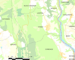
Surjoux (Surjoux)
- commune in Ain, France
 Hiking in Surjoux
Surjoux, located in the Auvergne-Rhône-Alpes region of France, offers a variety of hiking opportunities amid stunning natural landscapes. This area is characterized by its lush forests, rolling hills, and picturesque views, making it an appealing destination for hikers of all levels.
Key Hiking Areas and Trails
-
Nature Trails: Surjoux has several marked nature trails that are ideal for casual hikers and families. These trails often provide educational signage about the local flora and fauna.
-
Mountains and Peaks: For more experienced hikers, nearby mountain ranges offer challenging trails that lead to scenic viewpoints. These hikes may vary in difficulty and can involve significant elevation changes.
-
Lakes and Waterways: The region is also home to several lakes and rivers, providing opportunities for lakeside hikes and scenic picnics. Trails that follow these waterways can be particularly serene.
Recommendations
-
Trail Maps: It's advisable to obtain a local trail map or guide, as this will help you navigate the trails and ensure you stay on marked paths.
-
Seasonal Considerations: The best hiking months are generally from late spring to early autumn when the weather is mild. Be cautious in winter due to snow and icy conditions, which can make certain trails hazardous.
-
Gear: Make sure to wear appropriate hiking shoes with good traction, and bring enough water, snacks, and sun protection. A small first-aid kit is also a good idea.
-
Local Wildlife: Be mindful of local wildlife. While encounters are generally rare, it's wise to be aware of your surroundings and take precautions, especially in quiet areas.
Accessibility
Most trails in Surjoux are accessible by public transport or a short drive from the village. Check local transport schedules or websites for the most convenient options.
Conclusion
Whether you're looking for a leisurely stroll through nature or a more challenging hike with breathtaking views, Surjoux has something to offer every outdoor enthusiast. Remember to respect the environment and follow Leave No Trace principles during your hikes to preserve the natural beauty of this enchanting region. Happy hiking!
- Country:

- Postal Code: 01420
- Coordinates: 46° 1' 27" N, 5° 48' 10" E


- GPS tracks (wikiloc): [Link]
- Area: 4.31 sq km
- Population: 72
- Wikipedia en: wiki(en)
- Wikipedia: wiki(fr)
- Wikidata storage: Wikidata: Q271317
- Wikipedia Commons Category: [Link]
- Wikipedia Commons Maps Category: [Link]
- Freebase ID: [/m/081s3s]
- Freebase ID: [/m/081s3s]
- GeoNames ID: Alt: [6424710]
- GeoNames ID: Alt: [6424710]
- SIREN number: [210104139]
- SIREN number: [210104139]
- INSEE municipality code: 01413
- INSEE municipality code: 01413
Shares border with regions:

Chanay
- commune in Ain, France
Hiking in Chanay
Hiking in Chanay, a picturesque destination in the Auvergne-Rhône-Alpes region of France, offers a variety of trails that cater to different skill levels, from easy walks suitable for families to more challenging hikes for experienced adventurers. The area is characterized by its stunning landscapes, featuring rolling hills, dense forests, and breathtaking views of the surrounding mountains....
- Country:
- Postal Code: 01420
- Coordinates: 46° 0' 22" N, 5° 47' 8" E
- GPS tracks (wikiloc): [Link]
- Area: 18.1 sq km
- Population: 640
- Web site: [Link]

Injoux-Génissiat
- commune in Ain, France
Hiking in Injoux-Génissiat
Injoux-Génissiat is a charming commune located in the Ain department of the Auvergne-Rhône-Alpes region in southeastern France. The area is known for its natural beauty, making it a great destination for hiking enthusiasts. Here are some key points about hiking in Injoux-Génissiat:...
- Country:
- Postal Code: 01200
- Coordinates: 46° 3' 5" N, 5° 48' 9" E
- GPS tracks (wikiloc): [Link]
- Area: 29.61 sq km
- Population: 1144
- Web site: [Link]


Lhôpital
- commune in Ain, France
Hiking in Lhôpital
Lhôpital is a village located in the northeastern part of France, near the border with Germany. While it may not be widely recognized as a major hiking destination, the surrounding region offers scenic trails and outdoor activities that can appeal to hikers looking to explore the Alsace region....
- Country:
- Postal Code: 01420
- Coordinates: 46° 1' 18" N, 5° 46' 42" E
- GPS tracks (wikiloc): [Link]
- Area: 3.68 sq km
- Population: 47


Challonges
- commune in Haute-Savoie, France
Hiking in Challonges
Challonges is a charming area located in the Auvergne-Rhône-Alpes region of France, near the border with Switzerland. It offers a variety of hiking opportunities for different skill levels, with beautiful landscapes featuring rolling hills, forests, and the stunning backdrop of the Alps....
- Country:
- Postal Code: 74910
- Coordinates: 46° 1' 10" N, 5° 49' 52" E
- GPS tracks (wikiloc): [Link]
- Area: 7.9 sq km
- Population: 501


Franclens
- commune in Haute-Savoie, France
Hiking in Franclens
Franclens is a charming area located in the Haute-Savoie region of the French Alps. It offers beautiful landscapes and a range of hiking opportunities, suitable for various skill levels. Here are some highlights and tips for hiking in Franclens:...
- Country:
- Postal Code: 74910
- Coordinates: 46° 2' 33" N, 5° 49' 47" E
- GPS tracks (wikiloc): [Link]
- Area: 5.37 sq km
- Population: 529