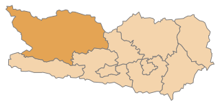
Tamsweg District (Bezirk Tamsweg)
- district of Austria
 Hiking in Tamsweg District
Tamsweg District, located in the state of Salzburg, Austria, is a beautiful destination for hiking enthusiasts. The region is characterized by its stunning natural landscapes, including mountains, valleys, and forests, making it a perfect spot for both casual walkers and serious hikers.
Hiking Opportunities
-
Scenic Trails: The district features a variety of well-marked trails ranging in difficulty from easy walks to challenging hikes. Popular hiking areas include the Nockberge and Lungau regions, where you can find diverse terrains and breathtaking views.
-
The Lungau Region: This area is known for its high-altitude trails, including parts of the Salzburg Almenweg, which connects various alpine pastures and offers magnificent views. Hikes like Murtal Rundwanderweg and paths around the Katschberg Mountain are highly recommended.
-
The Durlassboden Reservoir: A beautiful hiking area where you can combine walking with stunning views of the water and surrounding peaks. It’s suitable for families and offers a range of outdoor activities beyond hiking.
-
Historical and Cultural Trails: Many paths in the Tamsweg District lead to historical sites and cultural landmarks, providing a deeper insight into the local history and traditions.
Tips for Hiking in Tamsweg
-
Best Time to Hike: The hiking season typically runs from late spring to early autumn (May to October). Summer is the most popular time, but be prepared for changing weather conditions.
-
Preparation: Always check trail conditions and weather forecasts before heading out. Some trails can be steep or rocky, so proper footwear and safety gear are essential.
-
Local Guidance: Consider joining a guided hike to learn more about the local flora, fauna, and culture. Local guides can provide valuable insights and ensure your safety.
-
Wildlife: Keep an eye out for local wildlife, including chamois and various bird species, particularly in more remote areas.
Facilities and Accommodations
The Tamsweg District offers a range of accommodations, from hotels and guesthouses to campgrounds, making it accessible for both day hikers and those looking to spend several days exploring the region. Many places also provide information on local trails and may even offer guided hiking tours.
Overall, Tamsweg District is a fantastic destination for anyone who loves hiking, with its diverse landscapes and opportunities for adventure. Remember to respect nature and follow local guidelines to preserve the beauty of the area for future hikers!
- Country:

- Licence Plate Code: TA
- Coordinates: 47° 7' 0" N, 13° 49' 0" E


- GPS tracks (wikiloc): [Link]
- AboveSeaLevel: 1229 м m
- Area: 1019.69 sq km
- Population: 20547
- Web site: http://www.salzburg.gv.at/themen/se/bezirke/bh-tamsweg.htm/
- Wikipedia en: wiki(en)
- Wikipedia: wiki(de)
- Wikidata storage: Wikidata: Q268090
- Wikipedia Commons Category: [Link]
- Wikipedia Commons Maps Category: [Link]
- Freebase ID: [/m/06v467]
- GeoNames ID: Alt: [2763928]
- VIAF ID: Alt: [241422328]
- GND ID: Alt: [4036650-9]
- archINFORM location ID: [14706]
Includes regions:

Zederhaus
- municipality in Austria
Hiking in Zederhaus
Zederhaus is a beautiful region in Austria, known for its stunning alpine landscapes and excellent hiking opportunities. Nestled in the Hohe Tauern National Park, this area offers a mix of well-marked trails that cater to various skill levels, from easy walks to challenging mountain hikes. Here are some highlights to consider when hiking in Zederhaus:...
- Country:
- Postal Code: 5584
- Local Dialing Code: 06478
- Licence Plate Code: TA
- Coordinates: 47° 9' 0" N, 13° 31' 0" E
- GPS tracks (wikiloc): [Link]
- AboveSeaLevel: 1205 м m
- Area: 130.55 sq km
- Population: 1196
- Web site: [Link]

Muhr
- municipality in Austria
Hiking in Muhr
Muhr, a scenic area often associated with outdoor activities, particularly hiking, boasts a variety of trails suitable for diverse skill levels. It's situated in a beautiful natural landscape, making it a fantastic destination for both beginner and experienced hikers....
- Country:
- Postal Code: 5583
- Local Dialing Code: 06479
- Licence Plate Code: TA
- Coordinates: 47° 5' 0" N, 13° 29' 0" E
- GPS tracks (wikiloc): [Link]
- AboveSeaLevel: 1107 м m
- Area: 115.96 sq km
- Population: 510
- Web site: [Link]

Mauterndorf
- municipality in Austria
Hiking in Mauterndorf
Mauterndorf is a picturesque village located in the Lungau region of Austria, known for its stunning alpine scenery and rich cultural heritage. It serves as an excellent base for hiking enthusiasts, offering a variety of trails suited for all experience levels....
- Country:
- Postal Code: 5570
- Local Dialing Code: 06472
- Licence Plate Code: TA
- Coordinates: 47° 7' 57" N, 13° 41' 49" E
- GPS tracks (wikiloc): [Link]
- AboveSeaLevel: 1123 м m
- Area: 32.71 sq km
- Population: 1639
- Web site: [Link]
Mariapfarr
- municipality in Austria
Hiking in Mariapfarr
Mariapfarr, located in the Salzburg region of Austria, is a charming village surrounded by stunning mountain scenery, making it a great destination for hiking enthusiasts. Here are some key points about hiking in Mariapfarr:...
- Country:
- Postal Code: 5571
- Local Dialing Code: 06473
- Licence Plate Code: TA
- Coordinates: 47° 9' 0" N, 13° 44' 0" E
- GPS tracks (wikiloc): [Link]
- AboveSeaLevel: 1119 м m
- Area: 47.36 sq km
- Population: 2375
- Web site: [Link]
Lessach
- municipality in Austria
Hiking in Lessach
Lessach is a picturesque village located in the state of Salzburg, Austria, surrounded by stunning mountain landscapes, making it an excellent destination for hiking enthusiasts. The area is part of the Hohe Tauern National Park, which offers a variety of trails and routes for all skill levels, from easy walks to challenging mountain hikes....
- Country:
- Postal Code: 5575
- Local Dialing Code: 06484
- Licence Plate Code: TA
- Coordinates: 47° 11' 0" N, 13° 48' 0" E
- GPS tracks (wikiloc): [Link]
- AboveSeaLevel: 1208 м m
- Area: 72.23 sq km
- Population: 555
- Web site: [Link]

Tweng
- municipality in Austria
Hiking in Tweng
Tweng is a charming village located in the Pongau region of Austria, known for its stunning alpine scenery and numerous hiking opportunities. Surrounded by the majestic mountains of the Salzburg region, Tweng serves as a gateway to various trails suitable for all levels of hikers....
- Country:
- Local Dialing Code: 06471
- Licence Plate Code: TA
- Coordinates: 47° 11' 28" N, 13° 36' 1" E
- GPS tracks (wikiloc): [Link]
- AboveSeaLevel: 1233 м m
- Area: 86.54 sq km
- Population: 276
- Web site: [Link]
Göriach
- municipality in Austria
Hiking in Göriach
Göriach is a charming village located in the Salzburg region of Austria, renowned for its stunning natural landscapes and outdoor activities, particularly hiking. Here are some key features and tips for hiking in Göriach:...
- Country:
- Postal Code: 5574
- Local Dialing Code: 06483
- Licence Plate Code: TA
- Coordinates: 47° 10' 29" N, 13° 45' 53" E
- GPS tracks (wikiloc): [Link]
- AboveSeaLevel: 1180 м m
- Area: 44 sq km
- Population: 337
- Web site: [Link]
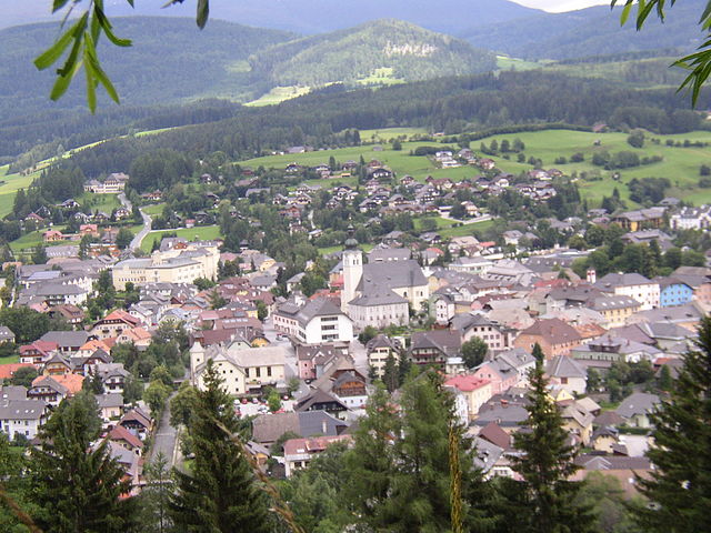
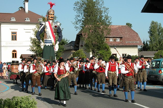
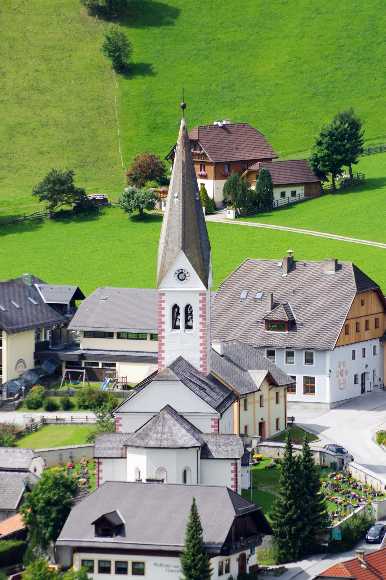
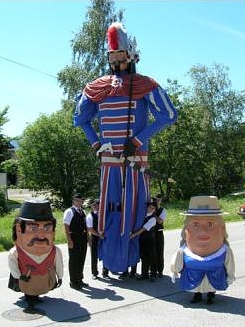
Tamsweg
- municipality in Austria
Hiking in Tamsweg
Tamsweg, located in the Lungau region of Austria, is a fantastic destination for hiking enthusiasts. The area is known for its stunning alpine landscapes, diverse flora and fauna, and well-maintained hiking trails that cater to different skill levels....
- Country:
- Postal Code: 5580
- Local Dialing Code: 06474
- Licence Plate Code: TA
- Coordinates: 47° 7' 0" N, 13° 48' 0" E
- GPS tracks (wikiloc): [Link]
- AboveSeaLevel: 1022 м m
- Area: 117.36 sq km
- Population: 5717
- Web site: [Link]

Sankt Margarethen im Lungau
- municipality in Austria
Hiking in Sankt Margarethen im Lungau
Sankt Margarethen im Lungau is a picturesque village located in the Lungau region of Austria, known for its stunning alpine landscapes and outdoor recreational opportunities. The area is ideal for hiking enthusiasts, offering a range of trails suitable for all levels, from beginners to experienced hikers....
- Country:
- Postal Code: 5581
- Local Dialing Code: 06476
- Licence Plate Code: TA
- Coordinates: 47° 4' 47" N, 13° 41' 43" E
- GPS tracks (wikiloc): [Link]
- AboveSeaLevel: 1065 м m
- Area: 24.47 sq km
- Population: 725
- Web site: [Link]
Weißpriach
- municipality in Austria
Hiking in Weißpriach
Weißpriach is a beautiful and scenic area located in the Lungau region of Austria, known for its breathtaking landscapes and outdoor recreational opportunities. Here’s an overview of what you can expect when hiking in Weißpriach:...
- Country:
- Postal Code: 5573
- Local Dialing Code: 06473
- Licence Plate Code: TA
- Coordinates: 47° 10' 0" N, 13° 42' 0" E
- GPS tracks (wikiloc): [Link]
- AboveSeaLevel: 1099 м m
- Area: 80.20 sq km
- Population: 306
- Web site: [Link]

Unternberg
- municipality in Austria
Hiking in Unternberg
Unternberg is a picturesque village located in the Salzburger Land region of Austria, known for its stunning natural landscapes and outdoor recreational opportunities. It serves as a great base for hiking enthusiasts looking to explore the surrounding mountains and valleys....
- Country:
- Postal Code: 5585
- Local Dialing Code: 06474
- Licence Plate Code: TA
- Coordinates: 47° 6' 44" N, 13° 44' 24" E
- GPS tracks (wikiloc): [Link]
- AboveSeaLevel: 1028 м m
- Area: 18.95 sq km
- Population: 1035
- Web site: [Link]

Sankt Andrä im Lungau
- municipality in Austria
Hiking in Sankt Andrä im Lungau
Sankt Andrä im Lungau is a beautiful destination for hiking enthusiasts, located in the Lungau region of the Austrian Alps. It offers a stunning blend of natural scenery, alpine meadows, and picturesque landscapes, making it an ideal spot for outdoor activities....
- Country:
- Postal Code: 5572
- Local Dialing Code: 06474
- Licence Plate Code: TA
- Coordinates: 47° 8' 56" N, 13° 47' 49" E
- GPS tracks (wikiloc): [Link]
- AboveSeaLevel: 1055 м m
- Area: 10.50 sq km
- Population: 761
- Web site: [Link]
Thomatal
- municipality in Austria
Hiking in Thomatal
Thomatal is a picturesque area located in the state of Salzburg, Austria, known for its stunning landscapes and beautiful hiking opportunities. It’s part of the larger Lungau region, which is characterized by its rolling hills, lush valleys, and majestic mountain ranges....
- Country:
- Postal Code: 5592
- Local Dialing Code: 06476
- Licence Plate Code: TA
- Coordinates: 47° 4' 0" N, 13° 44' 0" E
- GPS tracks (wikiloc): [Link]
- AboveSeaLevel: 1030 м m
- Area: 75.6 sq km
- Population: 333
- Web site: [Link]

Ramingstein
- municipality in Austria
Hiking in Ramingstein
Ramingstein is a picturesque village located in the Lungau region of Austria, surrounded by stunning landscapes that offer a variety of hiking opportunities. The region is known for its pristine nature, rolling hills, and majestic mountains, making it a fantastic destination for hikers of all levels....
- Country:
- Postal Code: 5591
- Local Dialing Code: 06475
- Licence Plate Code: TA
- Coordinates: 47° 4' 32" N, 13° 50' 12" E
- GPS tracks (wikiloc): [Link]
- AboveSeaLevel: 970 м m
- Area: 94.13 sq km
- Population: 1059
- Web site: [Link]

Sankt Michael im Lungau
- municipality in Austria
Hiking in Sankt Michael im Lungau
Sankt Michael im Lungau, located in the Lungau region of Austria, is a beautiful destination for hiking enthusiasts. The area is well-known for its stunning natural landscapes, including mountains, forests, and alpine meadows. Here are some key highlights about hiking in this picturesque locale:...
- Country:
- Postal Code: 5582
- Local Dialing Code: 06477
- Licence Plate Code: TA
- Coordinates: 47° 6' 0" N, 13° 38' 0" E
- GPS tracks (wikiloc): [Link]
- AboveSeaLevel: 1075 м m
- Area: 68.80 sq km
- Population: 3520
- Web site: [Link]
Shares border with regions:

Spittal an der Drau District
- administrative district in Carinthia, Austria
Hiking in Spittal an der Drau District
Spittal an der Drau District, located in the Carinthia region of Austria, is a stunning destination for hiking enthusiasts. Surrounded by the dramatic landscapes of the Alps and lush valleys, this area offers a diverse range of hiking trails suitable for various skill levels, from gentle walks to challenging mountain hikes....
- Country:
- Licence Plate Code: SP
- Coordinates: 46° 49' 59" N, 13° 18' 22" E
- GPS tracks (wikiloc): [Link]
- AboveSeaLevel: 922 м m
- Area: 2764 sq km
- Population: 76248
- Web site: [Link]