Thélus (Thélus)

- commune in Pas-de-Calais, France
- Country:

- Postal Code: 62580
- Coordinates: 50° 21' 18" N, 2° 48' 2" E


- GPS tracks (wikiloc): [Link]
- Area: 8.99 sq km
- Population: 1212
- Web site: http://www.commune-thelus.fr
- Wikipedia en: wiki(en)
- Wikipedia: wiki(fr)
- Wikidata storage: Wikidata: Q1022602
- Wikipedia Commons Category: [Link]
- Freebase ID: [/m/02z9hfp]
- GeoNames ID: Alt: [2972969]
- SIREN number: [216208108]
- BnF ID: [152692512]
- VIAF ID: Alt: [310693677]
- INSEE municipality code: 62810
Shares border with regions:


Neuville-Saint-Vaast
- commune in Pas-de-Calais, France
- Country:
- Postal Code: 62580
- Coordinates: 50° 21' 20" N, 2° 45' 29" E
- GPS tracks (wikiloc): [Link]
- Area: 12.59 sq km
- Population: 1493
- Web site: [Link]


Vimy
- commune in Pas-de-Calais, France
- Country:
- Postal Code: 62580
- Coordinates: 50° 22' 21" N, 2° 48' 38" E
- GPS tracks (wikiloc): [Link]
- Area: 11.33 sq km
- Population: 4261
- Web site: [Link]


Farbus
- commune in Pas-de-Calais, France
- Country:
- Postal Code: 62580
- Coordinates: 50° 21' 25" N, 2° 49' 27" E
- GPS tracks (wikiloc): [Link]
- Area: 3.49 sq km
- Population: 548
- Web site: [Link]

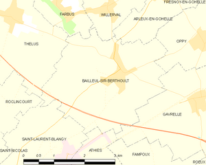
Bailleul-Sir-Berthoult
- commune in Pas-de-Calais, France
- Country:
- Postal Code: 62580
- Coordinates: 50° 20' 18" N, 2° 51' 1" E
- GPS tracks (wikiloc): [Link]
- Area: 9.35 sq km
- Population: 1384
- Web site: [Link]

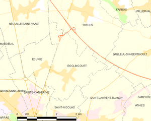
Roclincourt
- commune in Pas-de-Calais, France
- Country:
- Postal Code: 62223
- Coordinates: 50° 19' 32" N, 2° 47' 13" E
- GPS tracks (wikiloc): [Link]
- Area: 5.93 sq km
- Population: 764
- Web site: [Link]