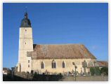
Thiron-Gardais (Thiron-Gardais)

- commune in Eure-et-Loir, France
- Country:

- Postal Code: 28480
- Coordinates: 48° 18' 38" N, 0° 59' 41" E


- GPS tracks (wikiloc): [Link]
- Area: 13.46 sq km
- Population: 1016
- Web site: http://www.mairie-thiron-gardais.fr
- Wikipedia en: wiki(en)
- Wikipedia: wiki(fr)
- Wikidata storage: Wikidata: Q542280
- Wikipedia Commons Category: [Link]
- Freebase ID: [/m/03nrn01]
- GeoNames ID: Alt: [6613872]
- SIREN number: [212803878]
- BnF ID: [15254317r]
- PACTOLS thesaurus ID: [pcrtEVBinLVpHI]
- INSEE municipality code: 28387
Shares border with regions:


La Croix-du-Perche
- commune in Eure-et-Loir, France
- Country:
- Postal Code: 28480
- Coordinates: 48° 16' 29" N, 1° 2' 55" E
- GPS tracks (wikiloc): [Link]
- Area: 12.5 sq km
- Population: 168


Chassant
- commune in Eure-et-Loir, France
- Country:
- Postal Code: 28480
- Coordinates: 48° 17' 40" N, 1° 3' 44" E
- GPS tracks (wikiloc): [Link]
- Area: 4.46 sq km
- Population: 333


La Gaudaine
- commune in Eure-et-Loir, France
- Country:
- Postal Code: 28400
- Coordinates: 48° 18' 8" N, 0° 55' 46" E
- GPS tracks (wikiloc): [Link]
- Area: 9.19 sq km
- Population: 177


Montigny-le-Chartif
- commune in Eure-et-Loir, France
- Country:
- Postal Code: 28120
- Coordinates: 48° 17' 9" N, 1° 9' 16" E
- GPS tracks (wikiloc): [Link]
- Area: 25.96 sq km
- Population: 648
- Web site: [Link]


Saint-Denis-d'Authou
- commune in Eure-et-Loir, France
- Country:
- Postal Code: 28480
- Coordinates: 48° 20' 41" N, 0° 59' 12" E
- GPS tracks (wikiloc): [Link]
- Area: 22.23 sq km
- Population: 487
- Web site: [Link]

Brunelles
- commune in Eure-et-Loir, France
- Country:
- Postal Code: 28400
- Coordinates: 48° 19' 27" N, 0° 53' 38" E
- GPS tracks (wikiloc): [Link]
- Area: 19.99 sq km
- Population: 566


Combres
- commune in Eure-et-Loir, France
- Country:
- Postal Code: 28480
- Coordinates: 48° 19' 29" N, 1° 3' 51" E
- GPS tracks (wikiloc): [Link]
- Area: 14.9 sq km
- Population: 560