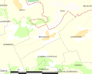
Thoix (Thoix)

- commune in Somme, France
- Country:

- Postal Code: 80160
- Coordinates: 49° 42' 23" N, 2° 4' 8" E


- GPS tracks (wikiloc): [Link]
- Area: 11.12 sq km
- Population: 145
- Wikipedia en: wiki(en)
- Wikipedia: wiki(fr)
- Wikidata storage: Wikidata: Q795490
- Wikipedia Commons Category: [Link]
- Freebase ID: [/m/03qmqwg]
- GeoNames ID: Alt: [6612845]
- SIREN number: [218007094]
- BnF ID: [152772288]
- INSEE municipality code: 80757
Shares border with regions:

Beaudéduit
- commune in Oise, France
- Country:
- Postal Code: 60210
- Coordinates: 49° 40' 45" N, 2° 3' 55" E
- GPS tracks (wikiloc): [Link]
- Area: 3.72 sq km
- Population: 212


Sommereux
- commune in Oise, France
- Country:
- Postal Code: 60210
- Coordinates: 49° 40' 43" N, 1° 59' 32" E
- GPS tracks (wikiloc): [Link]
- Area: 12.97 sq km
- Population: 472


Belleuse
- commune in Somme, France
- Country:
- Postal Code: 80160
- Coordinates: 49° 42' 23" N, 2° 7' 2" E
- GPS tracks (wikiloc): [Link]
- Area: 7.8 sq km
- Population: 358

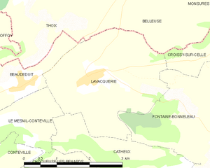
Lavacquerie
- commune in Oise, France
- Country:
- Postal Code: 60120
- Coordinates: 49° 40' 53" N, 2° 5' 35" E
- GPS tracks (wikiloc): [Link]
- Area: 8.28 sq km
- Population: 211


Courcelles-sous-Thoix
- commune in Somme, France
- Country:
- Postal Code: 80160
- Coordinates: 49° 43' 20" N, 2° 4' 45" E
- GPS tracks (wikiloc): [Link]
- Area: 4.37 sq km
- Population: 65


Dargies
- commune in Oise, France
- Country:
- Postal Code: 60210
- Coordinates: 49° 42' 5" N, 1° 59' 19" E
- GPS tracks (wikiloc): [Link]
- Area: 14.42 sq km
- Population: 250


Offoy
- commune in Oise, France
- Country:
- Postal Code: 60210
- Coordinates: 49° 41' 47" N, 2° 2' 15" E
- GPS tracks (wikiloc): [Link]
- AboveSeaLevel: 175 м m
- Area: 4.2 sq km
- Population: 113
- Web site: [Link]


Sentelie
- commune in Somme, France
- Country:
- Postal Code: 80160
- Coordinates: 49° 43' 28" N, 2° 1' 37" E
- GPS tracks (wikiloc): [Link]
- Area: 5.53 sq km
- Population: 201