Trefcon (Trefcon)
- commune in Aisne, France
- Country:

- Postal Code: 02490
- Coordinates: 49° 51' 28" N, 3° 5' 43" E


- GPS tracks (wikiloc): [Link]
- Area: 4.02 sq km
- Population: 89
- Wikipedia en: wiki(en)
- Wikipedia: wiki(fr)
- Wikidata storage: Wikidata: Q850128
- Wikipedia Commons Category: [Link]
- Freebase ID: [/m/03m7qt0]
- Freebase ID: [/m/03m7qt0]
- GeoNames ID: Alt: [6425269]
- GeoNames ID: Alt: [6425269]
- SIREN number: [210207205]
- SIREN number: [210207205]
- INSEE municipality code: 02747
- INSEE municipality code: 02747
Shares border with regions:


Pœuilly
- commune in Somme, France
- Country:
- Postal Code: 80240
- Coordinates: 49° 52' 54" N, 3° 6' 20" E
- GPS tracks (wikiloc): [Link]
- Area: 6.22 sq km
- Population: 123

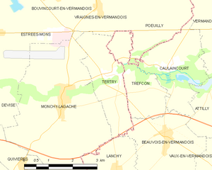
Tertry
- commune in Somme, France
- Country:
- Postal Code: 80200
- Coordinates: 49° 51' 45" N, 3° 4' 11" E
- GPS tracks (wikiloc): [Link]
- Area: 4.93 sq km
- Population: 173

Caulaincourt
- commune in Aisne, France
- Country:
- Postal Code: 02490
- Coordinates: 49° 51' 52" N, 3° 6' 22" E
- GPS tracks (wikiloc): [Link]
- Area: 5.96 sq km
- Population: 143

Beauvois-en-Vermandois
- commune in Aisne, France
- Country:
- Postal Code: 02590
- Coordinates: 49° 50' 20" N, 3° 6' 13" E
- GPS tracks (wikiloc): [Link]
- Area: 7.51 sq km
- Population: 283


Vraignes-en-Vermandois
- commune in Somme, France
- Country:
- Postal Code: 80240
- Coordinates: 49° 53' 14" N, 3° 3' 55" E
- GPS tracks (wikiloc): [Link]
- AboveSeaLevel: 93 м m
- Area: 4.22 sq km
- Population: 148