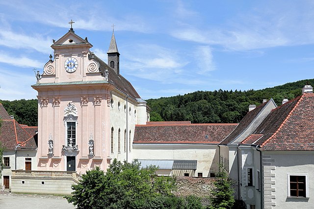
Tulbing (Tulbing)
- municipality in Austria
Tulbing is a picturesque area located in Lower Austria, not far from Vienna. It offers a variety of hiking opportunities, characterized by beautiful landscapes, charming villages, and a peaceful countryside atmosphere. Here are some highlights of hiking in Tulbing:
Hiking Trails
-
Danube Trail: This scenic trail runs along the Danube River and offers breathtaking views, lush greenery, and opportunities for birdwatching.
-
The Pielach Valley: Known for its rolling hills and idyllic nature, this area offers several trails that lead you through forests and along rivers.
-
Local Nature Trails: The region boasts numerous smaller trails that navigate through vineyards and farmland, which can be ideal for a leisurely hike with options for picnicking.
Key Features
-
Accessibility: Tulbing is easily accessible from Vienna, making it a perfect day trip for those looking to escape the city and immerse themselves in nature.
-
Flora and Fauna: The area is rich in biodiversity, with opportunities to see various plant species, wildlife, and stunning views of the surrounding countryside.
-
Cultural Sites: While hiking, you might come across local historic sites, including traditional villages and old churches that add cultural richness to your outdoor experience.
Tips for Hiking in Tulbing
-
Map and Routes: Always carry a map or a GPS device to help navigate the trails. Local tourism offices can provide detailed maps and advice on the best routes.
-
Weather Considerations: The weather can change rapidly, so check forecasts and dress in layers to ensure comfort throughout your hike.
-
Respect Nature: Stick to marked trails and follow local guidelines to preserve the natural environment.
-
Footwear: Wear comfortable, sturdy hiking boots to handle varying terrain.
Whether you're an experienced hiker or just looking for a pleasant nature walk, Tulbing offers a serene and beautiful setting for enjoying the great outdoors. Take the time to explore this charming area, and immerse yourself in the beauty of Lower Austria!
- Country:

- Postal Code: 3434
- Local Dialing Code: 02273
- Licence Plate Code: TU
- Coordinates: 48° 17' 15" N, 16° 7' 0" E


- GPS tracks (wikiloc): [Link]
- AboveSeaLevel: 206 м m
- Area: 18.36 sq km
- Population: 2971
- Web site: http://www.tulbing.at/
- Wikipedia en: wiki(en)
- Wikipedia: wiki(de)
- Wikidata storage: Wikidata: Q509583
- Wikipedia Commons Category: [Link]
- Freebase ID: [/m/03gs5yr]
- GeoNames ID: Alt: [7871917]
- VIAF ID: Alt: [239955106]
- GND ID: Alt: [4210865-2]
- archINFORM location ID: [15785]
- Austrian municipality key: [32134]
Shares border with regions:

Tulln an der Donau
- municipality in Austria
Tulln an der Donau, located in Lower Austria near the Danube River, offers a variety of scenic hiking opportunities that showcase the region's natural beauty and rich cultural heritage. Here are some highlights for hiking in and around Tulln:...
- Country:

- Postal Code: 3425, 3430
- Local Dialing Code: 02272
- Licence Plate Code: TU
- Coordinates: 48° 20' 0" N, 16° 3' 0" E


- GPS tracks (wikiloc): [Link]
- AboveSeaLevel: 180 м m
- Area: 72.23 sq km
- Population: 16197
- Web site: [Link]

Gablitz
- municipality in Austria
Gablitz, located in Austria's Lower Austria region, is surrounded by beautiful landscapes, making it an excellent destination for hiking enthusiasts. The area features a mix of forests, hills, and scenic views, providing a variety of trails suitable for different skill levels....
- Country:

- Postal Code: 3003
- Local Dialing Code: 02231
- Licence Plate Code: WU
- Coordinates: 48° 13' 33" N, 16° 8' 48" E


- GPS tracks (wikiloc): [Link]
- AboveSeaLevel: 284 м m
- Area: 18.14 sq km
- Population: 4968
- Web site: [Link]

Sieghartskirchen
- municipality in Austria
Sieghartskirchen is a beautiful municipality located in Lower Austria, not far from Vienna. The area boasts a scenic landscape that is ideal for hiking enthusiasts, offering a mix of forested areas, rolling hills, and picturesque views....
- Country:

- Postal Code: 3443
- Local Dialing Code: 02274
- Licence Plate Code: TU
- Coordinates: 48° 15' 14" N, 16° 0' 45" E


- GPS tracks (wikiloc): [Link]
- AboveSeaLevel: 205 м m
- Area: 61.59 sq km
- Population: 7528
- Web site: [Link]

Königstetten
- municipality in Austria
Königstetten is a small village located in Lower Austria, near Vienna. While it may not be a widely known hiking destination, it offers access to some beautiful trails and natural surroundings, particularly in the nearby Vienna Woods (Wienerwald) region....
- Country:

- Postal Code: 3433
- Local Dialing Code: 02273
- Licence Plate Code: TU
- Coordinates: 48° 17' 0" N, 16° 7' 0" E


- GPS tracks (wikiloc): [Link]
- AboveSeaLevel: 181 м m
- Area: 13.04 sq km
- Population: 2406
- Web site: [Link]

Mauerbach
- municipality in Austria
Mauerbach, located just outside of Vienna, Austria, offers a variety of hiking trails that cater to different skill levels and preferences. The region is well-known for its picturesque landscapes, lush forests, and charming rural surroundings, making it a popular destination for both locals and visitors....
- Country:

- Local Dialing Code: 01
- Licence Plate Code: WU
- Coordinates: 48° 14' 30" N, 16° 10' 35" E


- GPS tracks (wikiloc): [Link]
- AboveSeaLevel: 282 м m
- Area: 20.31 sq km
- Population: 3661
- Web site: [Link]
